Chile’s Forest Fires: A Glimpse Through the Smoke

Wildfires are engulfing Chile, claiming the lives of about 130 people so far and sparking questions about potential causes and solutions. 

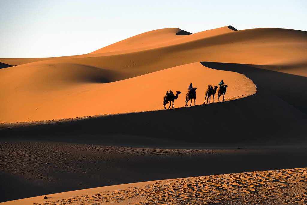
A 2014 forest fire in the Valparaíso region of Chile. Gabriela. CC BY-NC 2.0

As of February 9, 2024, nearly 5,000 people have been affected by what appear to be Chile’s deadliest forest fires on record. These devastating waves of flame follow the planet's hottest year and hottest January to date. Chile is not the only South American country to face an inferno following a scorching January, with forest fires reported in Colombia and Argentina as well.

Fires and climate change are in a feedback loop, amplifying each other. Consequences of climate change, including higher temperatures and heat waves, contribute to drier conditions and longer fire seasons. The fires create areas of dead, dry vegetation at greater risk of future fires, while the smoke from the fires pumps carbon dioxide to the atmosphere, further warming the planet. 

As the planet continues to warm, natural phenomena such as El Nino are intensified, resulting in hotter heat waves accompanied by dry spells, particularly affecting countries in northern South America such as Colombia and Venezuela. As recorded in 2018, about 21% of Chile is forest. The nation's tree cover, paired with its long dry season and heat waves, has proved to be a deadly combination. Forest fires in Chile have contributed to a range of destructive consequences throughout the years, including the loss of lives and biodiversity. 

Chile’s government has made strides to address climate change as a member of 20 international environmental agreements. Chile’s Forestry Service (CONAF) collaborates with the private forestry sector to implement preventative measures. In 2021, former Chilean President Sebastián Piñera presented the National Forest Fire Protection Plan. This plan allocated necessary resources to fire prevention and management, including firefighters, vehicles and technologies to predict and monitor fires. Despite these efforts, forest fires have continued in the country.

Scholars have identified that preventative measures are necessary in addressing forest fires. For example, controlled burns have been used by Indigenous People in North America for millenniums. Controlled burns are meticulously planned fires intentionally set to improve the health of a forest and reduce the risk of large-scale forest fires by decreasing the presence of dry vegetation. Other innovative measures to prevent forest fires include a gel-like fire retardant developed by researchers at Stanford University and technologies that can predict wildfires like Chile’s “Red Button” program.

Despite the issue of wildfires being amplified by climate change, about 99% of forest fires in Chile are caused by people, which is why education is another critical preventative measure. Tactics people can employ to prevent forest fires include taking steps to avoid creating sparks or fire when the area is hot, dry and windy and to refrain from driving over dry vegetation, as vehicle exhaust can reach temperatures over 1,000 degrees Fahrenheit.

Currently, the Chilean government is working tirelessly to combat the ongoing forest fires. For those looking to support these efforts, nonprofits like GlobalGiving provide platforms to donate to those affected, and social media offers a way for everyone to raise awareness.


Madison Paulus

Madison is a student at George Washington University studying international affairs, journalism, mass communication, and Arabic. Born and raised in Seattle, Washington, Madison grew up in a creative, open-minded environment. With passions for human rights and social justice, Madison uses her writing skills to educate and advocate. In the future, Madison hopes to pursue a career in science communication or travel journalism.

Unraveling the Mysteries of Rapa Nui (Easter Island)

Uncover Rapa Nui's mysteries, sustainable allure, and colossal moai on Easter Island.

Some of Rapa Nui’s stone statues (moai) watch as the sun sets behind the island. Antonio Sánchez. Unsplash.

Rapa Nui is a remote Polynesian island located 2,200 miles off the coast of Chile that spans only 63 square miles. The island is also known as Easter Island, a name that comes from Dutch explorers who arrived there on Easter Sunday in 1722. Rapa Nui gets its distinct triangular shape from the lava beds of three extinct volcanoes and is home to just a few thousand permanent residents. Despite this small population, the island has managed to land itself on many travelers’ must-see destination lists. The island is home to hundreds of imperious humanoid statues whose mysterious past have captured the attention of more than 100,000 visitors a year.

Travel Highlights

Like many other island destinations, Rapa Nui has beaches to enjoy in addition to a broad range of places to spend the night. Given the island’s many environmental concerns such as rock erosion and rising sea levels, there has been considerable focus on working toward a sustainable tourist industry. As such, Rapa Nui has several ecolodges that are popular with travelers. There is an abundance of fresh seafood, places to snorkel and opportunities to hike (Rapa Nui is a UNESCO-designated national park, making up 42% of the island). While walking around, visitors may be able to spot some of the wild horses that roam freely across the island; there are remarkably few indigenous plants, however, with only 31 wild flowering plants. The island’s three extinct volcanoes (Rano Kau, Poike, and Terevaka) also offer a chance for a unique exploration experience. 

The biggest draw of Rapa Nui is its moai. Most understand these statues as being representations of the ancestors of the Polynesian islanders who discovered the island over 1,000 years ago. Some moai have pukao, which are red ornaments that rest on some statues’ heads, and some moai sit on platforms. An ahu, where a number of these platforms can be found, was the traditional center for ceremonies on Rapa Nui. For visitors, the two most popular locations to see moai are at the Rano Raraku quarry and at the Ahu Tongariki. Although the average height of moai is 13 feet, these impressive sculptures can get as large as 80 tons and 33 feet tall. Archaeologists have determined that moai were originally made of basalt, trachyte and red scoria, but eventually moved to volcanic rock. The method of transportation for these especially large moai has sparked numerous theories and debates, with no plausible way for the statues to be moved from their place of creation to their final resting places with the resources available at the time. 

A close-up photo of a giant moai set against the Rapa Nui hillside. Thomas Griggs. Unsplash.

The Mysteries of the Island

Nearly every part of Rapa Nui’s early history has been met with some dispute; even the date of the Polynesians’ arrival has major discrepancies. One archaeological dig determined that humans first made contact with the island around 1200 A.D. This date is contested, however, with others believing that Polynesians found the island as much as 400 years earlier. The inconsistencies in archaeological data and lack of concrete evidence has led to numerous excavations being run and an abundance of people hypothesizing about the island, especially in regards to the Rapa Nui people’s process of moving the moai and how the population declined so quickly. Most of the speculation is about the time before the Dutch first arrived on the island in 1722. While there are nuances to each historian’s hypothesis, there are a few major trends. There are those who believe that the Indigenous Rapa Nui were victims of circumstance and those who believe they were inadvertently the main cause of their own suffering. While the exact truth of the early Rapa Nui history remains unknown, here are some common beliefs: 

For those who believe the Rapa Nui people were primarily victims of misfortune, there are mentions of a relatively sizable amount of wood being cut down, mostly to provide for the people and to transport the moai. Once the statues were in place, evidence suggests that additional changes were made in order to ensure they stayed upright. The complete destruction of large trees and foliage, however, can be mostly credited to invasive rats that feasted on the palm trees which once populated the island. As a dwindling Indigenous population continued to live on Rapa Nui, they were eventually confronted by a series of hostile visitors, all of whom contributed to their population becoming decimated. In 1722, the European explorers, beginning with a daylong visit from the Dutch, brought disease and strife to the Rapa Nui people. The continued arrival of European traders, explorers and other foreigners over the following decades contributed to the decline of the Rapa Nui people. 

Others adhere more to a story of ecocide. In order to move the moai, the Rapa Nui cut an excessive amount of trees down. Given that there is a considerable amount of charcoal in the island’s soil, some archaeologists have considered the possibility that the Rapa Nui people set fire to grass once they ran out of wood, another potential contributor to ecocide. Without the trees to anchor the soil, the fertile ground got washed away, ultimately leading to a shortage of crops and eventual starvation. Some have speculated about cannibalism, but this theory is less popular. In terms of outside contact, the Rapa Nui people may have had a war with another Polynesian group in 1680 which would have contributed to a population decline as well. Foreign arrivals then brought an additional, crippling blow of disease and violence.

Rapa Nui, from 1722-Present

Once Rapa Nui became known to foreigners, it suffered a similar fate to many other islands in Polynesia. At times, the Europeans destroyed property and forced many natives off of Rapa Nui. There were other hostile visitors as well. Peruvian slave traders came to the island during the 19th century and took many Rapa Nui people away as slaves. Despite the native Rapa Nui population having about 3,000 people in 1860, by 1877 so many people had been taken or killed that their numbers dwindled to just 111 individuals. 

Slavers and traders were not the only ones to come to Rapa Nui, and this heightened attention on the island eventually resulted in its current legal connection to Chile. Numerous missionaries came to the island as early as 1864, resulting in a shift toward Christianity for those who remained on Rapa Nui. This change made the island more welcoming in the eyes of many people from the mainland and prompted more interest from outsiders. The island’s annexation to Chile occurred in 1888, but the island was mostly left alone until 1903 when it was leased as a sheep farm for 50 years. During that time, the Chilean government applied an increasing amount of pressure on the Indigenous population such as confining them to one part of the island, Hanga Roa, and considering them the property of the state. By 1965 a governor was appointed to the island by the Chilean government, thus allowing the Rapa Nui people to become Chilean citizens. 

In 2010, Rapa Nui’s Indigenous clans began a major push back against the Chilean government, citing many injustices from the past decades including poverty, forced ghettos and land ownership discrepancies. This resulted in extensive discussion, violence and standoffs between the Chilean government and Rapa Nui’s Indigenous clans. In August of 2010, several Rapa Nui natives occupied a resort on the island, saying that their land had been taken unwittingly from them and was becoming developed by the Chilean government. Chilean police then forcibly evicted them from the premises, an action which received backlash from the Indigenous community. While the relationship between the two groups has since de-escalated, the situation is not truly resolved.

Seeing the Mystery for Yourself

Visiting Rapa Nui can be done by booking a 5 ½-hour flight out of Santiago, Chile. About half of the island’s current population considers themselves to be native Rapa Nui, and although some of the original Polynesian language is still present, residents speak Spanish predominantly. Rapa Nui is an island steeped in mystery and isolation, making it an intriguing and far-off destination for travelers looking to learn about Polynesian culture, explore volcanoes, and above all, meet the 887 moai that are scattered across the island. 


Phoebe Jacoby

Phoebe is a Media Studies major and Studio Art minor at Vassar College who believes in the importance of sharing stories with others. Phoebe likes to spend her free time reading, drawing, and writing letters. She hopes to continue developing her skills as a writer and create work that will have a positive outward effect.

The Atacama Desert’s Fashion Graveyard

Once a vast, uninterrupted plateau, Chile’s Atacama Desert is now a technicolor testament to overconsumption.

The Atacama Fashion Graveyard. Antonio Cosio. CC BY-NC.

A cursor hovering over the checkout of an Amazon cart; an unassuming paper bag carrying the new, trendiest cut of jeans from Forever 21; a Gmail notification that indicates a menagerie of Shein clothing has been shipped. These testaments to overconsumption in daily life may produce a quick, subtle pang of guilt. But, ultimately, this engagement with the world of fast fashion tends to be “out of sight, out of mind.” After all, once the clothing is donated or discarded most people assume it will end up in a landfill, neatly tucked away, never to be seen again. With no visual proof of the waste guilt subsides, and the cycle of overconsumption repeats. 

The cyclical and rampant nature of overconsumption, however, has real, tangible implications — implications that can be seen and felt by citizens of Iquique, a Northern Chilean city in the Atacama Desert. An average of 39,000 tons of fast fashion waste are dumped in Iquique per year, in addition to the approximately 60,000 tons of clothing imported into Chile annually. Roughly 40,000 square miles, the Atacama desert was once a pristine yet arid plateau; a prime sight for stargazing under a clear, open sky. The desert landscape, covered in salt flats, valleys and rocky topography, averages about 40,000 visitors per year but has since been contaminated. 

The clothing pile has grown to such an extent that it can be seen from space using satellite technology. But, before the magnitude of clothing became noticeable from an extraterrestrial viewpoint, people residing in Alto Hospicio, a municipality next to Iquique, watched as the unbridled clothing dumping grew out of hand. Clothes manufactured in China and Bangladesh that fail to sell in U.S. stores are brought in through the port of Iquique and subsequently dumped into the Atacama. The dumping site raised concerns among citizens of Alto Hospicio as early as 2012, but their unease was ignored.

The Atacama Desert. NASA. CC0.

Disheartened, the people of Alto Hospicio claimed to have experienced negligence by local and national government officials firsthand. For years, the waste grew despite continual pleas for action. Although in 2021 the former Minister for the Environment of Chile, Javier Naranjo Solano, expressed his worries about the vast quantities of textiles being imported into Chile and proposed remediation, some Chilean environmental engineers and scientists feared that the the laws he proposed, entangled with bureaucratic processes,  would be far too slow-moving considering the urgent, rapid growth of the clothing pile. Other citizens, however, have faith that Chile’s newly appointed Minister for the Environment, Maisa Rojas, will be able to translate eco-anxiety into concrete action.

Even under new leadership, however, the already massive pile of clothing is a nearly indestructible hazard. Much of the poor-quality fast fashion clothing dumped in Atacama is polyester, a material made out of the non-renewable resource petroleum. The open-air clothing pile secretes pollutants into the air; they seep into the ground. Thus, petroleum and other harmful materials can contaminate any remaining groundwater in aquifers under the desert. As potent as plastic and as enduring as steel, the clothing dumped in Atacama will take 200 years to biograde.

The Atacama Desert is often considered the driest climate on the planet, with annual rainfall averaging at only .03 inches. Atacama’s arid climate dangerously aids the spread of intentionally ignited fires. In order to curtail the amount of clothing discarded, fires are illegally and mysteriously started. These fires only serve as a further pollutant on top of the fabric already decomposing in the hot, arid environment. 

Although many merchants reside in Iquique,  one of South America’s largest duty free ports, many in the municipality of Alto Hospicio live in poverty — 25% of residents in Alto Hospicio specifically live in extreme poverty and, with many having poor access to quality housing. Although many residents travel to the Atacama fashion graveyard to salvage and sell discarded clothing, their proximity to the dump site has sinister implications: the negligence of the Atacama fashion desert and subsequent pollution acutely harms low-income communities in Northern Chile. Fast fashion waste, both burnt and decomposing, creates fumes that are linked to respiratory diseases, chronic illnesses, reproductive issues and even types of cancer.

The Port of Iquique. Diego Delso. CC-BY-SA 4.0.

Although there are efforts to repurpose the dumped clothing, with companies such as Ecofibra Chile taking the fabric and transforming it into thermal insulation panels, only one method of curtailing fast-fashion waste can truly have an impact: curbing our own overconsumption. Instead of purchasing that cost-effective Amazon fashion find, or the trendy new jeans from Forever 21, look into your own closet. Rediscover a dress that has been tucked away in the depths of your dresser. Organize a clothes swap with friends. Borrow your Aunt’s blouse or your Grandfather’s wool sweater. Rather than falling victim to trend cycles, explore what has been cherished, saved and passed down.


Carina Cole

Carina Cole is a Media Studies student with a Correlate in Creative Writing at Vassar College. She is an avid journalist and occasional flash fiction writer. Her passion for writing overlaps with environmentalism, feminism, social justice, and a desire to travel beyond the United States. When she’s not writing, you can find her meticulously curating playlists or picking up a paintbrush. 

6 Must-See Islands off the Coast of Chile

Traverse the natural gems and explore the historical sites of Chile’s outre-mer.

Penguins off the coast of Chiloe Island. Mary Madigan. CC BY 2.0. 

One of the westernmost countries of South America, Chile has gained fame for its gorgeous mountains and fjords, its delicious street cuisine, the integral place futbol has in its people’s everyday life, and perhaps even its complex political history. The distinct cultural and travel experience the country offers does not apply only to its mainland, but also to the islands that surround it. In fact, Chile’s islands house some of the most individual and exclusive travel experiences and institutions: 

1. Isla Magdalena

Off the coast of Isla Magdalena. Iamblukas. CC BY 2.0.

Isla Magdalena’s lush landscapes are home to everything from the circa 120,000 Magellanic penguins characteristic of southern South America, the National Monument for Penguins that explores and explains the members of this colony, and a magnificent view of the Strait of Magellan discovered by Portuguese explorer Ferdinand Magellan. The Isla Magdalena Lighthouse, another landmark, also rests on the island and contains many exhibitions that detail its history and traditions. Travel to Isla Magdalena by public ferry or private speedboat (for about 2 hours) after a fruitful day on the Chilean mainland; the island is 608 sq mi.

2. Robinson Crusoe Island 

A view of Robinson Crusoe Island’s mountains. Ashley Basil. CC BY 2.0.

Robinson Crusoe Island’s name comes from the titular Daniel Defoe protagonist and explorer who travels across the sea to a deserted island. Certainly, all visitors feel like explorers on Robinson Crusoe Island. Guests can snorkel or scuba dive along the island’s coral reefs, observe shipwrecks scattered across its coast, birdwatch, hike in the area’s luscious rainforests, visit ruins left from plundering pirates, and enjoy the local cuisine, especially the lobster.  You can even partake in day-long fishing trips to score fresh lobsters! A ~2 hour flight from Santiago or an hour-long water taxi journey drops guests off at this adventure-filled island; the island is 18.5 sq mi in area.

3. Chiloé Island

A view from Ancud on Chiloé Island. Ik T. CC BY 2.0.

Chiloé Island’s landscape defines it: the Chiloé National Park highlights much of this breath-taking landscape with green terrain, rivers, lakes, and stunning forests. For those further intrigued by the island’s natural beauty, horseback riding around the island quenches the explorer’s thirst. But this island is not only a place of natural beauty; history remains an important part of Chiloé Island culture. The churches of Chiloé, mostly built in the 17th century and showcasing Spanish colonial design, are monuments to the island’s rich history. The Ancud Regional Museum (Museo Regional de Ancud) also puts much of the island’s history, its mythology, and its indigenous residents under the spotlight. As with many other Chilean islands, water sports like kayaking and fishing also contribute to the visitor experience. A circa 30-minute ferry ride across the Canal de Chacao drops guests off on Chiloé; the island is 3,241 sq mi.

4. Isla Grande de Tierra del Fuego

Snow capped mountains of Isla Grande de Tierra del Fuego. James St. John. CC BY 2.0. 

South America’s largest island, Isla Grande de Tierra del Fuego, is part of the Tierra del Fuego archipelago off the coast of the southernmost tip of South America. A ~2 hour ferry ride across the Strait of Magellan drops visitors off at this island first dubbed “Land of Smoke” by Ferdinand Magellan. Walk the footsteps of explorers like Ferdinand Magellan and Charles Darwin on Isla Grande de Tierra del Fuego as you immerse yourself in the island’s spectacular flora, which includes many species of trees like the beech and conifer, and fauna the fauna of Parque Pinguino Rey (King Penguin Park) and the foxes, flamingos, and condors found all around the island’s mountains; the island is 18, 530 sq mi

5. Navarino 

A view of the Dientes de Navarino Mountains. Dimitry B. CC BY 2.0.

Navarino, another island that is far south of the Magellan Strait, is a worthwhile travel destination for outdoorsy adventurers. Hikers will enjoy walking among the island’s snow capped mountains and fishers can discover a multitude of rivers and even high-altitude lakes. One of the most beautiful routes for active visitors is the Dientes de Navarino (Teeth of Navarino) Trek. This somewhat frightening name refers to Navarino’s mountains through which many travelers enjoy hiking. The culturally inclined can visit Puerto Williams, the island’s only town and the past residence of indigenous Yaghan people. Puerto Williams’ museums offer insights on the isle’s Yaghan past and its weighty and resonant history. Access to Navarino is available by a 30-minute boat ride from the port of Ushuaia; the island is 35.7 sq mi.

6. Riesco Island 

A view of the Fitzroy Canal from Isla Riesco. Z_thomas. CC BY-SA 3.0.

Riesco Island’s must-see features range from Patagonian ranches to historical coal reserves. The bleating sounds ring across the island, while its cattle fields are still dominated by gauchos, or South American cowboys, and remain a sight to behold for those visitors who crave a distinctive cultural experience. The island, one of the largest islands in Chile and accessible from Patagonia through a 30-minute boat ride across the Fitzroy Canal, is also known for its coal reserves; in fact, coal mines such as the Invierno (winter) Mine, Magdalena, Elena, and Josefina are historical locations of note. Riesco sightseers should also watch out for glaciers lining Riesco’s coasts; the island is 1,970 sq mi.


Su Ertekin-Taner

Su Ertekin-Taner is a first year student at Columbia University majoring in creative writing. Her love for the power of words and her connection to her Turkish roots spills into her satire, flash fiction, and journalistic pieces among other genres. Su hopes to continue writing fearless journalism, untold stories, and prose inspired by her surroundings.

A Canvas of Colors: Chile’s Majestic Marble Caves

Mother Nature is often mentioned causing destructive hurricanes, explosive volcanic eruptions and other Earth-shattering natural disasters. Just as easily as she causes destruction, though, she creates unparalleled beauty. 

The Marble Caves in Chile. Javier Vieras. CC BY 2.0. 

In every region of the world lies some kind of cave system; they range from the awfully eerie such as Hellhole Cave in West Virginia to the wholly tantalizing psychedelic salt mines of Russia. Although all are beautiful in their own way, few turn heads quite like one such cave system in Chilean Patagonia. Situated along one lake is a particularly artistic cavern system called the Marble Caves. 

At the Argentina-Chile border lies the majestic General Carrera Lake. The lake is the largest in Chile, with a town called Chile Chico resting on its southern shore. Although the town itself is a quaint and quiet getaway, the treasures of the lake draw most visitors to the area; the massive lake boasts a dynamic palette of mesmerizing shades of sapphire and cobalt. The lake is an incredibly remote glacial lake, making it quite the journey to reach. The lake is surrounded by grand forestry, and enjoys a calm backdrop of snowcapped mountains against an expansive sky. In order to get to General Carrera Lake, visitors must depart from the city of Santiago, then embark on a string of drives totaling about 1,000 miles. From there, visitors can only visit the cave system by boat or kayak. 

General Carrera Lake. Dan Lundberg. CC BY-SA 2.0. 

Far from the coast of the lake stands a gargantuan block of calcium carbonate from which the caves formed. For over 6,000 years, the lapping waves of the lake eroded the calcium carbonate, slowly but gracefully constructing the Marble Caves. The mineral-rich location is protected from potential mining projects.

The caves earned their name from the masterfully striped walls; the reflection of the waters below create a cerulean painting on them, with complementary hints of yellow, turquoise, black and white. The caves house different cuts and textures due to the patterns of the eroding waves; some parts are rounded while other areas display sharp rocky points. In addition, the open layout of the cave serves it well, providing ample light for the various hues to stay in the spotlight. 

The vast range of the cave’s colors is ever changing. In spring, the lower water levels provide a sparkly turquoise-green shade, while the summertime gifts the walls a splendidly deep royal blue. 

Time and time again, travelers have found that Mother Nature can create just about any magnificent work of art. The local residents of the lake and any visitor bold enough to endure the journey to it can certainly attest that the Marble Caves are no exception. 


Ella Nguyen

Ella is an undergraduate student at Vassar College pursuing a degree in Hispanic Studies. She wants to assist in the field of immigration law and hopes to utilize Spanish in her future projects. In her free time she enjoys cooking, writing poetry, and learning about cosmetics.

8 Surprisingly Vibrant Desert Destinations

Deserts are much more than the beating sun and rolling sand dunes we often picture. These eight destinations showcase the incredible natural beauty of the desert, from salt flats and chalk formations to mountains and glaciers. 

Though deserts are often thought of as just hot, dry expanses of sand, they come in a variety of climates and landscapes and hold some of the world’s most fascinating natural formations. Deserts “are areas that receive very little precipitation,” making them arid but not necessarily hot and sandy. Many deserts are mountainous, and others are large expanses of rock or salt flats. Though their arid environment makes water in deserts scarce, they are far from lifeless. Plants and animals, including humans, have adapted to desert life. One-sixth of the Earth’s population lives in deserts, which are found on every continent. 

These eight desert destinations range from freezing to boiling in temperature and are all unique, with their own attractions and plant and animal life. Each of these stunning deserts is worth a visit, and they may change your opinion of the desert as a stark, lonely place to one of beautiful landscapes blooming with culture, history and life. 

White and Black Deserts, Egypt 

Located just a few hours from Cairo, Egypt’s White and Black deserts are two stunning and underappreciated visitor attractions. The White Desert is located in the Farafra Depression, a section of Egypt’s Western Desert, and boasts some of the most unique geological landscapes in the country. Incredible wind-carved white chalk formations rise from the sand in the shapes of towering mushrooms and pebbles, giving the White Desert its name. The White Desert stretches over 30 miles, and the most visited area is the southern portion closest to Farafra. To the north of the White Desert is the Black Desert, where volcanic mountains have eroded to coat the sand dunes with a layer of black powder and rocks. In the Black Desert, visitors can climb up English Mountain and look out over the landscape. The Egyptian Tourism Authority recommends booking a tour to explore the deserts in depth, and travelers can even stay in the White Desert overnight. 

Joshua Tree National Park, California 

Joshua Tree National Park in Southern California is where two different desert ecosystems meet. Parts of the Mojave and the Colorado deserts are both found in Joshua Tree, along with a distinctive variety of plant and animal life. The Joshua tree, the park’s namesake, is the most identifiable of the plants, with its twisted, spindly branches and spiky clusters of greenery. Some of the park’s most popular attractions are Skull Rock; Keys View, a lookout with views of the Coachella Valley and the San Andreas Fault; and Cottonwood Spring Oasis, which was a water stop for prospectors and miners in the late 1800s. Joshua Tree National Park has roughly 300 miles of hiking trails for visitors to explore. The park is open 24 hours and can be visited at any time of the year, but visitation rises during the fall due to the cool weather and is at its height during the wildflower bloom in the spring. 

Atacama Desert, Chile 

Trips to the Atacama Desert in northern Chile are likened to visiting Mars on Earth. The dry, rocky terrain is so similar to that of Mars that NASA tests its Mars-bound rovers here. The Atacama Desert, the driest desert on Earth, spans over 600 miles between the Andes and the Chilean Coastal Range. Some weather stations set up in the Atacama have never seen rain. Despite its dryness, the desert is home to thousands of people, as well as plants and animals. People have been living in the Atacama Desert for centuries; mummies were discovered in the Atacama dating back to 7020 B.C., even before the oldest known Egyptian mummies. Attractions in the Atacama Desert include El Tatio geyser field, the Chaxa Lagoon, the Atacama salt flats, and sand dunes over 300 feet tall. The Atacama Desert is also said to have some of the clearest night skies in the world, making it perfect for stargazing. It is best to avoid a trip to the Atacama during the summer months, as the high temperatures make for a sweltering visit. 

Salar de Uyuni, Bolivia 

The world’s largest salt flat, Salar de Uyuni, covers 3,900 square miles in the southwestern corner of Bolivia. Salar de Uyuni is so large it can be seen from space and holds an estimated 10 billion tons of salt. Beneath the salt flat is approximately 70% of the world’s lithium reserves. This lithium is carefully extracted and used for powering laptops, electric cars and smartphones. Salar de Uyuni is surrounded by scenic lakes, geysers and rock formations, and is one of the world’s most beautiful and untouched natural landscapes. Tours of Salar de Uyuni take visitors to the Valley of Rocks; Morning Sun, which is home to geysers and mud pots; Colchani, a salt-processing village; and the Polques Hot Springs, where travelers can soak in warm thermal water. The landscape of Salar de Uyuni changes based on the seasons, so travelers should plan their visits around what they want to see. From July to October, access to all sites of Salar de Uyuni is unrestricted, but during the rainy season from December to April, visitors may be able to witness the salt flat’s famous mirror effect, where a thin layer of water over the salt transforms the land into the world’s largest mirror. 

Tanque Verde Ranch, Arizona 

Located just outside of Tucson, Arizona, near Saguaro National Park and the Rincon Mountains, Tanque Verde Ranch gives visitors “the ultimate dude ranch experience.” The ranch sprawls over 640 acres and stocks over 150 horses. Visitors to the ranch can get a real-life cowboy experience, including horseback riding and team penning. Riders of all experience levels will find something to do at Tanque Verde, where visitors can take beginning, intermediate and advanced lessons and then go on a sunrise or sunset trail ride through the Arizona desert. Tanque Verde Ranch offers kids’ riding activities too, as well as activities for non-riders such as yoga, mountain biking, fishing, swimming and pickleball. Visitors should pack long pants and closed-toe shoes if they plan to ride, and casual wear is appropriate for all non-riding times. Trips to the ranch usually last around four days, and visitors stay on the property. Tanque Verde Ranch is open to visitors year-round. 

Gobi Desert, Mongolia 

Spanning most of southern Mongolia and its border with China, the Gobi Desert contains stunning views and years of history. The region was once populated by dinosaurs, and some of the best-preserved fossils in the world were found near the Flaming Cliffs of Bayanzag. The Gobi Desert showcases a variety of natural beauty, from towering sand dunes to incredible white granite formations. Dry desert plants that come to life after rain make the Gobi unique, as well as ”saxaul forests” made up of sand-colored shrubbery. Visitors to the Gobi Desert should explore the Khongor Sand Dunes, an area that offers rocky and mountainous terrain in the south, dry and barren terrain in the center, and several oases in the north. Other major attractions are the Flaming Cliffs of Bayanzag, where red clay seems to glow in the sun, and the Gobi Waterfall, which looks like a city in ruins but is a completely natural formation. The best time to visit the Gobi Desert is either in late spring or in autumn, when the weather is neither too hot nor too cold.

Nk’Mip Desert, Canada 

Also called the Okanagan Desert, Canada’s Nk’Mip Desert contains the most endangered landscape in Canada. Located in Osoyoos in British Columbia, the Nk’Mip Desert Cultural Center is a 1,600-acre area of the Okanagan Desert managed by the Osoyoos Indian Band, and is the only fully intact area of desert in Canada. The desert is situated in a semiarid microclimate. The cultural center was designed to be eco-friendly and resembles the traditional winter homes of the Osoyoos Indian Band. Visitors can explore the desert on walking trails, which are surrounded by sage, prickly pear cactuses and antelope brush, as well as sculptures of desert creatures and native peoples by Smoker Marchand. The trails take visitors through a traditional Osoyoos village, where they will find a traditional sweat lodge and pit house. Many visitors prefer to explore Nk’Mip Desert in the summer due to the region’s relatively cold winters. 

Patagonian Desert, Argentina and Chile

The Patagonian Desert is South America’s largest desert and the seventh-largest in the world. It covers parts of southern Argentina and Chile, and is a cold desert, sometimes reaching a high temperature of 68 degrees Fahrenheit. The Patagonian Desert is home to two national parks: Torres del Paine National Park in Chile and Los Glaciares National Park in Argentina. Torres del Paine and Los Glaciares aren’t typical desert environments, but since the Patagonian is a cold desert, its landscape is different from that of most deserts. Before the Andes were formed, the Patagonian Desert was likely covered by temperate forests, so the region containing the desert, Patagonia, is extremely ecologically and geographically diverse. Torres del Paine National Park is known for its towering granite structures, which were shaped by glaciers. Los Glaciares is home to large glaciers, as well as scenic mountains, lakes and woods. The Cueva de las Manos, or “Cave of Hands,” is a series of caves in Argentinian Patagonia which are filled with paintings of hands dating back to 700 A.D., likely made by ancestors of the Tehuelche people. Tehuelche people live in Patagonia today, some still following a nomadic lifestyle. The best time to visit Patagonia is generally said to be in the summer (December to February), when the days are warm and the fauna is in full bloom, but there are merits to exploring the area at all times of year. 


Rachel Lynch

Rachel is a student at Sarah Lawrence College in Bronxville, NY currently taking a semester off. She plans to study Writing and Child Development. Rachel loves to travel and is inspired by the places she’s been and everywhere she wants to go. She hopes to educate people on social justice issues and the history and culture of travel destinations through her writing. 

Fight for Civil Liberties Doesn't Stop for a Pandemic in Chile

Despite unrest in Chile, feminist group Las Tesis continues to advocate for justice against police brutality and sexual violence toward women in Latin America.

Translation: “Systemic violence is the worst crime.” John Englart. CC BY-SA 2.0

Last year, Chilean feminist group Las Tesis released “Un Violador en Tu Camino” (“A Rapist in Your Path”), a song that became an anthem against sexual violence worldwide. The piece, which calls out the judicial system and the struggle of women across Latin America, has been performed all around the world in the form of flash mobs. Many who participate wear black blindfolds and green scarves to advocate for legal abortion practices as well.

The song first was created in light of the social inequality protests occurring in Chile in November 2019. The lyrics call out the unfair treatment of the Chilean government toward women. It says that a narrative is being written where women are to blame for sexual violence. Yet, the song places blame on the patriarchy, police and government systems for being blind to this ongoing violence.

According to the Organization for Economic Cooperation and Development, Chile is considered one of the world’s most unequal countries and is susceptible to climate change. Chile is also considered to have one of the highest costs of living across South America. While the rich prosper from their investments in terms of development, the poor communities and Indigenous people suffer at the hands of urbanization.

Feminist sign in Chile which translates to “the feminist struggle is also against neoliberalism.” John Englart. CC BY-SA 2.0.

Many Chileans consider themselves “at war against a powerful enemy.” Rather than succumbing to the protesters’ demands, President Pinera declared a state of emergency that involved the deployment of the military to control crowds and the institution of a curfew. These measures have caused a sharp decline in protests like Las Tesis’.

International attention has focused on the treatment of protesters, with allegations of human rights violations. For instance, there have been claims that protesters may have been tortured, resulting in at least 19 deaths and 20 people being reported missing. Additionally, there has been a 15% increase in sexual violence reports since last year.

However, on June 12, the police filed a lawsuit against Las Tesis. In the lawsuit, police claim that the feminist group encourages violence against officers of Chile’s national police force, Carabineros de Chile. Charges came after the release of “Manifesto Against Police Violence,” a video produced alongside Russia’s Pussy Riot where protesters stood outside of a police station and demanded to “fire the police.” Chilean police took the video as threats against officers, but no papers have been officially served yet to the feminist group.

Daffne Valdes, one of the founders of Las Tesis, said in an interview with Al-Jazeera that “this is an attack on freedom of expression,” calling it a form of censorship. Even though in both the song and video by Las Tesis the police are called out as “rapists,” group members say they are simply referring to the corruption seen throughout Chile’s police system.

Eva Ashbaugh

is a Political Science and Gender, Sexuality, and Women's Studies double major at the University of Pittsburgh. As a political science major concentrating on International Relations, she is passionate about human rights, foreign policy, and fighting for equality. She hopes to one day travel and help educate people to make the world a better place.

Chile Protests Escalate as Widespread Dissatisfaction Shakes Foundations of Country’s Economic Success Story

Chile’s capital city Santiago appears dynamic and bustling, complete with gleaming skyscrapers and a modern metro network. Against the backdrop of the snow-topped Andes mountains, the Costanera Tower – South America’s tallest building – symbolises the country’s open neoliberal economy and mass consumption society. 

But protests have rocked the country, challenging this image of stability and prosperity.

Following a government proposal to increase the price of metro tickets, students began to dodge metro fares in protest on October 14, jumping the turnstiles en masse and setting metro stations on fire. The protests soon spread within Santiago and to other Chilean cities, leading President Sebastian Piñera to declare a state of emergency and daily curfews on October 18. This legislation, which dates from the dictatorship era of the 1970s and 80s, allows the military to patrol the streets. 

But the move has led to an escalation of the protests, as thousands of Chileans disobeyed the curfews by marching peacefully against government policy and violent repression on a daily basis, calling for Piñera to resign.

The images of soldiers and tanks on the streets, dispersing protesters with water cannon, tear gas, and physical violence, recall the images of military repression during the dictatorship of Augusto Pinochet between 1973 and 1990. The economic and ideological legacies of the Pinochet era as well as the nature of Chile’s transition to democracy are key to understanding the reasons for the protests. The anger of those on the streets is as much a reflection of the country’s high inequality as it is of these unresolved legacies.

Much of the media coverage of the protests has focused on the spectacle of looting, vandalism, and soldiers beating the protesters. Since the protests started, 18 people have died and there have been 3,000 arrests. But there are wider causes behind these events. The protests emerged in the middle of growing dissatisfaction with high levels of inequality and a high cost of living

Income inequality has not improved in Chile since the days of the military dictatorship. World Inequality Database

On the surface, Chile looks like an economic and political success story, as the country’s GDP growth has outpaced that of Latin America as a whole in recent years, but many Chileans are struggling. The metro fares have come to symbolise what they feel is the unjust distribution of income and social spending. 

Legacy of Pinochet era

Like the state of emergency, Chile’s social and economic policies also date from the dictatorship. Neoliberal reforms were introduced in the mid-1970s by Pinochet and his team of American-trained economists, known as the “Chicago Boys”. The reforms took place in the context of violent repression. Official investigations showed that 3,065 people were murdered by state agents during the dictatorship, 40,000 tortured, and hundreds of thousands forced into exile.

The 1970s reforms included the elimination of subsidies, welfare reform, and the privatisation of state-owned companies, the health sector, education and pensions. Pinochet’s reforms led to high levels of unemployment, declining real wages, and expensive social services, such as education. The impact is clear today in education, characterised by low levels of public spending and highly unequal access to good-quality schools and universities. Between 2011 and 2013 students organised mass demonstrations against Chile’s education policies, and dissatisfaction remains.

Chile turned from a military to a civilian government in 1990, following the 1988 referendum in which Pinochet was defeated. But due to the nature of the transition, social and economic policies changed very little. Pinochet negotiated his departure in such a way that the armed forces kept control of the political process, including his own appointment as a lifelong senator. The 1980 military constitution – which is still in place today – has allowed Piñera to declare the controversial state of emergency to deal with the protests. Although some of the military control structures have been dismantled since Pinochet’s death in 2006, the civilian governments on the right and the left have had a limited appetite to address the country’s inequalities.

Anger on the streets of Santiago. Fernando Bizerra Jr/EPA

In response to the protests, on October 22 Piñera suspended the planned fare increases and announced a spending package of reforms to address the protestors’ concerns. The fact that Chileans continue to protest around the country shows that many people feel these measures are too little, too late. 

Given the long historical roots of the inequalities, it’s unlikely that one-off extra spending can address the country’s structural problems. Even if the government’s intention has been to de-escalate the situation, its hardline response to the protests signals growing polarisation rather than a quick resolution to the issues.

Marieke Riethof is a Senior Lecturer in Latin American Politics, University of Liverpool

THIS ARTICLE WAS ORIGINALLY PUBLISHED ON THE CONVERSATION