Nazaré, Portugal: How A Fishing Village Became a Surfing Mecca

For centuries, Nazaré, Portugal was a traditional fishing village; until it made its way on the big wave surfing map. Now, it’s what many consider to be the Mecca of surfing, drawing crowds from across the globe. 

Historically, big wave surfers gravitated towards the waves found in the surfing communities of Hawaii and California. Locations like Jaws, Mavericks, Shipstern Bluff and Mullaghmore were thought of as the best of the best. However, it wasn’t until recently that Nazaré, Portugal made its name as a surfing destination. Nazaré’s beach of Praia do Norte has all the elements for disaster—a deep underwater canyon and currents of waves that collide into one, breaking towards the coast of monumental cliffs. Surfing there, in the winter especially, was long thought to be impossible. It wasn’t until 2010 that someone was daring enough to surf the uncharted waters and alter the history of Nazaré forever. 

Just a few meters off the shore of Praia do Norte is the Nazaré Canyon, an underwater submarine valley 3 miles deep. When water currents move through the valley, they get compressed and begin to move faster. When these currents collide with the local water current, they forge waves upwards of 10 stories high. Among villagers, the waves in Praia do Norte were forbidden. Many had loved ones who died at sea, and they taught their children to avoid the huge waves. So in 2010, when Garret McNamara first arrived, locals were apprehensive about getting behind him and his mission to ride a 100-foot wave.  

It took five years for McNamara to take up an invitation from Dino Casimiro, a local bodyboarder who worked to publicize Nazaré’s waves. When he first laid his eyes on the view from the cliff, he told The New York Times, “it was like finding the Holy Grail.” He’d spend the next year preparing, studying the rhythm of the waves, and developing a safety system with his team of jet-ski tow-riders and spotters on walkie-talkies. Finally, in November of 2011, McNamara conquered a 78-foot wave, earning him a Guinness World Record, and serving as proof that Nazaré’s waves were real and surfable. From that moment on, every big wave surfer in the world wanted their shot to make a name for themselves at Nazaré. Today, at least 20 professional surfers stay in Nazaré during any given week in the winter, including men and women like Justine Dupont, Lucas Chianca, and Kai Lenny. 

In 2013, the town’s current mayor Walter Chicharro was elected. Chicharro worked with McNamara and Casimiro to capitalize on their waves’ fame and invested in the professionalization of the surfing scene. The World Surf League now hosts an annual big wave surfing challenge event every winter, a time that Nazaré’s 10,000 locals were accustomed to having to themselves. In additon, Mayor Chicharro opened the town’s 17th-century lighthouse, Farol Da Nazaré, both as a museum showcasing the town’s history and as a space to view the waves. According to an article in The New York Times, about 40,000 people visited it in 2014, while more than 220,000 entered the fort in 2018. 

Today the town is used to the presence of surfers; even the local fisherman welcome them thanks to the business they bring. Joao Carlines, a retired fisherman, told reporters that “Surfers have a different relationship with the sea, but I’m happy the town’s become known for surfing because it means we have people coming here in the winter.” While the elusive 100-foot wave has yet to be ridden, rest assured that it will be one day, and it will be in Nazaré. In anticipation of that day, surfers and their fans will continue traveling to the seaside village in hopes of witnessing the historic event for themselves.  


Claire Redden

Claire is a freelance journalist from Chicago, where she received her Bachelor’s of Communications from the University of Illinois. While living and studying in Paris, Claire wrote for the magazine, Toute La Culture. As a freelancer she contributes to travel guides for the up and coming brand, Thalby. She plans to take her skills to London, where she’ll pursue her Master’s of Arts and Lifestyle Journalism at the University of Arts, London College of Communication. 
Hut-to-Hut: Hiking in the Italian Dolomites

Mountain Huts, called Rifugios, make multiple day treks through the Italian Alps accessible to hikers.

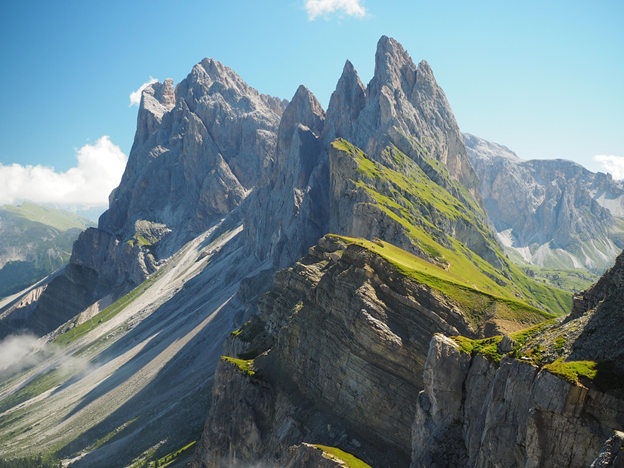
Puez-Geisler nature park in the Dolomites. Dmitry Djouce. CC BY 2.0

The mountain range located in northern Italy has 18 major peaks and uniquely diverse mountain landscapes. The Dolomites have sharp peaks in varying shapes, along with alpine meadows and valleys that have drawn hikers for years. Mountain huts, also known as rifugios, are placed throughout the Italian mountain range, all within a day’s hike of the next hut. The trek to visit each hut is a total of 75 miles, and typically takes hikers ten days to complete. The huts are stocked with food, and offer basic bedding for travelers. While not every rifugio offers places for hikers to stay overnight, many only serve food, so travelers can stop for lunch before continuing to the next hut. The huts allow hikers to do multiple day-treks without having to pack much. All they will need is personal items and sleeping bag linings. The rifugios are open starting in June and often draw travelers of varying hiking experience.

The Dolomites first started attracting hikers during the ‘golden age of mountaineering’ in the late 19th century. Many mountaineers who first summited the peaks wrote early travel guides for the region, drawing more explorers. Then, in World War One, the Dolomites became the front line for the Italian and Austro-Hungarian armies to pass through. As a result, there are still visible remnants of the war, one being an open-air museum of Mt. Lagazuoi. The ‘castle of rock’ has complex systems of tunnels dug into the mountainside during the war. The tunnels are open for people to walk through and learn more about World War One’s impact on the region. 

Additionally,a museum is dedicated to World War One on the range’s highest peak, Marmolada. The summit stands at over 10,000 feet, making the museum the highest in Europe. The locals of the region often speak Italian, German and Ladin, a Rhaeto-Romaniclanguage that is recognized as an official language of the region. Roughly 30,000 people speak Ladin, and there are considerable efforts to preserve the region’s language and the culture.


Dana Flynn

Dana is a recent graduate from Tufts University with a degree in English. While at Tufts she enjoyed working on a campus literary magazine and reading as much as possible. Originally from the Pacific Northwest, she loves to explore and learn new things.

Volcano Boarding in Nicaragua

Looking for an adrenaline rush? Slide down the side of an active volcano at up to 60 miles per hour during your stay in Nicaragua.

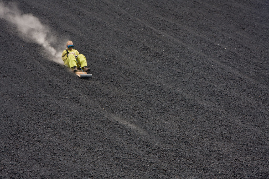
Volcano boarding on Cerro Negro, Nicaragua. Garrett Ziegler. CC BY-NC-ND 2.0.

Bigfoot Hostel in Leon, Nicaragua is one of the only places in the world where you can go volcano boarding. According to their website, volcano boarding is the “thrill of a lifetime.” The hostel’s original owner, Daryn Webb, created the extreme sport, where those brave enough to try it can speed up to 60 miles per hour down the side of an active volcano.

Webb and his crew tested various objects for sliding down the volcano, and after some trial and error, they created a sit-down toboggan made of metal and plywood. The hostel offers daily tours beginning at 9 a.m., with prices at $25 per person. Tours return at 3 p.m.

The Cerro Negro volcano is the youngest volcano in Central America, and is also one of the most active volcanoes in Nicaragua, erupting nearly every 20 years.

Bigfoot Hostel has sent over 20,000 people down Cerro Negro slope at up to  62 miles per hour, and it is known for attracting many sports enthusiats  and adrenaline junkies. One of the most famous people to attempt the extreme sport was Eric Barone, who rode down the volcano on a bike at 107 miles per hour in 2002.

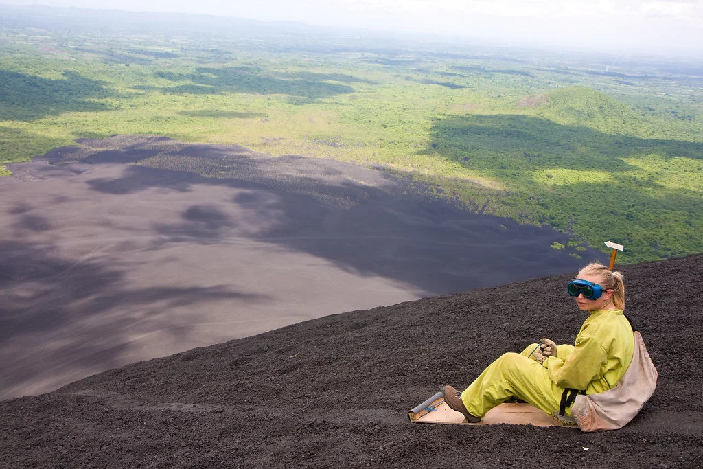
Volcano boarding on Cerro Negro. Garrett Ziegler. CC BY-NC-ND 2.0.

It is possible to slide down the Cerro Negro because the volcano is made of small grain-like volcanic rocks, which came from the crater. In addition, there is almost always a very strong wind hitting the volcano, so it’s the perfect surface for boarding.

Those who have visited before say that they could feel the heat radiating from the volcano and could even cook their meals in a hole dug out in the volcano.

All visitors must wear closed toe shoes and comfortable clothing. Those who have boarded down the volcano before recommend wearing hiking boots (since it takes about 45 minutes to reach the summit) and a multipurpose head wrap to cover your nose and mouth while boarding. Also, take a large water bottle and a GoPro if you want to record the experience.

The hostel offers dorm-style rooms, with rooms with fans at $6 and rooms with air conditioning at $10. There are also private rooms with double, triple, or quadruple beds.


Isabelle Durso

Isabelle is an undergraduate student at Boston University currently on campus in Boston. She is double majoring in Journalism and Film & Television, and she is interested in being a travel writer and writing human-interest stories around the world. Isabelle loves to explore and experience new cultures, and she hopes to share other people's stories through her writing. In the future, she intends to keep writing journalistic articles as well as creative screenplays.

6 Interesting Facts about the Egyptian Pyramids

There is still so much we don’t know about the history and structure of the Egyptian pyramids. Here are six things that you may not have known about the pyramids and ancient Egypt.

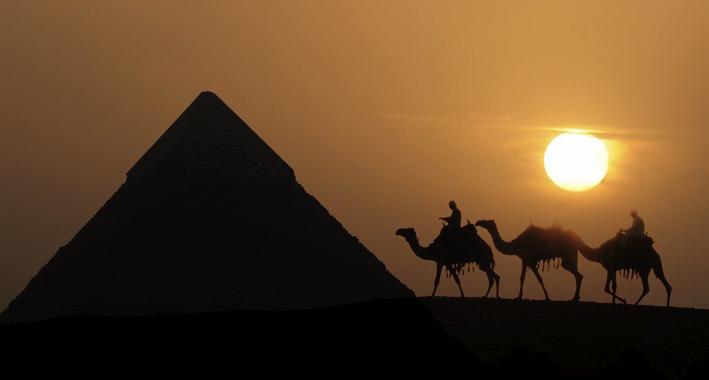
Egyptian pyramids in the sunset. Club Med UK. CC BY-NC 2.0.

The Egyptian pyramids are famous for their buried mummies and treasures, but there are still many secrets waiting to be uncovered about their history. Take a deep look into the ancient pyramids’ past with these six interesting facts.

The seven wonders of the world, Egyptian pyramids. Boston Public Library. CC BY 2.0.

1. Once upon a time, they sparkled.

According to research on ancient texts and found evidence, it is thought that the Great Pyramid of Giza used to shine like glass and sparkle in the sunlight. Ancient Egyptians even called the pyramid “Ikhet,” which translates to “glorious light.” This is mainly because the pyramid was originally covered in polished limestone which reflected light like a mirror and made the pyramids visible from anywhere nearby. What is even more interesting is that the speed of light—299,792,458 m/s—are also the exact coordinates of the Great Pyramid of Giza, which is at 29.9792 degrees north, 31.1342 degrees east. Spooky? Definitely.

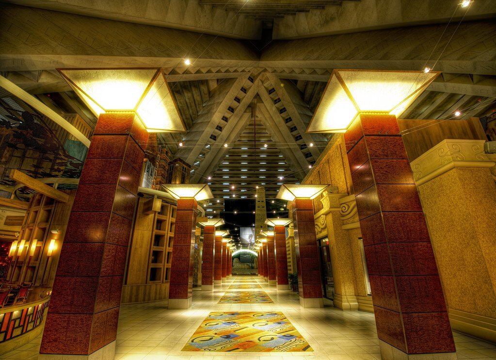
Entering the pyramid. Trey Ratcliff. CC BY-NC-SA 2.0.

2. Many of them were robbed.

A lot of the unknown history of the pyramids can be blamed on tomb robbers. Tomb robbing was a serious problem in ancient Egypt because robbers targeted the tombs for looting—even Kings’ tombs were broken into. It was the Egyptian belief that everything buried with you was taken into the afterlife, so Kings and Queens were buried with unimaginable amounts of riches. It was also very common for people to steal from their ancestors’ tombs —some even dumped the body and stole the sarcophagus. Egypt was a cashless society until the Persians came in 525 BCE, so those who stole from the tombs would have had to trade their stolen goods to higher, corrupt officials. Those caught would be executed for the offense.

The Great Pyramid of Cheops. Boston Public Library. CC BY 2.0.

3. We still don’t know how they were built.

Although the pyramids are over 4,000 years old, professionals still don’t understand how the ancient Egyptians managed to build the pyramids without advanced technology. The most accepted theory is that they used ramps to bring materials to the top, which has been proven by a recent discovery. Researchers in Egypt discovered a 4,500-year-old ramp used to haul alabaster stones out of a quarry. The ramp system dates back to Pharaoh Khufu, who built the Great Pyramid of Giza. However, the way in which the ancient Egyptians built the pyramids is still a mystery because the pyramids were not made of alabaster, which is what the discovered ramp helped to move.

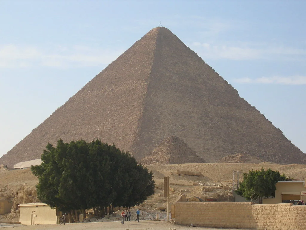
Khufu’s Great Pyramid. Bernt Rostad. CC BY 2.0.

4. There is a secret chamber in the Great Pyramid of Giza (Khufu’s Pyramid).

Weighing in at 5,750,000 tons, the Great Pyramid is simply a feat of architecture. To add further to the mystery, a previously unidentified chamber in the Great Pyramid was discovered in 2017 when physicists used the by-products of cosmic rays to reveal an at least 100-foot long void. The mysterious space’s dimensions are similar to the pyramid’s Grand Gallery, which is the corridor that leads to the burial chamber of Pharaoh Khufu. What lies within the space is still unknown, as well as its purpose. Scientists hope to find out more about this newly discovered area and what it was used for.

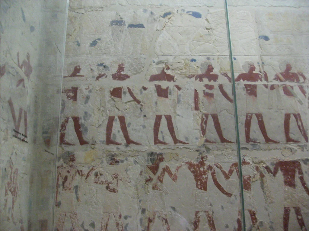
Tomb of Perneb, carving of offering bearers. Peter Roan. CC BY-NC 2.0.

5. It was tradition for the living to share food with the dead.

Ancient Egyptians believed that tombs were eternal homes for the mummified bodies and the ka spirits that lived within them. Each tomb had a tomb-chapel where families and priests could visit the deceased and leave offerings for the ka, while a hidden burial chamber protected the mummified bodies from potential harm. Visitors offered food and drink to the dead daily, and once the offerings were consumed by the ka, the living were free to eat and drink their offerings. The Beautiful Feast of the Valley was an annual festival of death and renewal where families spent the night in the tomb with their ancestors and feasted with them in celebration of their lives.

A statue ofNefertiti in the Altes Museum in Berlin. George M. Groutas. CC BY 2.0.

6. Egyptian women and men had equal rights.

In ancient Egyptian times, men and women of the same social class were treated as equals in the eyes of the law. Women could sell, own, earn, buy and inherit property. If widowed or divorced, women could raise their own children. Women could also bring cases before a court. Overall, women could legally act on their own and were responsible for their own actions. Although everyone in ancient Egypt was expected to marry, wives still had an important, equal and independent role in their marriage. 


Isabelle Durso

Isabelle is an undergraduate student at Boston University currently on campus in Boston. She is double majoring in Journalism and Film & Television, and she is interested in being a travel writer and writing human-interest stories around the world. Isabelle loves to explore and experience new cultures, and she hopes to share other people's stories through her writing. In the future, she intends to keep writing journalistic articles as well as creative screenplays.

Siberia's Lake Baikal, One of the Deepest Lakes in the World

Recognized as one of the few remaining ancient lakes in the world, Lake Baikal has preserved natural history and housed thousands of animal species for centuries.  

Lake Baikal surrounded by greenery. Markus Winkler. Unsplash.

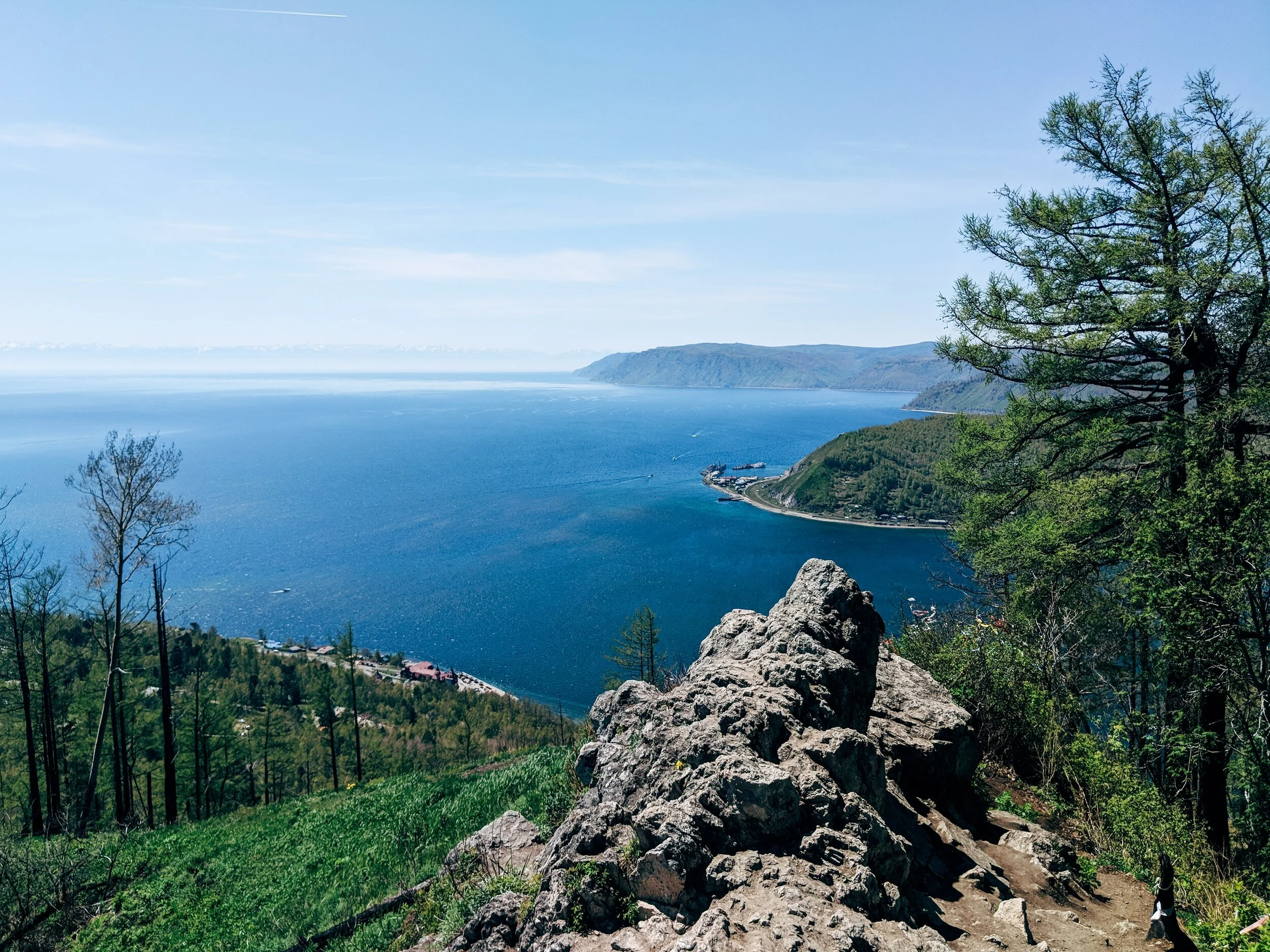
In Siberia, just north of the Mongolian border, sits Lake Baikal, one of the deepest lakes in the world. The lake houses 22 percent of our planet's fresh water and measures over 5,300 feet deep. Furthermore, its location between mountains allows for over 330 rivers and streams to connect to it, and the lake is made up of three basins. While Lake Baikal only equates to around half the surface area of Lake Michigan, measuring in at about 12,200 square miles, its magnificence lies in its history. 

Experts have estimated that the lake is between 25 and 30 million years old, making it one of the few remaining ancient lakes on the planet. This is because it lies in an active rift zone due to its plate tectonics, unlike most other lakes which have a history of being covered by ice sheets in previous glacial periods. Most ancient lakes are formed when the Earth's plates begin to move apart from each other, creating a rift valley that is deepened over time by erosion. Eventually, the rift widens so much that it begins to fill with fresh water. Around 75 percent of Earth's ancient lakes have been formed through this process, with the exceptions having been formed by meteor impacts and volcanic action.

 Therefore, not only does Lake Baikal preserve years of Earth's history, but it is exclusively home to around 2,000 unique animal species. Although the lake is protected as a UNESCO World Heritage Site, that hasn’t stopped climate change from affecting the lake, as the surface temperature has increased by 1.5 degrees Celsius over the past 50 years. In conjunction with increasing chemical pollution, the ecosystem is believed to be rapidly changing for the first time in decades.  

Throughout the COVID-19 pandemic, locals have been taking advantage of the lack of visitors populating the lake, many beginning to trek out to visit the body of water themselves. Especially during the fall and winter months, many visitors enjoy skating, hiking, or even skiing over the  ice and snow. 

Ice formed over Lake Baikal. Daniel Born. Unsplash. 

Located near one of Russia's largest cities, there has been a constant tug-of-war between developers, locals and environmentalists to seek a balance between encouraging tourism which benefits the local economy, and protecting the deteriorating ecosystem. While the momentary break in visitors has undoubtedly allowed the ecosystem to begin to recover, ultimately its fate lies in the hands of its visitors.


Zara Irshad

Zara is a third year Communication student at the University of California, San Diego. Her passion for journalism comes from her love of storytelling and desire to learn about others. In addition to writing at CATALYST, she is an Opinion Writer for the UCSD Guardian, which allows her to incorporate various perspectives into her work.

Islamic Architecture in Spain 

While many can forget that Arab and North African Muslims controlled parts of Spain for almost 800 years, longstanding Spanish architecture is a testament to the Muslim reign. Arabesque patterns, Islamic motifs and sandy colors have been preserved in some of Andalusia’s most famous palaces and fortresses. 

Arab and North African Muslims conquered the Iberian Peninsula in the eighth  century. Ruling for almost 800 years in Al-Andalus (currently Andalusia), Muslims inevitably left traces of their presence in the region. Everything from language and religion to architecture and art was adopted by Spain during the Muslim reign. Around 4,000 Spanish words which are still in use today originated from Arabic. The majority of these words are nouns related to food, animals, nature and science. For example, the Spanish word for “olive” is “aceituna” and is derived from the Arabic word “zaytünah.”

While aspects of the Arabic language can be found in Spanish, Islamic architecture is the true evidence of the Arab and North African Muslim reign in Spain. Certain sites in modern-day Andalusia make you feel like you’re in Morocco or Syria. Today, Islamic architecture is most prevalent in Cordoba, Seville and Granada—Spanish cities in Andalusia—with their palaces and holy sites. 

 Cordoba 

Desert colored walls in the Great Mosque of Cordoba. Waqqas Akhtar. CC BY-NC-SA 2.0. 

Cordoba was the capital of Al-Andalus when it was first conquered in 711 A.D. The Great Mosque of Cordoba is a testament to the Arabic and Islamic influence in the city. Elaborate building programs and agricultural projects were sponsored by Prince Abd al-Rahman I from Damascus, Syria. The prince imported plants from Damascus, some of which still stand in the yard of the Mosque of Cordoba today. 

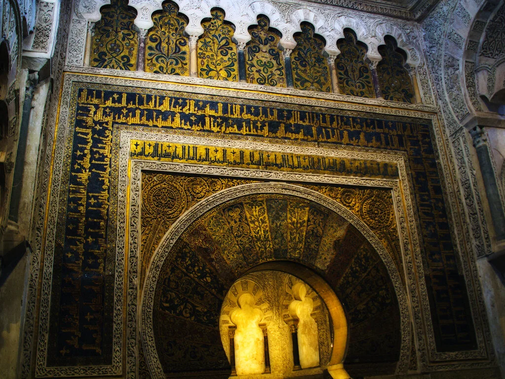
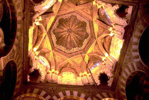
Previously operating as a mosque and church at different points in history, the captivating structure includes a hypostyle prayer hall, a beautiful courtyard with an extravagant fountain, a colorful orange grove, a walkway circling the courtyard and a minaret which is now a bell tower. Islamic calligraphy and verses from religious scriptures fill the sandy, red and white colored columns. Geometric shapes dominate the structure—in everything from design to entryways. One major Islamic motif that is evident in this structure is the horseshoe shaped “mihrab.” The mihrab identifies the wall that faces Mecca—Islam’s holiest city that features the home of God, the Kaa’ba—and indicates which direction to face while praying. The mihrab is decorated in gold and brown detailing. Above the mihrab sits a mesmerizing dome filled with pointed gold arches and radial patterns fill the ceiling. 

The mihrab, Great Mosque of Cordoba. Kevin Poh. CC BY 2.0.

The dome above the mihrab in the Great Mosque of Cordoba. mitopencourseware. CC BY-NC-SA 2.0.

Seville 

The Royal Alcazar in Seville is one of the world’s oldest palaces that is still in use today. This palace has been awarded status as a UNESCO World Heritage Site. The Alcazar was first built in the 11th century when the Arabs moved in and sought to create a secure, residential fortress. Since then, Alcazar has been home to the many monarchs who have taken control of Seville. The initially Islamic structure was renovated by its following rulers; however, the palace’s Islamic roots shine through as many of its Islamic components have been preserved. 

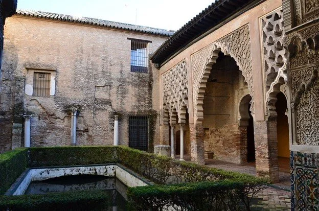
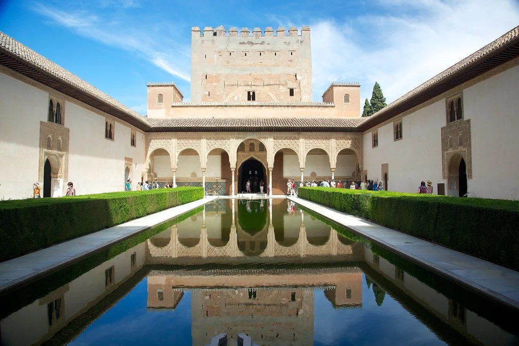
One of the palace’s courtyards, the Patio del Yeso, was created in the 12th century when the region was still under Muslim control. The courtyard features a large pool in the middle—a common theme in Islamic architecture. Water is at the heart of Islamic architecture for both practical and spiritual reasons. Considering that the Arabs and North Africans came from dry climates and desert landscapes, it was important for them to have easy access to reliable sources of water. Furthermore, in Islam, water symbolizes life and purity. Water in gardens, specifically, symbolizes the sacred lake in paradise that is reserved for only the righteous. 

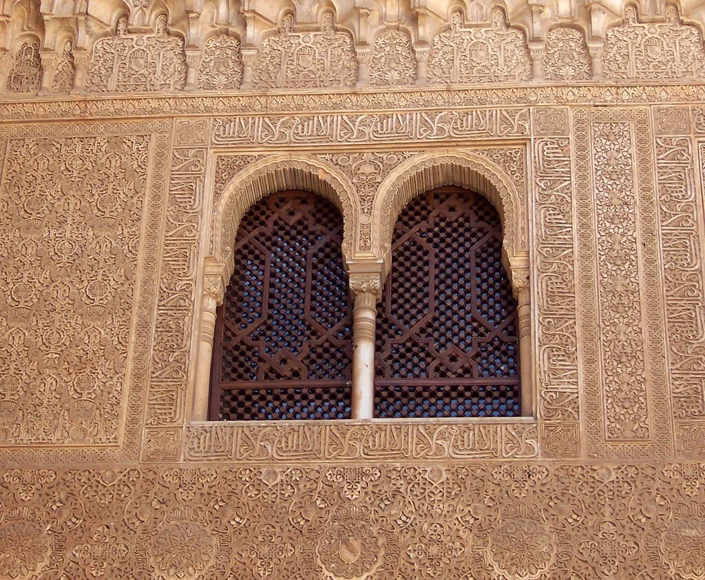
Other recurring Islamic motifs that are found in the Alcazar include keyhole or horseshoe shaped arches, doors and windows; traditional Islamic plasterwork and latticework; Islamic writings; and a heavy presence of plants. The horseshoe arch is known as an “alfiz” and the Islamic-style window screens are known as “mashrabiya.” These, in addition to the icicle-like droppings from ceilings and domes, are common components of modern-day mosques and other traditional Islamic structures. 

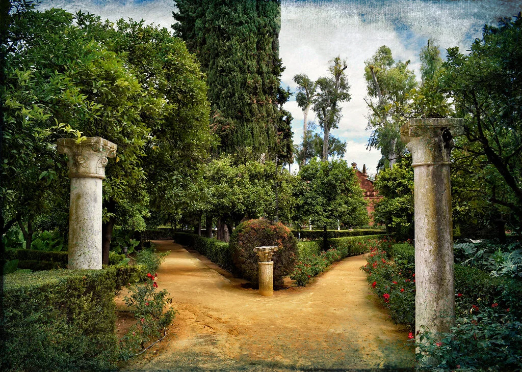
The gardens of the Alcazar were used not only for aesthetic purposes, but also for functional purposes. While the plants and trees were grown in the palace’s gardens for beauty, the plants were also used to feed members of the court. The gardens themselves were strategically structured to resemble what Muslims imagined paradise to look like based on the descriptions in the Quran. 

Garden in the Royal Alcazar, Seville. Jocelyn Erskine-Kellie. CC BY-SA 2.0.

Granada

The Alhambra Palace in Granada is further evidence of the Islamic rule in Spain. The name Alhambra itself derives from the Arabic word “Al-Hamra” which means “red.” The palace was given this name for its reddish bricks and walls which can be seen from afar. Alhambra’s layout mimics that of many other palaces for Muslim princes. Three main floor plans dominate the site: the “mexuar” was open to all and the room where sultans received their subjects, the “diwan” is the throne room where receptions were held, and the “harem” is the prince's private quarters. Islamic inscriptions and verses from the Quran flood the walls, while the gold detailing accents the writings. 

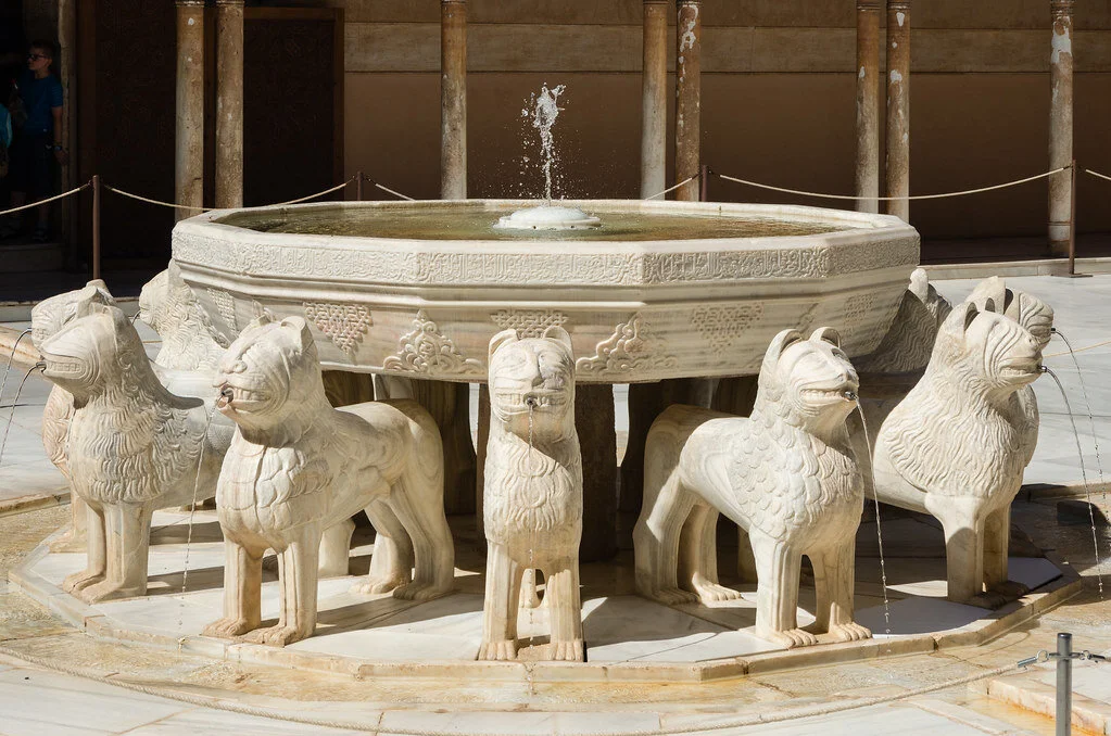
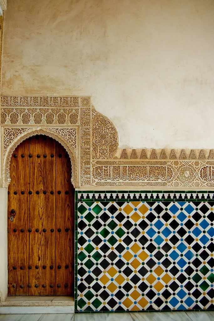
 Mosaics and colored tiles in geometric and plant-like shapes, referred to as “alicatado,” are also in certain quarters. The mosaics are not only decorative but also contain strategically chosen tiles to cool the structure in the summertime. Plant motifs align with Islamic principles, as the depiction of human images is often frowned upon. The Fountain of the Lions in Alhambra is one of the most photographed features of  the palace, with 12 lions spewing water in the middle of the courtyard. Other famous aspects of Alhambra which are covered in arabesque patterns and constructed to resemble the gardens in heaven, include the Generalife and El Partal, two of the quieter locations in the palace. 

Keyhole shaped windows with arabesque patterns in Alhambra. Güldem Üstün. CC BY 2.0.
Geometric mosaics in Alhambra. Víctor. CC BY-NC-ND 2.0.


Mia Khatib 

Mia is a rising senior at Boston University majoring in journalism and minoring in international relations. As a Palestinian-American, Mia is passionate about amplifying the voices of marginalized communities and is interested in investigative and data-driven journalism. She hopes to start out as a breaking news reporter and one day earn a position as editor of a major publication..

5 of the World’s Most Dangerous Hiking Trails

Everyone loves a good hike, but some trails around the globe stand out due to the intense challenges that they provide. The following five hikes should not be attempted by novice hikers.

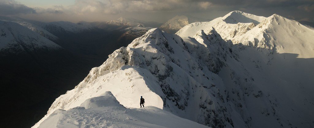
Aonach Eagach, Scotland. Andrew Marshall. CC BY-NC-SA 2.0.

Hiking can test our physical and mental limits, and is a powerful cardio workout that is proven to boost your mood. While it  can be fun to test yourself and get your adrenaline flowing and blood pumping, there are some hikes around the world that can cause serious injuries if you are not careful.

These five hiking trails are not for the faint-hearted and should not be attempted by novice hikers.

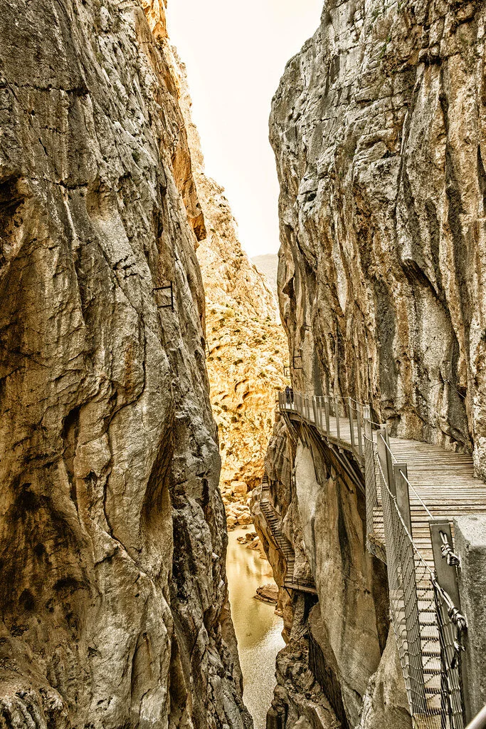
El Caminito del Rey, Spain. Arthur Harrow. CC BY-NC-ND 2.0.

1. El Caminito del Rey, Spain — 4.8 miles

The name of this hike translates to “The King’s Little Pathway,” and it once was one of the world’s most hazardous footpaths. This aerial path is suspended 100 meters high against the walls of a gorge,. It was originally built from 1901 to 1905 between the waterfalls of Gaitanejo and El Chorro to move materials and workers to the local hydroelectric dam. The trail is named “The King’s Little Pathway” because, in 1921, King Alfonso XIII opened it to visitors and traveled along the walkway to the Conde de Guadalhorce dam.

The Caminito del Rey route runs through cliffs, canyons and large valleys. The area is inhabited by a wide variety of plant and animal species, such as Egyptian vultures, griffon vultures, golden eagles and wild boar. The path takes about three to four hours to walk, starting in the town of Ardales and ending in Álora.

The path closed to hikers in 2001 when five people fell to their demise into the river below. Fences were since built into the renovated path and it reopened in 2015.

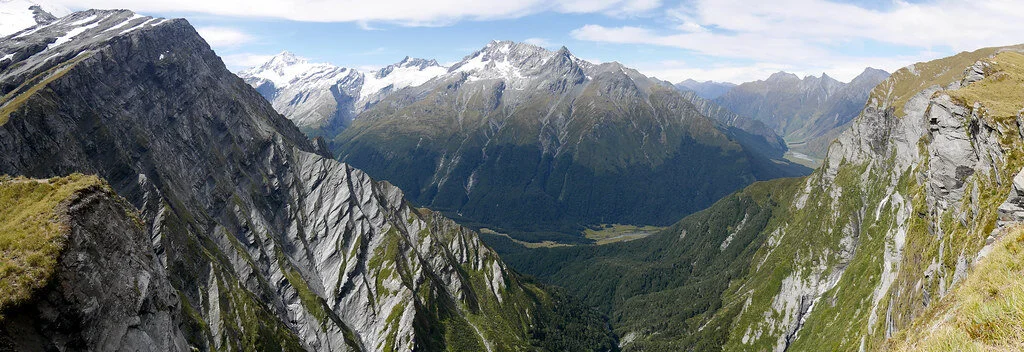
Cascade Saddle. Tom@Where. CC BY-NC 2.0.

2. Cascade Saddle Route, New Zealand — 29.9 miles

This trek takes almost two days, or four to five days if you choose the expert route. Built in 1939 and located in the Matukituki Valley area and Mount Aspiring National Park in the Otago region, the route travels through scenery featured in the Lord of the Rings films, so many visitors flock to this route for photo opportunities.

The Cascade Saddle route is an alpine crossing recommended for experienced trampers. It is also recommended to hike it only in good weather during the summer. The Department of Conservation advises hikers to begin from the Matukituki side of the route, since ascending is much safer than descending. There are various different routes to take from there.

However, this route can be very dangerous in some parts, where the ground is slippery and unstable—especially when it is raining. Furthermore, there is danger of  avalanches from June to November. Check the New Zealand Avalanche Advisory website before you go.

Several hikers have been injured on this trek, and some have even died. If you go, be sure to have the right skills and experience to make the decisions best for you along the trek—you must also bring the proper equipment.

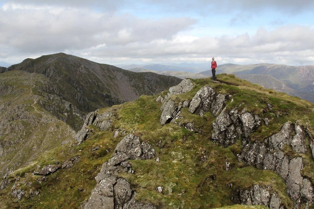
Aonach Eagach ridge. mr__fox. CC BY-NC-ND 2.0.

3. Aonach Eagach, Scotland — 6 miles

Located near Kinlochleven in the Scottish Highlands, the Aonach Eagach trail features beautiful wildflowers and mountainous scenery. However, it is also a hard, exposed scrambling ridge between Am Bodach and Stob Coire Lèith. Getting to the summit requires endurance, hard work and lots of climbing. The ridge is 3,126 feet  high, making this trail one of the U.K.’s toughest ridge walks.

The trail is only recommended for very experienced hikers in good weather conditions. The rocks can get very slippery in rainy conditions, and side paths are often extremely hazardous and difficult to return from. Over the last 10 years, there have  unfortunately been many deaths on the trail, the most recent being in 2017.

The trail is best done east to west, and those who push through the experience are rewarded with the view of a lifetime.

Backpacking in Utah. Zach Dischner. CC BY 2.0.

4. The Maze, Utah, USA — 2.9 miles

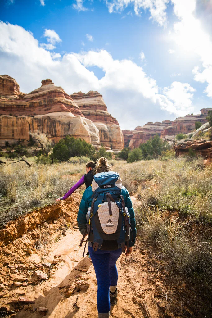
Although short, trails in the Maze are ancient and lead into various different canyons. Located near Gunlock, Utah, the Maze Overlook Trail requires basic climbing skills in order to navigate steep portions of rock. A 25-foot length of rope also comes in handy to raise or lower packs in difficult spots.

The Maze sees only 2,000 hikers per year since it is so remote and is the least accessible hike in the Canyonlands. The best time to go is in the spring, when temperatures are lower.

The Maze is quite literally a maze of intertwined canyons and dead-ends. The routes do not have beaten trails and they often weave up and over canyons, which are extremely difficult to traverse. Water sources in the Maze are also very limited. Part of the danger comes from how it can take rescuers up to three days to reach hikers because the path is so remote.

The highlight of this difficult and remote path is the view. Hikers will be able to see the Colorado River and Green River converge from atop a massive desert rock in a breathtaking view. Visitors can also see petroglyphs (prehistoric rock carvings) from ancient human history.

5.Mount Huashan, China — 12.2 miles

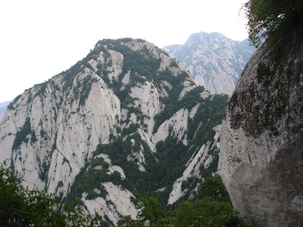
Located near Huayin in the Shaanxi province of China, Mount Huashan trails are not very trafficked due to their narrow peaks and dangerous, steep paths. However, the trails feature beautiful wildflowers and scenery, as well as built-in steps and light poles.

Mount Huashan is known to be one of China’s five sacred mountains and one of the most popular pilgrimage sites for Chinese people. It is also considered by many to be the original place of Chinese civilization and is praised as the “Root of Huaxia (China).” The famous plank walk is 7,070 feet high and located on the mountain’s highest peak. There are many different trails to follow in the mountain, but the Changkong Plank Trail is the most dangerous and thrilling.  The  700-year-old trail is only  12 inches wide.

The first few miles of the trail are a gradual ascent until Thousand Foot Narrow, and then the trail becomes narrow and steep toward the North Peak. There are many places to stop to experience breathtaking sunrises or sunsets and mountainous scenery. This trail is meant for only very experienced hikers.


Isabelle Durso

Isabelle is an undergraduate student at Boston University currently on campus in Boston. She is double majoring in Journalism and Film & Television, and she is interested in being a travel writer and writing human-interest stories around the world. Isabelle loves to explore and experience new cultures, and she hopes to share other people's stories through her writing. In the future, she intends to keep writing journalistic articles as well as creative screenplays.