
By Thao
In Ho Chi Minh City, the most revealing routes are rarely the ones on any map.
Ho Chi Minh City moves fast. Motorbikes weave through six lanes of traffic that exist mostly in theory, construction cranes punctuate the skyline and the city's commercial core hums with the kind of relentless energy that has come to define modern Vietnam. But a few kilometers from the glass towers of District 1, the rhythm changes entirely. Down narrow alleyways and across a single bridge into District 4, and along quiet canal roads that lead toward the city's last patch of countryside, a different version of Saigon still exists, one shaped by its residents rather than its skyline.
For travelers willing to trade tour buses for bicycles, cycling in Ho Chi Minh City opens up something increasingly rare in Southeast Asia's fastest-growing cities: a chance to move at the pace of the people who actually live here.
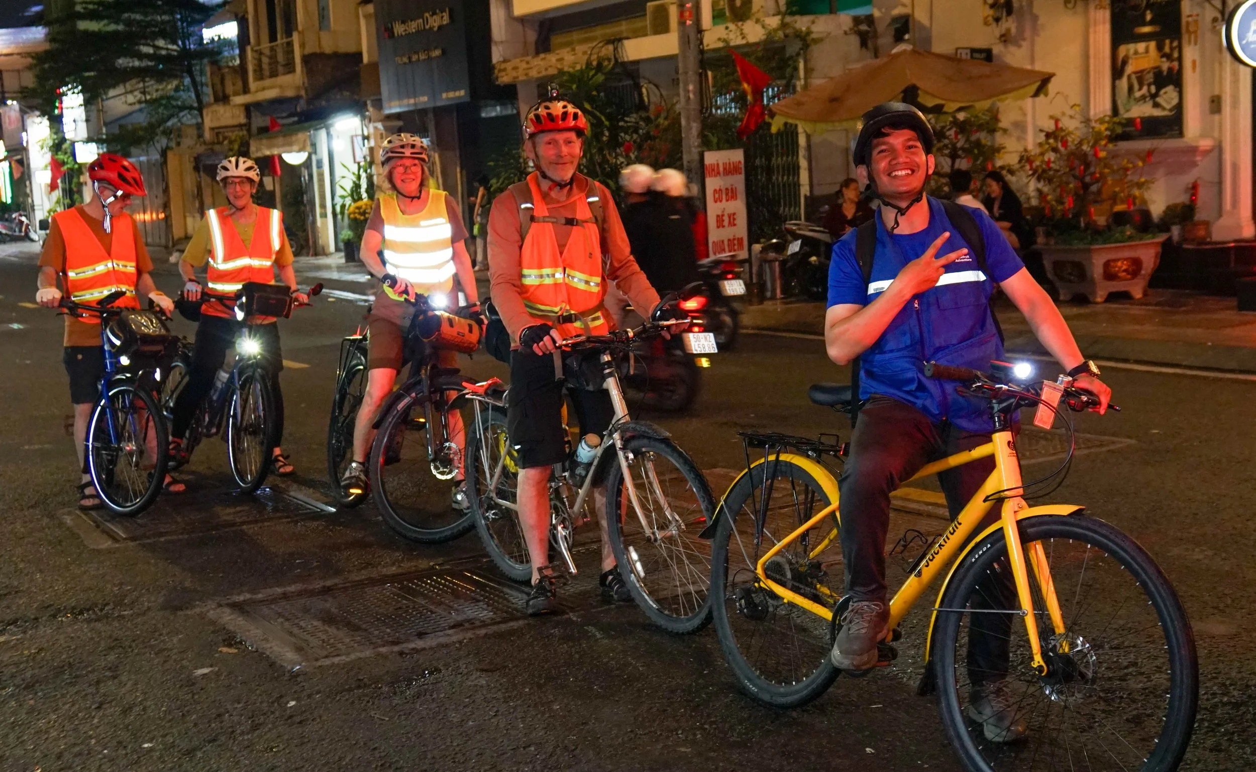
Cycling through a narrow alley in District 4, Ho Chi Minh City. Jackfruit Adventure.
Why Cycling Is the Best Way to Explore Saigon's Hidden Side
The case for cycling in Ho Chi Minh City is partly practical, partly philosophical. Practically, a bicycle fits where most vehicles cannot: into the narrow hem, or narrow alleys, that thread between apartment buildings, across bridges too small for tour vans and through residential pockets where the pavement disappears into something closer to a path. Philosophically, cycling enforces a kind of slowness that is otherwise difficult to maintain in a city built around speed. At walking pace, the distances can feel discouraging. By taxi, the windows are closed and the landscape blurs. On a bicycle, both problems dissolve. The city becomes navigable and legible at the same time, the canal routes, the alleyway markets, the residential streets that look identical on a map but reveal entirely different characters when ridden through in the early afternoon.
What follows covers two of the most compelling cycling routes in Ho Chi Minh City for travelers interested in the city beyond its tourist corridor: District 4's network of historic alleys, and Thanh Da, the peninsula that somehow remains countryside inside a metropolis of nine million people.
District 4: Cycling Through a Neighborhood That Reinvented Itself
District 4 occupies a triangular islet surrounded by the Saigon River and a network of canals, separated from District 1 by the narrow Ben Nghe Creek. The geography alone makes it unusual, a district defined by water on every side, just minutes from the city center yet operating at a noticeably different pace.
A Neighborhood Shaped by Its Own History
Despite its proximity to downtown Saigon, District 4 carries a reputation that took decades to soften. Throughout the 1990s, it was known in local media as one of the city's roughest neighborhoods, associated with organized crime and a string of high-profile gang activity. The most concrete reminder of that era is Alley 148 on Ton Dan Street, once home to a gang leader whose name still surfaces in conversations with older residents.
Today, the alley tells a different story. Small homes have been renovated, residents greet passersby without hesitation and the maze of interconnected paths feels more like a close-knit village than a former crime hotspot. The transformation did not erase the past so much as build something new on top of it, a quality that makes the neighborhood more interesting to move through, not less.
Alleyways Worth Cycling Through in District 4
Cycling through District 4 is less about following a route than letting the alleys lead you. Doan Van Bo Street is a good starting point, with narrow lanes that turn into dead ends, hidden food stalls, quiet cafes and homes packed tightly together. Getting lost here becomes part of the experience.
Nearby, Alley 200 on Xom Chieu Street comes alive after 1:30 p.m., turning into a 300-meter food corridor with more than fifty stalls serving sweet soups, stews and local snacks. Known as “Cho 200,” it stays busy into the evening.
Biking makes the district easier to explore, offering access to narrow streets while moving slowly enough to notice what cars would miss.
Thanh Da: Where Saigon's Countryside Somehow Survived
If District 4 reveals an urban Saigon shaped by history, Thanh Da reveals one that has, so far, resisted urbanization almost entirely. Technically, a peninsula formed by a wide loop in the Saigon River, Thanh Da is connected to the rest of the city by a single bridge from District 1. The shift in atmosphere happens almost the moment that the bridge is crossed.
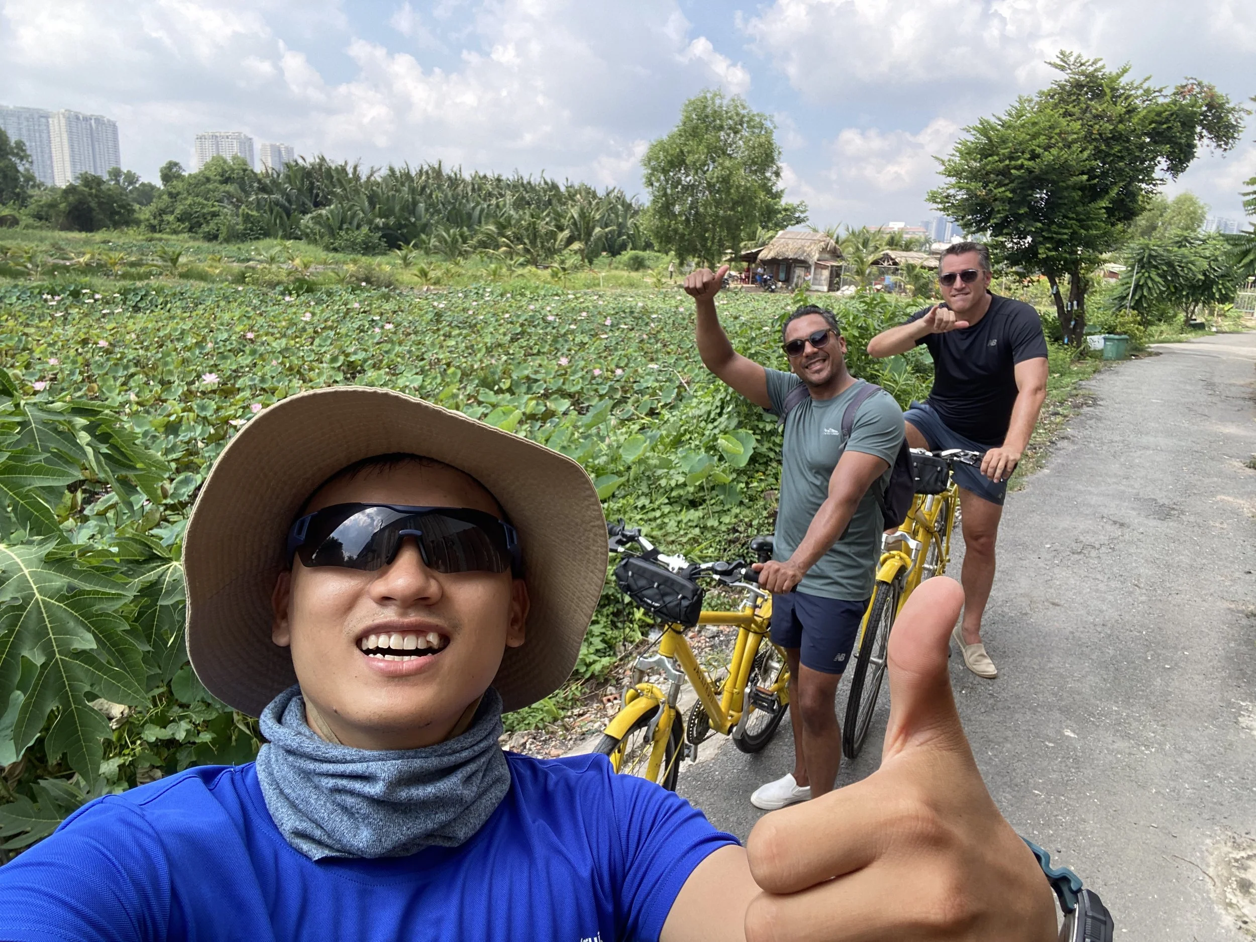
Cycling along a quiet road on Thanh Da Island, Ho Chi Minh City. Jackfruit Adventure.
Countryside, Seven Kilometers from Downtown
On the District 1 side of the bridge, a four-lane road is lined with shops, offices, and high-rise apartment buildings. Cross over, and the road narrows abruptly into the two-lane Binh Quoi Road, which feels more like a provincial route than a thoroughfare inside a major city. The peninsula sits only about 7.5 kilometers from the city center, reachable by taxi in roughly 20 minutes or by bicycle in around 40.
Beyond the cluster of apartment blocks near the bridge entrance, Thanh Da is dominated by low-rise homes, small shops and scattered government buildings. Much of its road network has never been formally mapped, a fact immediately apparent to anyone navigating the peninsula's interlaced paths and dead-end lanes. The area is dotted with rice paddies, market gardens and fish ponds, and it is common to come across chickens, geese and the occasional pig wandering an unfenced yard.
What Thanh Da Actually Offers
For travelers cycling in Ho Chi Minh City, the appeal of Thanh Da lies in this contradiction: countryside scenery that exists not hours outside the city, but within it. Locals fish in its ponds, tend small gardens and move along paths that long predate the apartment towers visible across the river. Lotus ponds appear in unexpected corners. Small temples sit along the water's edge.
What Thanh Da offers is not a curated attraction but an accident of geography; a peninsula that happened to remain agricultural while the rest of the city grew up around it. For a city often defined by speed and density, it is a reminder that not every part of Ho Chi Minh City has chosen to keep up.
A more detailed account of the area, including access points and what to expect on the roads, can be found in this overview of cycling to Thanh Da Island.
What Slow Travel Reveals About Ho Chi Minh City
Some understanding only comes from moving slowly through unfamiliar streets, not toward a landmark, but along a road and watching what appears. In District 4’s alleys and Thanh Da’s quiet paths, it shows up in small, unscripted moments: a vendor calling out a snack price, a resident untangling fishing line, a temple half-hidden behind houses.
These places are rarely packaged for international visitors because they do not follow a fixed itinerary. There is no perfect time, no must-see checklist and no promise that the same alley will feel unchanged next time. What they offer is a Ho Chi Minh City still being lived in, not staged.
Travelers who want to ride farther can explore Hoang Sa-Truong Sa’s canal paths or the longer riverside route toward Can Gio. But for now, District 4 and Thanh Da remain close, quiet and worth discovering by bicycle.

Thao
Thao is a content writer and Saigon wanderer who has spent years getting lost in the city's back alleys, canal-side roads, and neighborhood markets. She writes about food, culture, and slow travel in Ho Chi Minh City, and contributes to Jackfruit Adventure.