
Following the earthquakes on June 24, organizations are mobilizing to provide food, water, medical care and relief services to Venezuela.
Read MoreThe Fight Against a Sinking City: Jakarta’s Sea Wall
Julia Kelley
While Indonesia’s government seeks to build a large sea wall to protect Jakarta from detrimental floods, criticism in the name of environmental and economic loss urges them to look for other solutions.
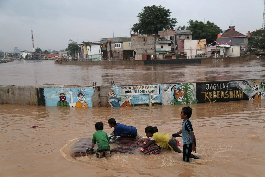
Flooding Ciliwung River in Jakarta Region. World Meteorological Organization. CC BY-NC-ND 2.0.
On the northwest coast of Indonesia stands Jakarta, the country’s capital and largest city. Sitting upon a low, flat alluvial plain with swampy areas, Jakarta is notably susceptible to major floods every few years from its multiple rivers and the adjoining Java Sea. This is made worse by excessive groundwater extraction and rising global sea levels, which have seen a worldwide mean increase of about eight to nine inches since 1880 due to global warming. Rapid urbanization, population growth and a change in land use have crowded more and more people into high-risk floodplain areas, leaving thousands displaced and large parts of the city submerged underwater during these natural disaster events. Although the Indonesian government built a coastal wall in 2002 to combat this, its collapse in a storm only five years later renewed the call for protective measures against destructive flooding. A new mega-project began in 2014, outlining both the construction of a new 29-mile-long sea wall and the so-called “Giant Sea Wall.” This “Giant Sea Wall,” a 20-mile-long artificial island shaped like a Garuda bird, Indonesia’s national symbol, will not only block storm surges but is also planned to contain homes, offices and recreational facilities.
This massive undertaking officially kicked off in February 2025 and is said by supporters to be key in dealing with the country’s land subsidence and flooding. Both President Prabowo Subianto and Minister of Infrastructure and Regional Development Agus Harimurti Yudhoyono claim that the project could save the government billions of dollars in disaster mitigation over the following 30 years. Despite this optimism, critics have come out against the large project, citing an array of detrimental economic and environmental issues that could result from construction. For example, many have noted how the proposed solution does not address the over-extraction of groundwater, which comes from excessive use by industrial and economic activities. In addition, the sea wall could disrupt marine biodiversity and, subsequently, the fishing industry, one of Indonesia’s strongest monetary sources. According to Maleh Dadi Segoro, a coalition of environmental and social groups, the sea wall would potentially narrow and close fishing catch areas, disrupting marine ecosystems and threatening the livelihoods of those who depend on them for food and income. Jakarta already faces low water quality in its rivers and canals, causing sewage and a lack of proper sanitation. Closing off Jakarta Bay for this sea wall, critics say, would turn the water into a “septic tank” or “black lagoon,” which necessitates a stronger water sanitation system immediately.
Controversy stirred up by the sea wall proposal has thus solicited alternative solutions. There has been an interest in using the water to its advantage, rather than working against it. This would entail diverting surplus waters, including that from floods, to surrounding farm areas where it could be stored. Restoration has also been widely proposed, as described by professor of oceanography Alan Koropitan for The Guardian: “If, instead, we can restore the bay and its polluted waters, that would mean something good for civilization in Indonesia.” Among all these suggested plans, environmental, social and economic protection are set at the center, urging the Indonesian government to rethink its monumental and costly plan.
GET INVOLVED:
Those looking to help support those affected by floods and flood prevention in Indonesia can do so by checking out relief organizations, such as The International Federation of Red Cross and Red Crescent Societies’ Disaster Response Emergency Fund, Peace Winds and Mercy Corps, all of which provide immediate and long-term support. Furthermore, individuals interested in combating sea level rise can look into taking actions that counter global warming, including using renewable energy, reducing greenhouse gas usage, considering electric vehicles, recycling, decreasing food waste, keeping the environment clean, or getting involved with local communities and government to organize plans and legislation.
Julia Kelley
Julia is a recent graduate from UC San Diego majoring in Sociocultural Anthropology with a minor in Art History. She is passionate about cultural studies and social justice, and one day hopes to obtain a postgraduate degree expanding on these subjects. In her free time, she enjoys reading, traveling, and spending time with her friends and family.
Uncontrolled Burn: Canada’s Devastating Wildfires
Thousands of wildfires, miles of scorched forests and colossal plumes of smoke are threatening Canada on all fronts.
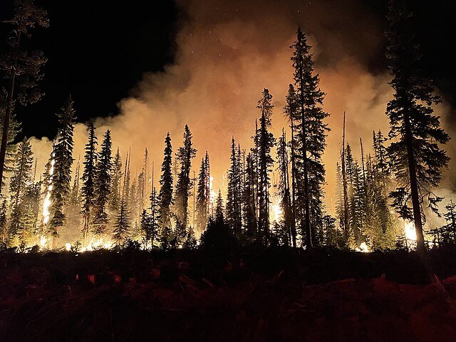
Forest fire at night. U.S. Forest Service, public domain
Canada is no stranger to wildfires. According to the Canadian National Fire Database, over 8,000 fires occur every year, burning over 2 million hectares of land. The highest risk period for fires starts in April or May and lasts all the way through September or October, with hold-over fires potentially burning well into winter.
But recently, fires have become more and more frequent earlier in the year. These early fires have also been growing in severity and damage, which should only happen well into the summer. Canada has endured over a thousand fires in 2024 alone, with 104 currently raging as of late May. Most are relatively under control thanks to quick responses from fire teams, but about a seventh are registered as “uncontrolled.” Despite the best efforts of local fire companies and government action, these fires have devoured thousands of hectares of land and are currently threatening several cities across the country.
The Parker Lake fire, named for its apparent origin point, caused thousands of citizens of Fort Nelson in British Columbia to flee their homes. At that time the fire was already roughly 3 square miles in size; the long period of dry weather, coupled with strong winds, caused the fire to grow out of control, which prompted evacuation orders on May 11th. Parts of Alberta have also been given orders to prepare for evacuation as other fires steadily approach.
In addition to the threat posed by the blazes themselves, the smoke produced by the constant burning has blanketed most of Canada and is beginning to drift south into the midwestern United States. This smoke can cause serious reactions in those with existing respiratory illnesses and even be harmful to the lungs of healthy individuals. Given the severity of 2023’s wildfire season, we can expect a tremendous amount of smoke this year as well.
There are many possible causes for wildfires, ranging from the carelessness of individual hikers or campers to the climate itself. Higher global temperatures can cause more frequent flare-ups, long-lasting droughts can leave forest floors incredibly dry and flammable, and warmer winters leave less snow behind, resulting in even dryer conditions. Additionally, zombie fires—blazes that have smoldered underneath the snow over winter only to reemerge after the spring thaw—have increased the number of threatened communities.
How You Can Help
Fire season has only just begun in Canada and the nation is already being battered from all sides. Conditions are only expected to worsen as the temperatures rise and droughts linger; more evacuations are also expected as a result. However, several charities have already begun donating to the firefighters working to combat the blazes, as well as the many displaced citizens. Sites such as Global Giving and the Canadian Red Cross are excellent ways to help offset the devastation wreaked by the hundreds of wildfires.
Ryan Livingtston
Ryan is a senior at The College of New Jersey, majoring in English and minoring in marketing. Since a young age, Ryan has been passionate about human rights and environmental action and uses his writing to educate wherever he can. He hopes to pursue a career in professional writing and spread his message even further.
Madagascar’s Cyclone Gamane—The Devastating Storm Nobody’s Talking About
Thousands of homes were destroyed and families displaced, with almost no American news coverage.
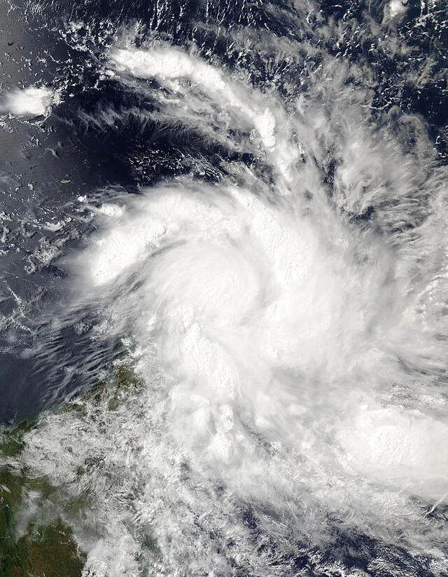
Cyclone Gamane over Madagascar. NASA, CC0
A few weeks ago, Cyclone Gamane made landfall on Madagascar. It devastated the island in no time flat, leaving tens of thousands of people homeless and without food or electricity. It arrived on March 27th; the government declared a state of emergency on April 3rd. And despite all of this, there was almost no American news coverage about the disaster.
Gamane began as a tropical cyclone over the South Indian Ocean. By the time it reached Madagascar, its wind speed was clocked at an average of 93 mph, with gusts up to 130 mph recorded. Thirty-three communes were flooded in the three days it pummeled the northern coast, and more than 780 houses were destroyed. Eighteen people were killed and more than 22,000 were displaced from their homes. Estimates suggest that there are roughly 220,000 people in need of humanitarian assistance on the island.
Even before the cyclone, Madagascar was numbered among the worst off in the Global Hunger Index in 2023. Before the flooding in February and with Gamane, much of the island was unable to produce enough food to support the population. Roughly 1.6 million citizens are food insecure, relying instead on humanitarian aid. Additionally, the cyclone came at the beginning of Madagascar’s notoriously dry lean season, which lasts from late March until May. If conditions don’t improve quickly, there are concerns that large chunks of the country will experience crisis-level food insecurity.
Emergency supplies on the island are already low—Gamane is only the third crisis to hit Madagascar in 2024, after the Alvaro storm in January and heavy flooding in February. Local humanitarian associations have made efforts to help the populace recover, but without resources, the government has had to call for aid from other countries.
The UN has set up a funding program under the CERF, the Central Emergency Response Fund, to accumulate funds to send to Madagascar. As of April 21st, the program is 20% funded, and is seeking to raise 90 million dollars. Smaller humanitarian organizations, such as the Redemptorist Solidarity Office (headquartered in Cork, Ireland), have taken action in the meantime to provide what help they can. According to their website, the RSO has provided 15,000 pounds for financial support and is shipping several tons of food items and medical kits. They hope to raise enough money to help provide shelter-building supplies for the displaced as well.
Madagascar is uniquely situated as one of the most susceptible places on Earth to natural disasters. Over the last 35 years, more than 50 hazards, including locust swarms, droughts, and heavy flooding, have struck the country and affected nearly half of the entire population. This has, to some degree, resulted in less coverage being dedicated to each event; even now, almost a month since the storm first made landfall, it has received very little publicity in the United States. But despite this lack of interest, humanitarian action is still being taken. It will be an uphill battle, between the fallout from the storm and the height of the lean season approaching, but with the help of the UN and other independent aid groups, Madagascar can and will recover.
Get Involved
At the moment, due to the lack of publicity that the crisis has received in the US, there are not many volunteer opportunities within the country. Those looking to help can donate to SEED Madagascar (which seeks to combat food insecurity), UNICEF Madagascar (which is working to minimize the effects of climate change on the island), or the World Food Programme’s Madagascar mission (which aims to supply over 1.6 million people with humanitarian assistance).
Ryan Livingston
Ryan is a senior at The College of New Jersey, majoring in English and minoring in marketing. Since a young age, Ryan has been passionate about human rights and environmental action and uses his writing to educate wherever he can. He hopes to pursue a career in professional writing and spread his message even further.
Beyond the Quakes: Taiwan’s Earthquake Preparedness
Despite being hit with a 7.4 magnitude earthquake during rush hour on April 3rd, 2024, Taiwan has emerged largely unscathed. Why is that?
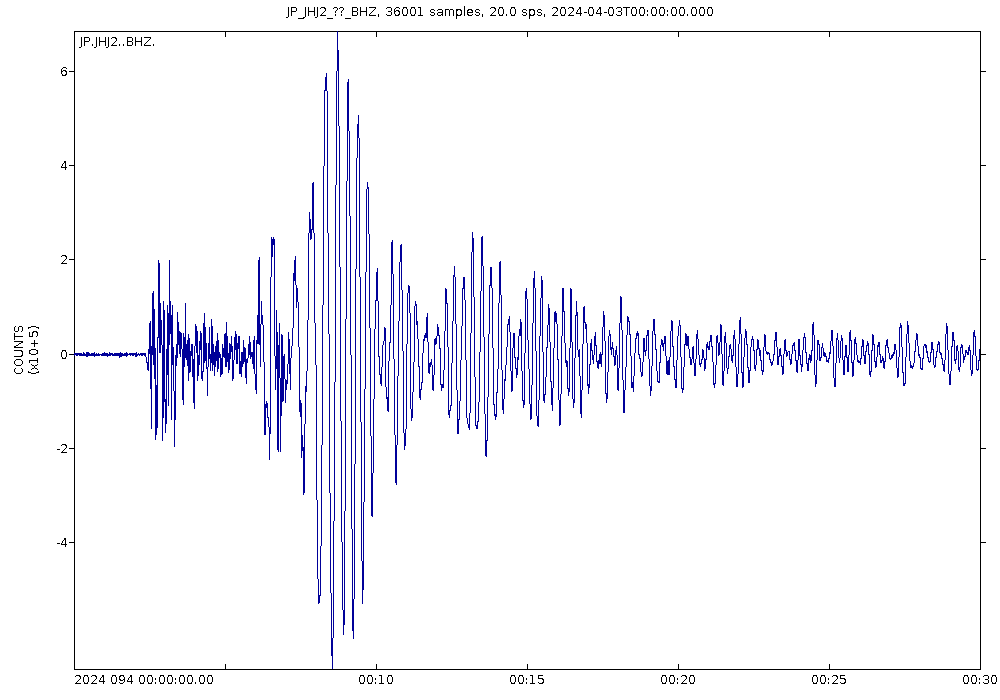
A seismogram of the April 3rd, 2024 earthquake in Taiwan. James St. John. CC BY 2.0
On April 3rd, 2024, the strongest earthquake in about 25 years rocked the streets in and around Hualien on the east coast of Taiwan, followed by hundreds of aftershocks. While the search for survivors remains underway, so far 13 people have been found dead, and nearly 1,000 people have reported injuries. While any number of deaths and injuries is tragic, these figures are minuscule compared to the near 2,500 dead and 100,000 injured during the 7.7 magnitude earthquake that struck in 1999 and left approximately 50,000 homes destroyed.
Considering its location along the Ring of Fire and the presence of three seismic belts in the country, Taiwan has a long history of earth-shaking events. The Ring of Fire refers to a fault line around the Pacific Ocean that is home to a majority of the world’s earthquakes. Because of this, Taiwan records an average of about 2,200 earthquakes every year, with a record of nearly 50,000 during 1999. Taiwan’s mountains then amplify the impact of earthquakes, which resulted in the landslides that accounted for most of the deaths on April 3rd.
Because of this susceptibility and catastrophic earthquakes in the past, Taiwan has developed some of the best earthquake preparedness techniques in the world. Following the devastating Chi-Chi earthquake in 1999, the Taiwanese government began reforming construction regulations. This included seismic retrofitting in buildings and infrastructure across the country and the prosecution of inadequate construction practices. Years of experience have also resulted in efficient emergency response, aided by surveillance cameras and social media used to identify locations requiring aid.
Educating the public has been another initiative to prevent deaths during earthquakes and aftershocks. In addition to public awareness campaigns, the Central Weather Administration frequently publishes resources including information and tips surrounding earthquake preparedness. The Central Weather Administration has also run a real-time seismic network since 1994, which tracks data and notifies the public of seismic activity through an early warning system. The data collected by the seismic network is also used to update building codes.
GET INVOLVED
Ways for people to support Taiwan’s emergency response and earthquake preparedness include donating to and supporting organizations such as the Red Cross, Taiwan Root Medical Peace Corps and Peace Winds America.

Madison Paulus
Madison is a student at George Washington University studying international affairs, journalism, mass communication, and Arabic. Born and raised in Seattle, Washington, Madison grew up in a creative, open-minded environment. With passions for human rights and social justice, Madison uses her writing skills to educate and advocate. In the future, Madison hopes to pursue a career in science communication or travel journalism.
10 Natural Disasters that Shook History
Witness the awe-inspiring forces of nature unleashed through devastating hurricanes, volcanic eruptions and catastrophic floods.
Read MoreKazakhstan's Journey From Nuclear Devastation to Disarmament
The harrowing story of Soviet nuclear testing in Semipalatinsk, Kazakhstan, and the wrangling with its legacy.

The center of the Semipalatinsk nuclear test site.Alexander Liskin.CC BY-SA 3.0.
It was the summer of 1953. Valentina Nikonchik was outside playing in Semey, a village in eastern Kazakhstan, then part of the Soviet Union. The ground suddenly trembled, and the air filled with a deafening boom that shook Nikonchik to her core. Little did she know that she had witnessed the first detonation at “the Polygon” of a thermonuclear device, a monstrous weapon of mass destruction that released a force equivalent to 400 kilotons of TNT.
West of Nikonchik’s hometown of Semey lies Semipalatinsk, the testing location where the Soviet Union’s nuclear visions were accomplished. A once-thriving region, now a desolate wasteland, has a dark history. In this Central Asian Soviet Republic, the Soviets conducted nearly 400 nuclear tests, blasting a lethal storm of radioactive isotopes into the environment and soil from 1949 to 1989. Even now, the consequences of these tests are still felt, with environmental damage and public health risks ongoing in the area.
At a conference commemorating the ninth anniversary of the Nevada-Semipalatinsk movement, the first anti-nuclear protest movement in the USSR, statistics showing that between 500,000 and 8 million people were directly impacted by the test site’s operations were presented. The detonations, with their tragic and predictable repercussions, represent one of the twentieth century’s major ethical violations. Altogether, the total force of the nuclear explosions at Semipalatinsk equals more than 2,500 Hiroshima bombs. The long-term health effects for the region were harrowing, including an alarming spike in health issues such as miscarriages, birth deformities, and suicides blamed on “unsanitary conditions” in the area by Soviet military scientists in the following decades. What is so disturbing about these dismissals is that the same medical professionals had been performing creeping radiation tests on the villagers for years.
The testing site, despite being uninhabited, is encircled by villages, and the major hub of Semipalatinsk lies just 160 km away. But the testing was kept secret, known only to top Communist Party officials, while anyone who spoke out against the detonations was immediately silenced. Russian scientists confessed that they failed to follow burial and nuclear material protection protocols, as they thought that no one would be in the area. The newly independent Kazakh government officially acknowledged 1,323,000 people as negatively affected by nuclear testing in 1992. However, just 1,057,000 of them received radiation passports, leaving over a quarter of those affected without the requisite documentation. From 2003 to 2017, a $30.5 million reimbursement was intended to give relief to over 700,000 passport holders. Divided between them, a pittance of only only $40 was allocated to each individual each year.

Map of Semipalatinsk Nuclear Test Range, Area “N”. Martin Trolle Mikkelsen.CC BY 2.0.
In 1990, a year before independence, the International Physicians for the Prevention of Nuclear War (IPPNW) and Kazakh poet Olzhas Suleimenov’s Nevada-Semipalatinsk Movement banded together and pushed Soviet leader Mikhail Gorbachev’s to issue declaration of a nuclear testing moratorium. Kazakhstan seized the opportunity to declare independence the same year and promptly closed down the infamous Semipalatinsk plant. Then, the nation went further, renouncing its inherited position as the world's fourth-largest nuclear weapons owner, and relinquishing its stockpile.
Despite this, the inhabitants go about their regular lives, seemingly unaware of the danger that surrounds them. They swim and fish in the lakes, graze their herds and pick wild strawberries all while being exposed to the poison lurking in the ground and air. However, the danger does not end there. The area will remain a bleak wasteland for millennia, poisoned with plutonium, strontium, and cesium, unfit for human habitation. Residents continue to graze their animals and collect contaminated scrap metal on the polluted land as the 7,065 square mile region is devoid of barriers, fencing, and warnings reminding people of its radioactive status.
Semey, once a thriving city, has suffered the brunt of the devastation. While acute blasts of radiation produced immediate harm, repeated modest doses of radiation over time can accumulate to cause great damage. The wind on the Kazakh steppe has brought the radioactive fallout to nearby settlements, amplifying the impact. The repercussions of nuclear testing have been passed down to future generations as a result of radiation-induced mutations in the population’s chromosomes. As a result, the region’s life expectancy is seven years lower than the national average due to a rise in the prevalence of cancer, thyroid sickness, and birth abnormalities. Tolkyn Bulegenov, Vice President of Semey Medical University, confirms that “in the zones adjacent to the test site, one can encounter 10 to 15% more malignant thyroid and blood malignancies - hematological blastoma, leukosis, lymphoma, and chronic leukemia - than in other regions of Kazakhstan.”

Semipalatinsk Nuclear Test, the effect of radiation on the fetus. Perrona Patrick André Perron.CC BY 3.0.
The late 1980s saw a glimmer of hope for the people of Kazakhstan. As the world was introduced to Gorbachev’s nuclear testing moratorium, the Nevada-Semey movement was born on Kazakh soil with a mission to shut down the Semipalatinsk polygon. Kazakhstan destroyed its inherited weapons testing infrastructure and disposed of the remaining vulnerable nuclear material with the cooperation of foreign partners, including the United States.
On August 29, 1991, President Nursultan Nazarbayev signed the proclamation closing the test site, popularly known as the Polygon, which marked a watershed point in Kazakhstan’s recent history. As part of the Nunn-Lugar Cooperative Threat Reduction Program, the United States collaborated with Kazakhstan between 1995 and 2001 to seal 13 boreholes and 181 tunnels at the test site. From 2012 to 2019, the National Nuclear Security Agency and the Netherlands led two major radiological security operations in Kazakhstan, securing approximately 13,000 radioactive sources from the National Nuclear Center and the Mangystau Atomic Energy Complex. Kazakhstan confirmed its commitment to a nuclear-free world in 2021, in accordance with the Treaty on the Prohibition of Nuclear Weapons.
Kazakhstan’s commitment to disarmament has allowed the nation to serve as an example of a responsible state that has relinquished its nuclear weapons, setting a global precedent for responsible statehood. Kazakhstan has created an environment conducive to the formulation of a multifaceted foreign policy by abandoning its nuclear weapons and closing the world's most extensively used nuclear test site, allowing the country to collaborate with China, Central Asia, Europe, and the United States. While each nuclear-armed state faces unique problems, Kazakhstan’s peaceful approach to disarmament has encouraged many, and its lessons serve as a guide for other countries seeking a similar path.
TO GET INVOLVED:
The Nuclear Threat Initiative (NTI) is a nonprofit global security organization focused on reducing nuclear and biological threats imperiling humanity. You can learn more about NTI and its records on nuclear disarmament in Kazakhstan here.
Togzhan Kassenova’s Atomic Steppe: How Kazakhstan Gave up the Bomb explains Kazakhstan’s denuclearization process in detail. Kassenova’s book explains how Kazakhstan’s leadership considered security interests as well as economic, political, and diplomatic priorities when making the decision to give up nuclear weapons. You can learn more about Atomic Steppe on Amazon here.

Hope Zhu
Hope is a Chinese international student at Wake Forest University in North Carolina studying sociology, statistics, and journalism. She dreams of traveling around the globe as a freelance reporter while touching on a wide range of social issues from education inequality to cultural diversity. Passionate about environmental issues and learning about other cultures, she is eager to explore the globe. In her free time, she enjoys cooking Asian cuisine, reading, and theater.
Earthquake in Turkey and Syria: What This Means for Regional Development
In the early hours of February 6th, Turkey and Syria were struck by a destructive earthquake that will have lasting implications for living standards.
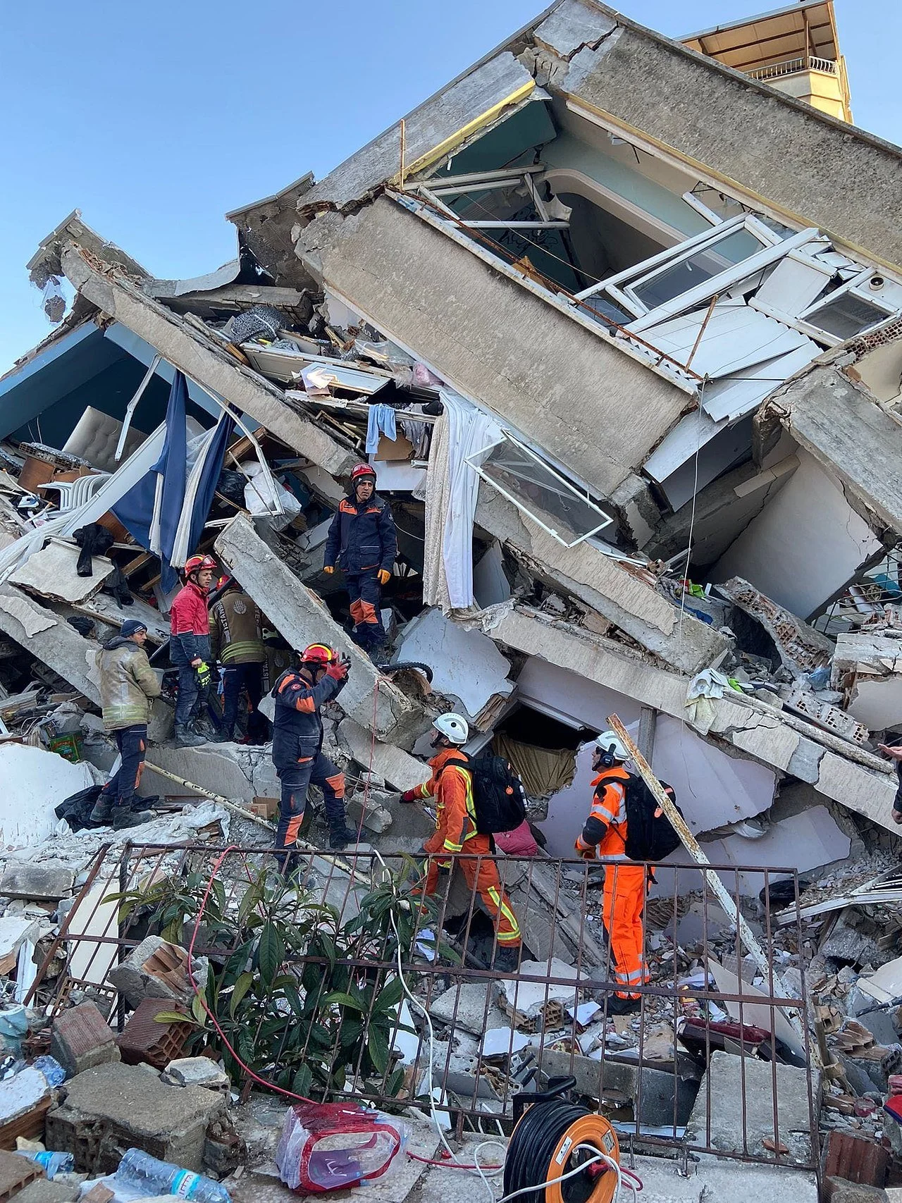
Hatay, Turkey, 9 February 2023. CC BY 2.0
In the early morning of February 6, southeastern Turkey was hit by a magnitude 7.8 earthquake, running all the way through most parts of Syria. About 9 hours later another 7.5 quake rocked the Turkey-Syria border, with over 200 aftershocks recorded. The seismic phenomena have left over 33,000 dead, a number that is expected to rise, buildings turned to rubble, and a region on the brink of developmental disaster. Survivors have been left homeless in the streets in sub-freezing temperatures with no access to food or water, struggling to find their loved ones amid the remains.
Sitting on the Anatolian plate between two major faults - the North Anatolian Fault and the East Anatolian Fault - Turkey is vulnerable to strike-slip seismic activity. The main earthquake that occurred on Tuesday morning had its epicenter in the city of Nurdaği, located in the Gaziantep province, which is home to many Syrian refugees who have escaped that country’s Civil War. A developing nation, Turkey struggles to implement legitimate housing laws that keep buildings up to safety standards. The nation’s president, Recep Tayyip Erdoğan, has reported that poorly enforced regulations played a role in making earthquakes so damaging, as buildings quickly collapsed due to their already vulnerable state. In Syria 11 years of conflict have made it nearly impossible to enforce building standards, and most cities already host vulnerable living conditions, the war leaving buildings and areas unstable and unprepared for seismic activity.
What are the long-term implications of such natural disasters on this region of the world? Sitting on such an active fault line, with Syria to the south on the Arabia Plate Tectonic, Turkey and its neighbor could experience more quakes. Buildings which have not collapsed from this earthquake are at risk if there is any more seismic activity. At the moment Turkey and Syria both face a deep humanitarian crisis, and will soon have to come up with the money to rebuild. Turkey, already facing a turbulent economic situation, must now spend billions of dollars in a rebuilding project, combined with upcoming elections on May 14. The nation’s economic growth for 2023 could now be up to 2 percentage points less, leaving the nation behind in its development goals.
President Erdoğan has continued to threaten Syria’s Assad regime on political matters, which include his habitual threats to attack Kurdish groups in the northern part of Assad’s domain. However, both nations have agreed to offer each other diplomatic assistance and aid after this disaster, and accept international help for the wellbeing of their citizens. This type of earthquake diplomacy is also paving the way for other states with bilateral tensions, such as the United States and Russia, to collaborate with one another and assist Turkey and Syria for the sake of supporting human life and future development in the region.
TO GET INVOLVED:
UNICEF is accepting donations and financial contributions to help on-the-ground volunteers get aid to children and families affected in both Turkey and Syria. For more information on getting involved, click here.
Save the Children is accepting donations to help surviving children receive food and shelter. To get involved, click here.
CDP has opened a Recovery Fund to help in the reconstruction of buildings in Turkey and Syria, as well as provide aid and resources for survivors. To donate, click here.

Kimberly Hidalgo
Having obtained a MA in International Policy, Kimberly seeks to bridge the gap between global development and government legislation. Growing up between the United States and Spain, she believes that travel is the best way to discover yourself and understand the world. Her goal is to promote a deeper awareness of the effects of climate change in society and politics.
World Central Kitchen: Relief Through Food
World Central Kitchen is a relief program that sends food and cooks to areas affected by disaster, that recently had a base in Ukraine hit by a Russian missile. Read to learn more about World Central Kitchen and how to support its efforts.
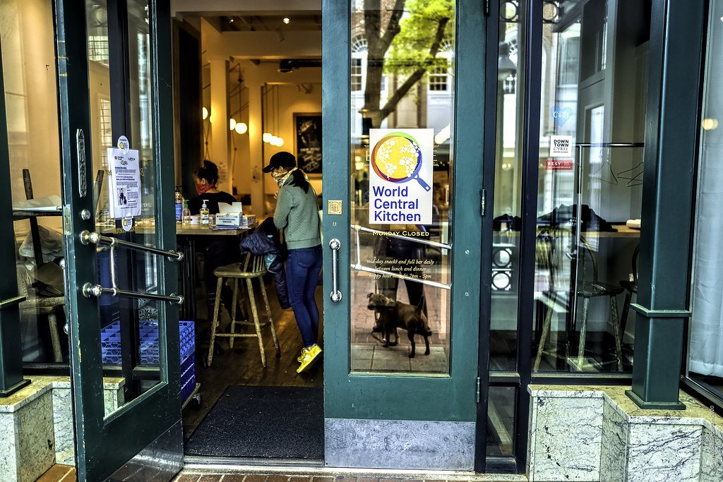
World Central Kitchen location in Charlottesville, Va. Rick Stillings. CC BY-NC-SA 2.0.
José Andrés founded World Central Kitchen in 2010 when Haiti was hit by an earthquake. The philosophy behind World Central Kitchen is that it isn’t simply food needed after a disaster, but chefs who are willing and able to cook food in the style that the people in the affected area are accustomed to, as a source of not only nourishment but also comfort. Ever since, World Central Kitchen has responded to disasters both environmental and humanitarian.
While World Central Kitchen works to support any area in crisis, it has a specific Climate Disaster Fund. The fund is committed to spending $1 billion over the next ten years to combat climate change and assist those affected by extreme weather. It focuses on three areas: food provision for victims of climate disasters, investment in the communities most impacted by climate change and climate policy change. In terms of investing directly into communities, World Central Kitchen has a program called the Food Producer Network, which works directly with and financially supports independent farmers, fisherman and other food providers within these communities. The Food Producer Network provides grants and loans, as well as sending volunteers to work for these small businesses (if volunteers are desired). The Food Producer Network specifically operates in the Bahamas, Guatemala, Puerto Rico and the U.S. Virgin Islands.

World Central Kitchen/World Food Programme Volunteers in Beira, Mozambique. DFID - UK Department for International Development. CC BY 2.0.
World Central Kitchen recently received a lot of publicity because its base in Kharkiv, Ukraine was destroyed by a Russian missile on April 15. This is the first time that World Central Kitchen has set up a kitchen in an active war zone, and the kitchen was not the only place hit; residences and businesses in Kharkiv were hit as well, as the missile directly hit the building across the street from the kitchen. Despite several staff members being hospitalized as a result of the missile, World Central Kitchen intends to set up another location elsewhere in Ukraine.
World Central Kitchen accepts monetary donations and trains volunteers in or adjacent to the places that they are currently serving. As of May 17, they are looking for volunteers in Poland, Madrid, Barcelona, Málaga, Puerto Rico, Virgin Islands, The Bahamas and Guatemala. Some other food relief programs currently working to provide food (or money, through food) for the disaster in Ukraine are Cook For Ukraine, founded by Eastern European chefs working in conjunction with UNICEF, and Bakers Against Racism’s “Bake For Ukraine” campaign, which is an international bake sale program that has raised over $2.5 million for several global causes.

Calliana Leff
Calliana is currently an undergraduate student at Boston University majoring in English and minoring in psychology. She is passionate about sustainability and traveling in an ethical and respectful way. She hopes to continue her writing career and see more of the world after she graduates.
Chernobyl Becomes a Symbol of Resilience, 35 Years After Disaster
Time and time again, humans have been ravaged by disaster, only to successfully prove their resilience. Thirty-five years after the Chernobyl nuclear disaster, Ukrainians appear eager to rewrite their story.
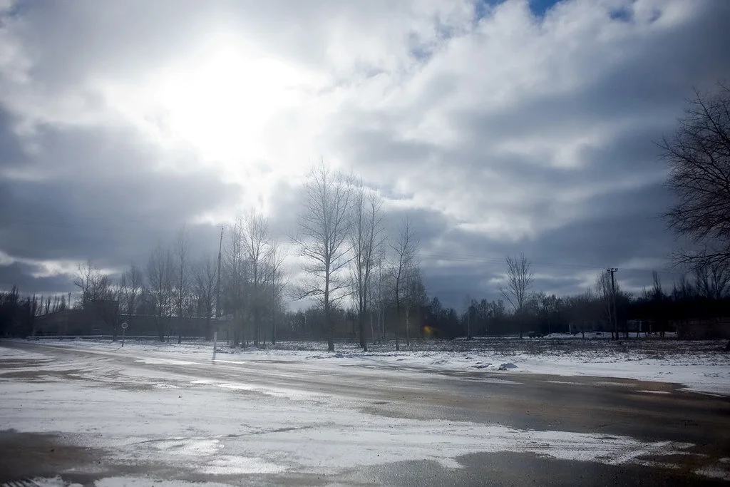
The abandoned streets of Chernobyl, Ukraine. Pedro Moura Pinheiro. CC BY-NC-SA 2.0.
The Chernobyl nuclear disaster of 1986 marked chaos for the Soviet Union and still influences modern-day Ukraine. The accident was caused by a series of technical faults, resulting in a nuclear explosion that spewed radioactive substances into the air. Chernobyl stands as the most devastating nuclear incident to have ever occurred, with 31 deaths as a direct result of the meltdown, 4,000 cancer deaths from exposure to radiation and millions affected in various other ways.
President Volodymyr Zelenskyy announced that Chernobyl will now function as a nuclear waste site.
Now, at the 35th anniversary of the Chernobyl disaster, Ukrainians are determined to move forward. Life has slowly begun to return to the area; the “exclusion zone” stands as a prime example of the resilience of nature. What was once a deadly zone, marked as a no man’s land, now abounds with life. Radiation levels in the area have decreased over the years, creating a nature preserve of sorts—elk, deer and other wildlife graze throughout the empty space.
As frightening as Chernobyl may seem, locals have moved back. Elderly residents have returned to the surrounding area despite being advised against it; for them, the comfort of home outweighs the peril of living in the region. These residents stand as a reminder of the power—and the risks—that follow one’s determination.
Officials in Ukraine hope that Chernobyl will be added as a World Heritage Site, as many residents believe that the outsize influence of the site merits its inclusion.
Once wholly abandoned, Chernobyl and the nearby town of Pripyat allow visitors today. Travelers come to the site and find an unconventional experience; the disaster has created a reflective tone, as Chernobyl’s tragic history sheds light on the lows of human struggle and the highs of human triumph.
On April 26, Ukrainian President Volodymyr Zelenskyy announced that Chernobyl will now function as a nuclear waste site. It is projected that the nuclear waste site will save Ukraine about $200 million per year.
Zelenskyy also promised to “transform the exclusion zone, as Chernobyl is referred to, into a revival zone.” While it won’t be easy, Ukraine intends to move on from the past and head toward a stronger future.
As time passes, many tragic incidents of history dissolve from the spotlight. With revival on the horizon, Ukraine hopes for a triumph at Chernobyl.

Ella Nguyen
Ella is an undergraduate student at Vassar College pursuing a degree in Hispanic Studies. She wants to assist in the field of immigration law and hopes to utilize Spanish in her future projects. In her free time she enjoys cooking, writing poetry, and learning about cosmetics.
Ten Years After Nuclear Disaster, Recovery Remains Distant in Fukushima
The tsunami and ensuing meltdowns at the Fukushima Daiichi nuclear power plant forced thousands to flee their homes. A decade later, some locals have returned home, but full recovery remains remote.
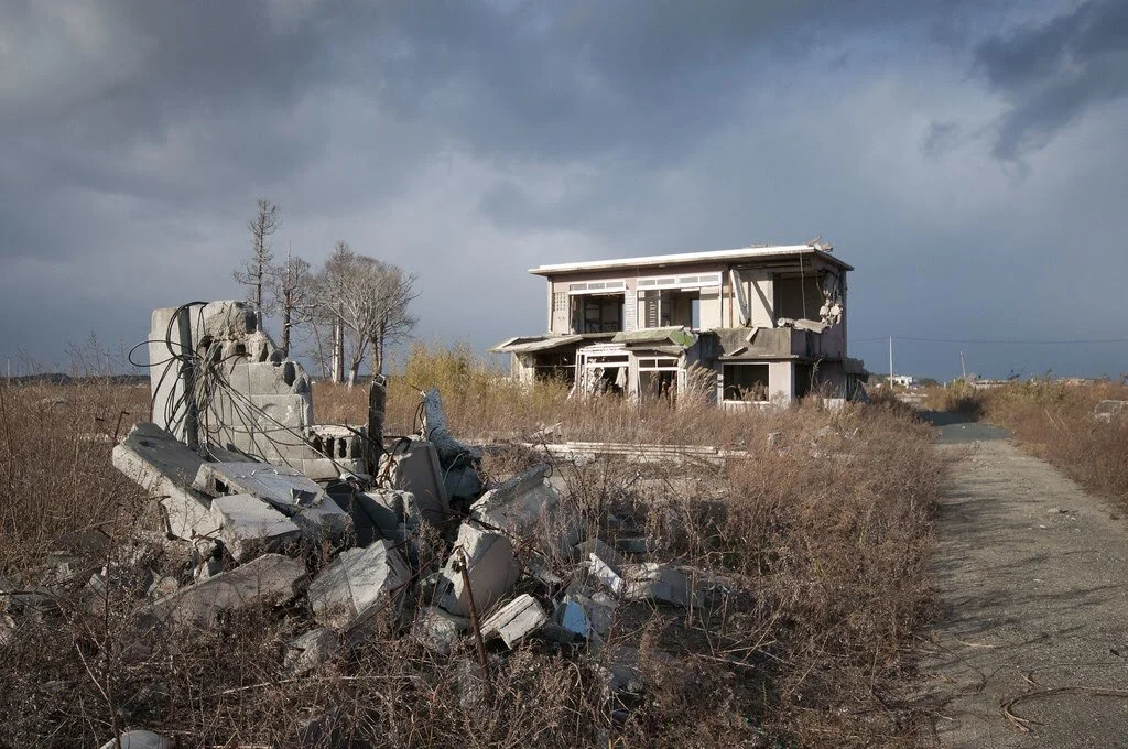
A tsunami’s wreckage. UCLAnewsroom. CC BY-NC-SA 2.0.
Upon returning home after 10 years away, Masumi Kowata found a monkey in her living room. It wasn’t a joyful homecoming. In 2011, she evacuated her home along with 160,000 locals across Japan’s Fukushima prefecture. A cloud of radiation, spewing from three simultaneous meltdowns at the Fukushima Daiichi nuclear power plant, rendered swaths of land uninhabitable. Only in 2021 did the government allow she and her husband to return. Even then, it was only safe for them to visit for the day. Clad head to toe in plastic protective gear, she tread cautiously through the wreckage of an earthquake, a tsunami and neglect: a house shaken by earthquake, food left to rot for a decade, overgrown plants vining up the walls. The monkey had helped itself to Kowata’s belongings. It pranced around the room “wearing our clothes like the king of the house.”
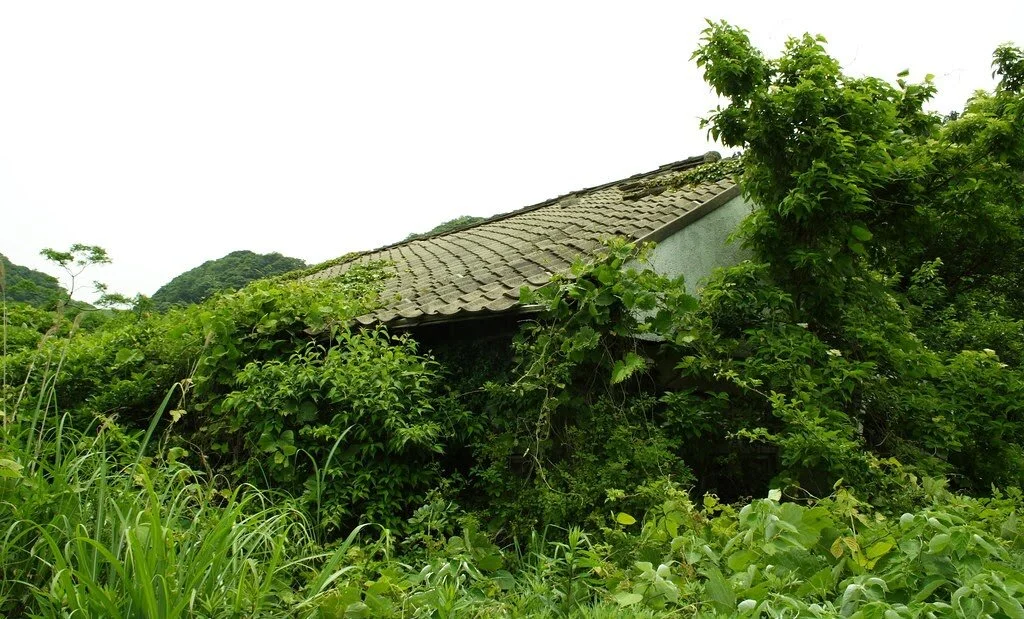
A house under nature’s dominion. colincookman. CC BY-NC-SA 2.0.
Wild animals have overtaken “difficult-to-return” zones, as the government termed them. Such areas encompass 2.4% of Fukushima prefecture and experience 50 times more radiation than what is considered safe. Boars, raccoon dogs and macaques roam the dangerously radioactive neighborhoods oblivious to the damage but unfettered by human life. They can cross streets without fear of speeding cars and feed on the produce of untended gardens, long overgrown. Human beings have returned much more slowly. Currently, the zones remain stuck in time at the moment of disaster.
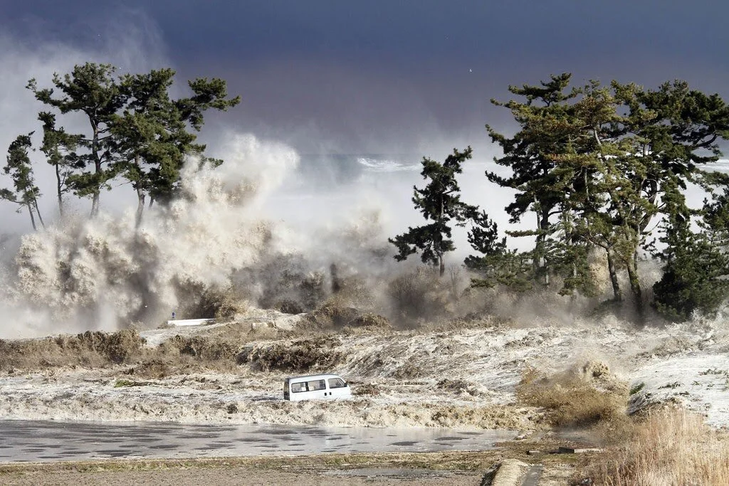
The tsunami crashing through Minamisoma, Fukushima. Warren Antiola. CC BY-NC-ND 2.0
Agriculture struggles to recover as a result. Boars descended from the nearby mountains and invaded farms and rice paddies to feast on the crops. Hunters struggle to control the wild boar population. That is to say, they shoot as many as possible. “When I got married and was about to have my first child,” said one elderly boar hunter, “my mother said to me, ‘You’re going to be a father. Stop killing. Is that really the right thing to do?’ I stopped hunting then.” Now, he ventures out each day to beat back nature’s 10-year-long advance on Fukushima’s villages. “My town is abandoned and overrun with radiated boars,” he says. “It is my duty to help.”
The tasks of hunting down boars, tending to radioactive cattle and repopulating deserted towns fall to the few who have returned. Of the 160,000 who were evacuated after the meltdowns, only one-fourth plan to return. Most of them are elderly. The majority of evacuees found it easier to settle down elsewhere than endure a yearslong wait to return home. Young people especially favored big cities filled with jobs over their provincial hometowns, a trend that predated the disaster. In the nine years before the meltdowns, Fukushima’s population declined by 100,000. In the nine years after, it fell by another 180,000.
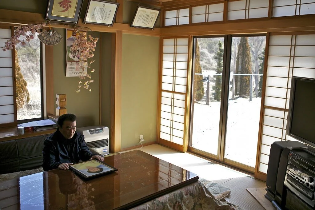
An elderly man with a picture of his late wife. Al-Jazeera English. CC BY-SA 2.0.
Local communities feel the absence of locals. As residents begin to plan for the future, they struggle to build a new community amid the ruins of an old one. Ancestral homes sit empty. Classrooms are frozen in time at the moment of the tsunami. Farmers spent generations breeding prized lines of livestock which are now useless. Radiated cattle, horses and pigs—as well as hunted boar—cannot be consumed because of radiated meat. Once famous for its produce, the prefecture’s fruits and vegetables now sell for below the national average. Though radiation tests ensure that the food is safe to eat, the stigma of nuclear disaster keeps customers away.
Hope Tourism seeks to make these ruins the foundation of the future. The group offers tours through areas that reflect both the devastation wrought by the nuclear disaster and the communal efforts toward reconstruction. Tourists see the abandoned elementary school in Ukedo, roads bent out of line by the tsunami’s rip current and black bags filled with radioactive soil. They can also tour villages trying to revive their local industries and meet community leaders who spread awareness about the dangers of nuclear fallout.
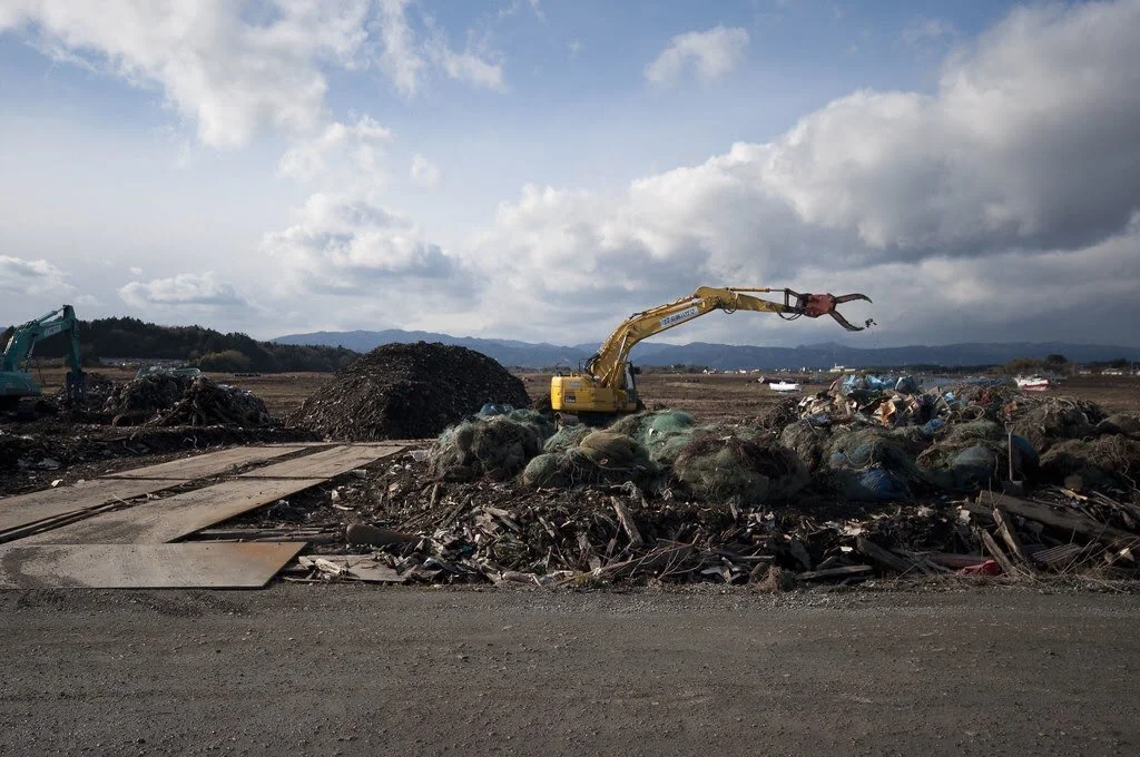
Where to put radioactive waste? UCLAnewsroom. CC BY-NC-SA 2.0.
In the face of hardship, locals still express pride in their roots. Iitate village joined the exclusive club of “most beautiful villages of Japan” in 2010, only to be wrecked by the tsunami and ensuing meltdowns. Ten years later, locals gathered to celebrate the opening of a new community center. It was built from parts of abandoned buildings: windows from old businesses, doors from run-down houses, a chalkboard from a school with no children to attend. An elderly woman in a green kimono sang folk tunes while the crowd enjoyed chestnut-filled rice balls. The Hope Tourism website states the village’s motto is a single word: madei. It means “thoughtfully” or “wholeheartedly” in the local dialect. It refers to the steady, persistent progress toward a revived community.
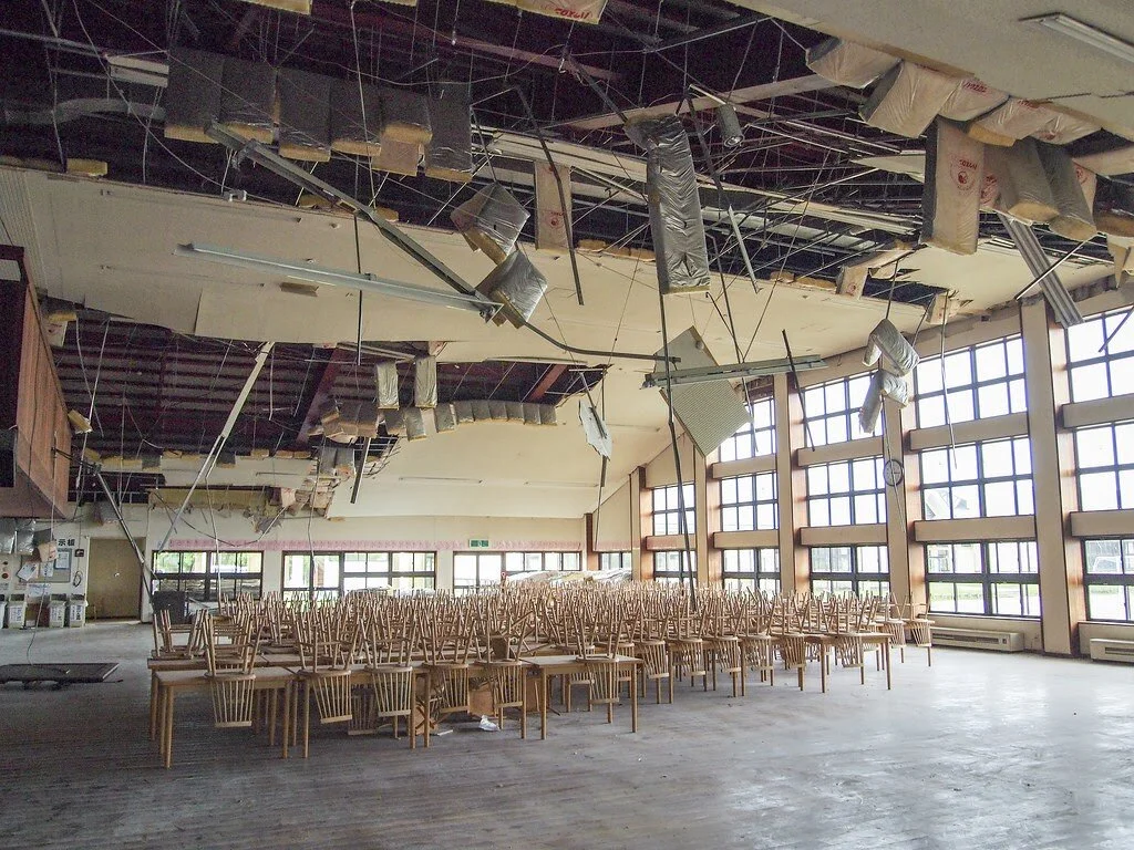
An abandoned building. Patrick Vierthaler. CC BY-NC 2.0.
The fight against nature’s invasion of Fukushima’s villages still preoccupies recently decontaminated zones. The national government branded the upcoming Olympics as the “Recovery Olympics” to highlight the region’s progress since the disaster. The Olympic torch relay will begin at Fukushima’s J-Village sports complex, which workers used as a base during the crisis in 2011. Japan will need to escape the shadow of the Fukushima disaster if the government is to accomplish key items on its agenda. Prime Minister Yoshihide Suga pledged a carbon neutral Japan by 2050, an unthinkable prospect without nuclear power.
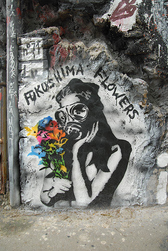
A radioactive bouquet. Abode of Chaos. CC BY 2.0.
National priorities rarely concern those repopulating Fukushima, though. They focus on the day-to-day resurrections of ghost towns. Some still search for ghosts. “I often tell people that my daughter would be a very independent and successful adult out in the world,” says one man. He lost his entire family in the tsunami, including his young daughter. “She was the type of girl other people could rely on.” With a shovel, a trowel and his gardening gloves, he digs through the soil for his daughter’s remains. “I’ve found about 20% of her, but 80% is still missing,” he says. “That means she’s definitely still here.”
Radiated livestock are marked with a white symbol that tells farmers the animal was affected by the 2011 meltdowns. There is no such symbol for the psychic wounds that Fukushima’s disaster continues to exact on its people.

Michael McCarthy
Michael is an undergraduate student at Haverford College, dodging the pandemic by taking a gap year. He writes in a variety of genres, and his time in high school debate renders political writing an inevitable fascination. Writing at Catalyst and the Bi-Co News, a student-run newspaper, provides an outlet for this passion. In the future, he intends to keep writing in mediums both informative and creative.
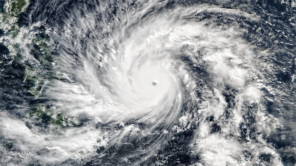
Typhoon Hagupit’s eye. Sjrankin. CC BY-NC 2.0
East Asia Braces Itself as the 2020 Typhoon Season Begins
Southeast Asia is known for its tropical climate and distinct rainy, or monsoon, season. This sort of climate brings about an annual typhoon season. Typhoons are mature, tropical cyclones that mostly occur in the Pacific Ocean. They carry with them heavy winds, rain and tornadoes that rip through villages and beaches. These storms have the potential to be devastating, a fact confirmed by history several times over.
Thailand
While Thailand is not hit with as much force as its southern neighbors, the typhoon season is still clear. From September through November, the country is prone to typhoons with the potential to change the country’s landscape and infrastructure.
In 2006, Typhoon Xangsane made landfall in the Philippines and devastated its way across Laos, Vietnam and Thailand. It wiped out 810 square miles of farmland across Thailand and caused 47 deaths. The storm brought with it strong winds, landslides and torrential rain that wiped out villages and caused hundreds of families to become homeless.
Fortunately for Thailand, most storms are not nearly as devastating as Xangsane. Monsoons can be counted on, though, to bring about tropical storms each year.
Vietnam, Laos and Cambodia
These three Southeast Asian countries feel the brunt of two different sets of cyclones. Typhoons move in from the northern Pacific, while tropical cyclones make landfall from the south. While safety measures are in place, such as shelters, help lines and emergency services, ultimately their geographic location leaves them vulnerable to Mother Nature’s worst.
In 2017, Vietnam experienced its deadliest typhoon since 2001. Dubbed Typhoon Damrey, the storm originated in the Philippines’ Visayan archipelago toward the end of the rainy season and killed at least 123 people and over 600 injured. The severe flooding and winds swept away anything that was not secured to the ground and left an estimated $1 billion in damages across Vietnam. Since then, the country has taken measures to ensure that it has a better communication system for its citizens to learn about the threat of storms as they arise.
Korea
Farther north, the Korean Peninsula sits in a spot not nearly as impacted by typhoon season as countries in Southeast Asia. While the peninsula experiences jangma, or the rainy season, its normal extent is heavy rains that inconvenience residents. This shows just how quickly tropical storms lose power as they move inland; they dissipate soon after doing so.
A recent exception was Typhoon Hagupit, which made landfall in August. The Category 1 typhoon traveled north from the Philippines to China before impacting Korea as a subtropical storm. South Korea reported 15 deaths along with considerable property damage from the storm.
The western Pacific typically sees more tropical storms than anywhere else in the world. About one-third of the world’s natural disasters occur in the region, and the numbers only seem to increase each year. These storms have caused countries to increase safety measures, focus on disaster communication, develop evacuation measures and create safe spots in public areas. The countries are well-known among visitors, but during the rainy season, the more experienced traveler might count these locations out.

Elizabeth Misnick
Elizabeth is a Professional Writing and Rhetoric major at Baylor University. She grew up in a military family and lived in Europe for almost half her life, traveling and living in different countries. She hopes to continue writing professionally throughout her career and publish her writing in the future.
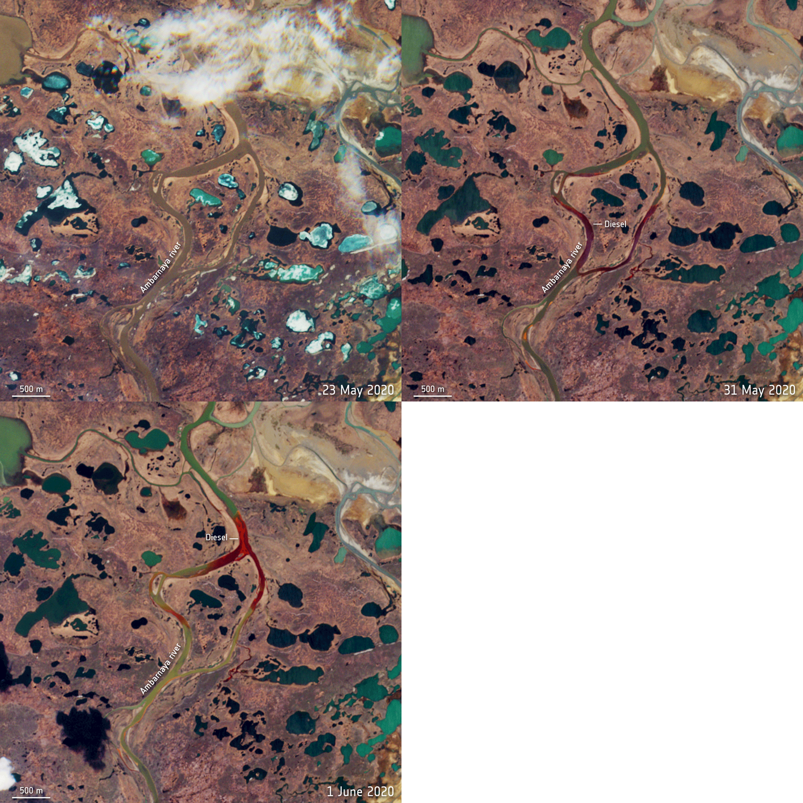
Arctic oil spill over time as seen by the European Space Agency’s Copernicus Sentinel-2 satellite. CC BY-SA 3.0 IGO.
Russia’s Oil Disaster in the Arctic Circle
On June 4th, 20,000 tons of diesel fuel spilled into the Russian Arctic after a fuel reservoir collapsed at a power plant near the city of Norilsk. It is considered Russia’s second largest oil spill in modern history. The site of the spill is the Ambarnaya River. The site of the spill, the Ambarnaya River, has turned into a deep red pool of deadly oil. Since then, Russian President Vladimir Putin has instituted a state of emergency for the region around Norilsk, and investigations into the power plant are beginning.
In terms of economics, it is vital that Russia acts with speed in order to clean up the oil, as they are the world’s third largest oil producer. Environmentally, though, the disaster is even worse. This oil spill has the potential to wipe out entire species in the region, literally poisoning and suffocating the plants and animals that rely on the Ambarnaya.
How it happened
There was a slight delay between the actual spill and reporting of the incident to the public, so the investigation process is playing catch-up. As investigations are ongoing, it is not entirely clear how such a massive disaster could have happened. The power plant claims that the fuel reservoir possibly collapsed due to thawing of permafrost below it. This could be a result of the larger issue of global warming and over-construction on unstable permafrost.
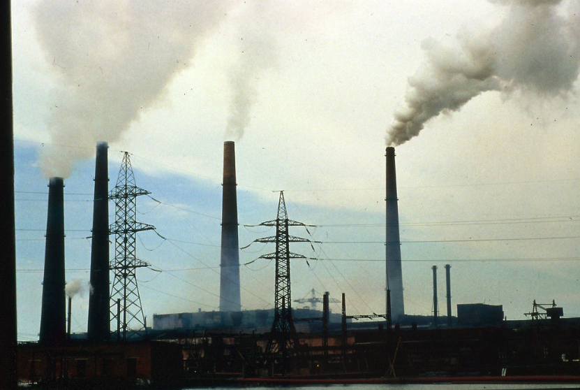
Norilsk, Siberia, Russia. GRIDArendal. CC BY-NC-SA 2.0
Norilsk Nickel, the company that owns the power plant under investigation, is a huge economic force in Russia as they lead the world in nickel and palladium production. This has not stopped the Russian government from taking the power plant director, Vyacheslav Starostin, into custody. It is pursuing a criminal case of pollution and alleged negligence against the company.
What is being done
Putin began the work to remedy the spill by declaring a state of emergency over the region, but he expects the company to pay for the costs of damages. In collaboration with Norilsk Nickel, the Russian government’s state of emergency allows for more clean up personnel to be dispatched to the area. According to BBC, Oleg Mitvol, former deputy head of Russia's environmental watchdog Rosprirodnadzor, said there had "never been such an accident in the Arctic zone". Mitvol said the clean up could potentially cost 100bn roubles (£1.2bn; $1.5bn) and take between five and 10 years
Cleanup efforts have been difficult because of the remote location of the plant. The crews are unable to use barges due to the shallow water, and there are no roads leading to Norilsk. Sergey Dyachenko, chief operating officer of Norilsk Nickel, told reporters on June 4 that the company plans “to transport contaminated oil to temporary sites for remediation.”
To prevent the oil from spreading to other areas, containment booms have been placed on the Ambarnaya River. In response, Greenpeace stated on its website that it “will help collect only a minor part of the pollution, and therefore it would be safe to say that nearly all of the diesel fuel will remain in the environment.”
U.S. Secretary of State Mike Pompeo. Gage Skidmore. CC BY-SA 2.0.
The United States has also offered its help. U.S. Secretary of State Mike Pompeo tweeted on June 6, "Saddened to hear about the fuel spill in Norilsk, Russia." He added that despite their disagreements, “the United States stands ready to assist Russia to mitigate this environmental disaster and offer our technical expertise.” Although the U.S. State Department and White House have not specified the ways they plan to help, efforts are in progress.
The future
It is not known how long the process to clean up the oil will take, or if all of the oil can even be cleaned up. Until then, it is important to note how environmental disasters in the Arctic like this are a result of the other dangerous environmental practices in place. The soil, plants and animals in this region of Siberia will be undoubtedly impacted and some species may never recover. This is not the first oil spill of its kind, and it will likely not be the last.

Renee Richardson
Renee is currently an English student at The University of Georgia. She lives in Ellijay, Georgia, a small mountain town in the middle of Appalachia. A passionate writer, she is inspired often by her hikes along the Appalachian trail and her efforts to fight for equality across all spectrums. She hopes to further her passion as a writer into a flourishing career that positively impacts others.
‘AILA’AU's Volcano: The Forest Eater
On April 30th, 2018, Hawaii’s Puʻu ʻŌʻō crater collapsed after erupting for 35 years.
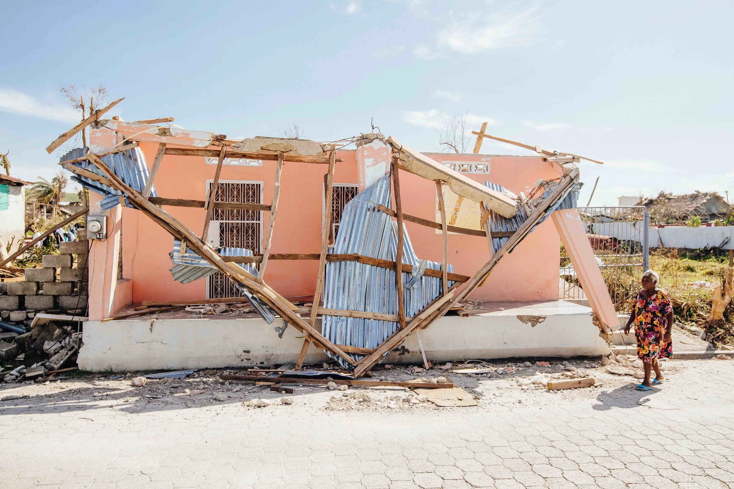
Photo credit: Waves for Water
Update from Waves for Water's Efforts Post-Hurricane Matthew in Haiti
Jon Rose, founder of the non-profit Waves for Water, sent CATALYST an update on recovery efforts in the wake of Hurricane Matthew.
It’s been just about two weeks since Hurricane Matthew made landfall on the South Western tip of Haiti. Two long, hard weeks for millions of people affected by this catastrophic event. In retrospect, I went into this one a little cocky, I think, mostly because I feel so comfortable in Haiti. It felt like no matter how bad it was going to be, it was happening in a place that feels like a second home. I thought the relief plan/action would also be easier because we have such a solid, extensive local network and team there. And I thought my own psychological capacity would be more balanced on this one because I had gone through it before, in the same country. I assumed a bunch of things…
Well, the universe sure has a way of humbling us. In other words, I was mistaken on just about everything.
By day two on the ground, our W4W country director, Fritz Pierre Louis, and I, sat shaking our heads in disbelief. We basically had to throw everything that we thought we knew or expected out the window – to start fresh, as if this was an entirely new country. It is a different beast entirely than the 2010 earthquake that leveled Port-au-Prince.
Why? Many reasons, but I’ll list a few:
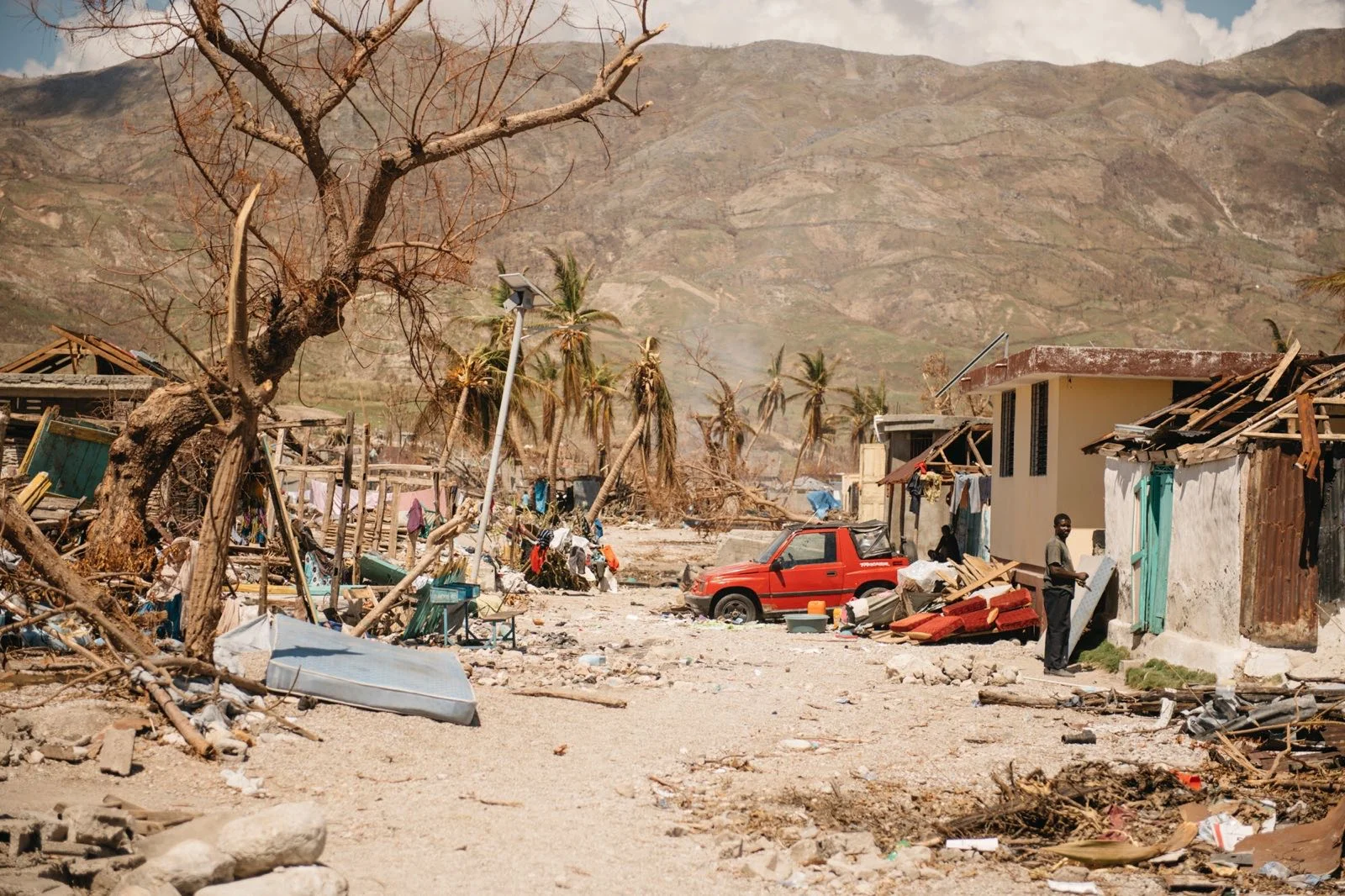
Photo credit: Waves for W
1. Scope of Destruction -
Earthquakes have an epicenter – a narrower, more pinpointed area of impact. With hurricanes of this size the swath of destruction can cover hundreds of miles in all directions, leaving town after town after town leveled. The mountain villages see tornado-force winds (140 mph) with flash flooding that turns each valley into a violent river, destroying anything in its path. The coastal towns get the worst of it with those same tornado-force winds mixed with a 15-20 ft+ storm surge (aka tsunami). Basically a storm like Hurricane Matthew is like if a tsunami and a tornado got in a fight. The sheer scale of devastation, the widespread scope, has left many very experienced relief agencies (including us) with the very hard decision of where to start first.
2. Remote Area -
The majority of the Southwestern tip of Haiti is quite rural. Which means that most of the towns that got hit hardest are small and hard to get to on a normal day – windy coastal roads or mountainous dirt roads the only way in or out. This was before the storm. Now, most of those roads have been compromised, leaving relief capabilities at a bare minimum. For many of these places, supplies can really only be dropped by sea or air, which both tend to have limited payload capacity. This limits not only the speed with which supplies can come in, but the quantity. And with the massive amount of need, quantity is everything at the moment. Normally, relief initiatives will set up a solid distribution outpost in or around all the ground zero areas and then create a regular flow of supplies to feed those outposts (almost always by convoys of large trucks). This just isn’t possible for many of these places, and it won’t be for some time – bridges and roads are washed out, making them only passable via 4x4 vehicles that can traverse the riverbeds.
3. Base of Operations -
In any good, large-scale/long-term disaster relief initiative, a solid BOO (base of operations) is imperative. This is the place from which teams can do all their planning/staging. It is basically home, office, and everything in between for the duration of the initiative. It needs to be close to ground zero, but with enough breathing room to create a habitable environment. It can often be a scenario as simple/rugged as a camp with tents, or commandeering an old building, or in the best case there are hotels or private rentals available. But in all these cases, we find a way to ensure the teams are safe and have what they need to do their job – power, cell and internet service, food, water, etc. In this case, the only real option was in the city of Les Cayes, which got hit really damn hard itself. But there is an airstrip, it has some hotels still operating on generators, cell service is in and out, and there is water and food accessible. The problem is some of the hardest hit areas are 4-5 hrs drive on 4x4 roads, so the amount one team can do per day, staging from so far away, is incredibly limiting. Until some of the major infrastructural issues in that part of the country are restored (roads, power, etc), which will be months, it’s nearly impossible for relief teams to set up proper long-term operations in those hardest hit areas. The only exceptions are small, targeted teams that can travel lightly in 4x4’s because they don’t have bulky supplies, such as ours (we can carry 200 water filtration systems and 100 solar powered LED lanterns, in two 4x4 vehicles), or medical triage teams. We have seen some of the medical teams already posted up throughout the region, in whatever buildings are still standing. But those aren’t long term operations, as medical is mostly needed in this initial stage.
These are all things I’ve encountered (individually) before, over the many disasters we've worked. But it’s the combination of them all at once that is making this thing such a beast. The only other one I’ve seen with a magnitude like this was Typhoon Haiyan in the Philippines, which is still known as the largest storm ever recorded. If Haiyan is the largest, then Matthew was its equally evil twin brother, whose only difference is being a few seconds younger.
So, what does all this mean for W4W? After two weeks of traversing the whole Southwest, we now have a very accurate assessment of the hardest hit zones and a good plan to serve them. I shall note, unlike the majority of our other disaster relief initiatives, this one will include a few new categories of relief beyond our normal focus of access to clean water.
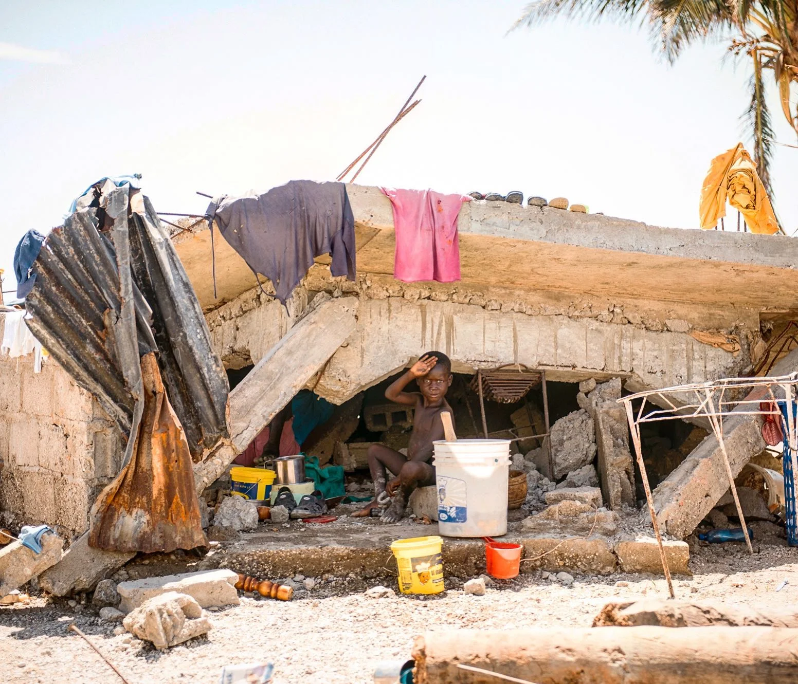
Despite all challenges, W4W has hit the ground running with an action plan that focuses on access to the following essentials:
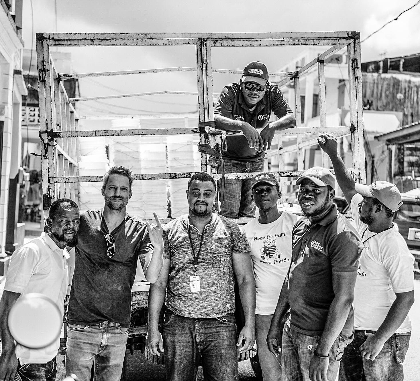
1. Water -
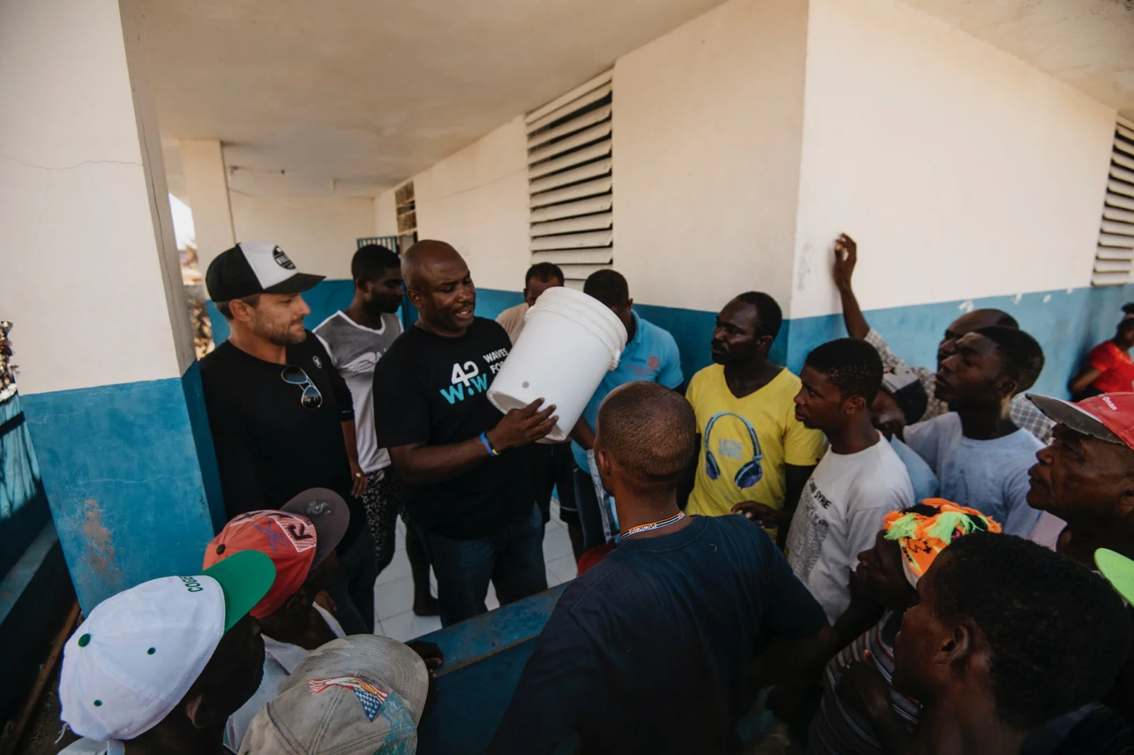
Access to clean water will still be our main focus, with a targeted implementation strategy aimed almost entirely on cholera hotspots. There have been over 20 new (Matthew related) cases of cholera that have popped up and these numbers are expected to rise dramatically in the coming weeks. Clean water is kryptonite for waterborne diseases such as cholera, so the more we target the areas where it is starting to spread, the better chance we have of curbing the amount of cases popping up, and prevent new ones. We did a very similar program in 2011, when the first outbreak happened in the Artibonite department of Haiti. In partnership with UN’s CVR division, we implemented 4,000 water filtration kits, with a full WASH (water, sanitation, hygiene) education protocol/training, directly in two of the epicenters of the outbreak (Mirebalais and Saint Marc). Shortly thereafter, reported cases leveled out. The implementation strategy for our program this time will be very similar – we’ve identified five areas where confirmed cases have popped-up, or ones we feel are most susceptible to developing them. We will focus the majority of our water filter supply on these areas. We realize that so many places need access to clean water (even before the storm), but since we have limited resources and can’t help everyone, we feel that the best way for us to make the biggest impact is to target our efforts, by tackling the cholera issue head on.
2. Light -
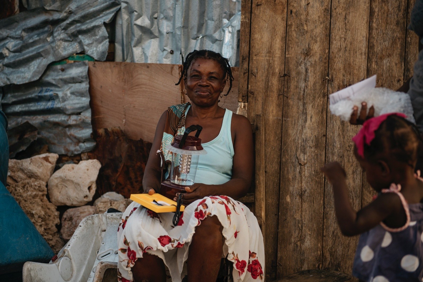
One of the main things that we feel is being overlooked is lighting. The power is out in all of these areas and will be for months. This means that once the sun goes down it is pitch black. There are obvious reasons why this is a challenge, but one of the major issues is safety. Light = community, people gather around any light source when it’s dark. To put it bluntly, a good light source dramatically cuts down the scenario of young women being alone/vulnerable in whatever dark shelter they’re staying. Right now, some families are burning small fires, inside or near their makeshift shelters. Which brings up other safety concerns in terms of breathing in smoke in a confined space, not to mention the incredible discomfort from the added heat alone. It’s already extremely hot, even at night. All of these points, we’ve witnessed personally, and has now brought this topic to the forefront for us. We feel that it is imperative to add this facet to our Matthew Relief Initiative. The lights we are implementing are solar powered LED lanterns that also have a USB port to charge a cellphone, as well as a built in radio (one of the primary ways that rural communities get their news/information). As a last little added bonus, we’ve sourced the lights in-country – so by adding them into our program, we are also contributing to the local economy.
3. Cash for Work -
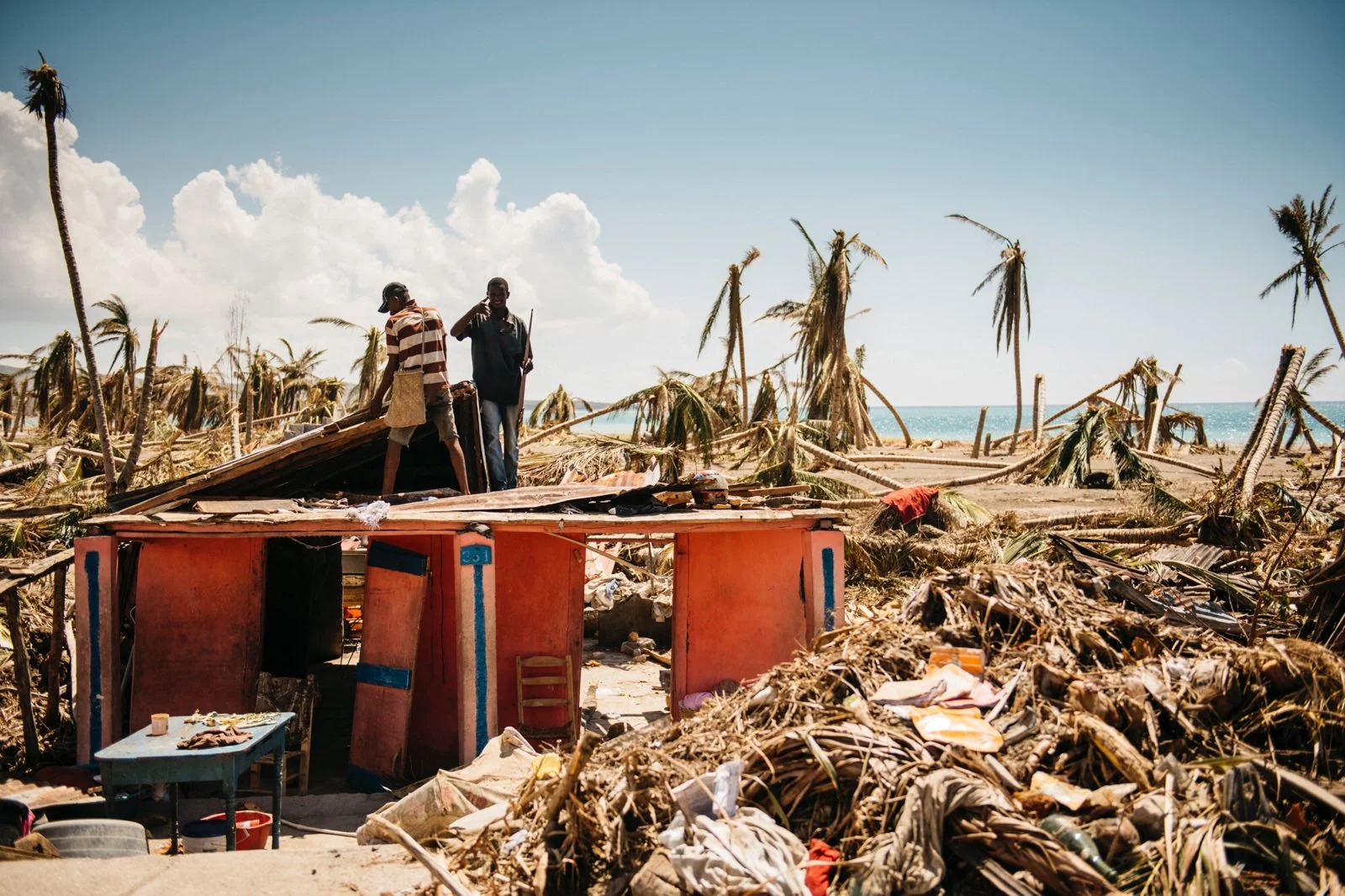
We are establishing small scale CFW (cash-for-work) programs, focused primarily on rubble/debris removal from, starting with roads and community centers. These types of programs are widely used in development and disaster initiatives around the world. In a disaster situation, it’s a good way to help spark the local economy and fill some of the gaps left from the vacuum that follows a catastrophe such as this. The bottom line – everything has been stripped from these folks (including their jobs) and they need money, so rather than just give straight hand-outs, it's best to employ them, as there is so much to be done and they want/need the work. It's an honest job for services rendered, just like many of them had before. Local residents are already rallying and working for free to help their communities as best they can, but that doesn't put food on the table at the end of the day. The whole thing is overwhelming for them, so something like this helps to restore at least a little normalcy.
Given the conclusions I’ve come to from the last two weeks on the ground and our vast experience in this field, I feel like we are well equipped to not only handle this, but to create a large-scale, long lasting, impact.
I will also note that even though these first two weeks were primarily focused around assessing the situation on the ground, we also started implementing of all three facets of the program. At this point, we've already distributed 500 water filtration systems and 300 solar lanterns in eight communities — Port Salut, Chardonnieres, Port-a-Piment, Coteaux, Les Cayes, Aquin, Jeremie, and Leogane. We've done this through some of our existing local networks and in collaboration with NGO partners such as (Les Cayes based) Hope for Haiti and local Rotary Club chapters. Lastly, in terms of our CFW (cash-for-work) initiative, we kicked things off with the clearing of rubble/debris on the main road in Chardonnieres.
As our programs gain more traction in the coming weeks/months, more updates from us will follow. Thanks to all of you who have supported and believed in this initiative so far… this stuff simply doesn’t happen without you.
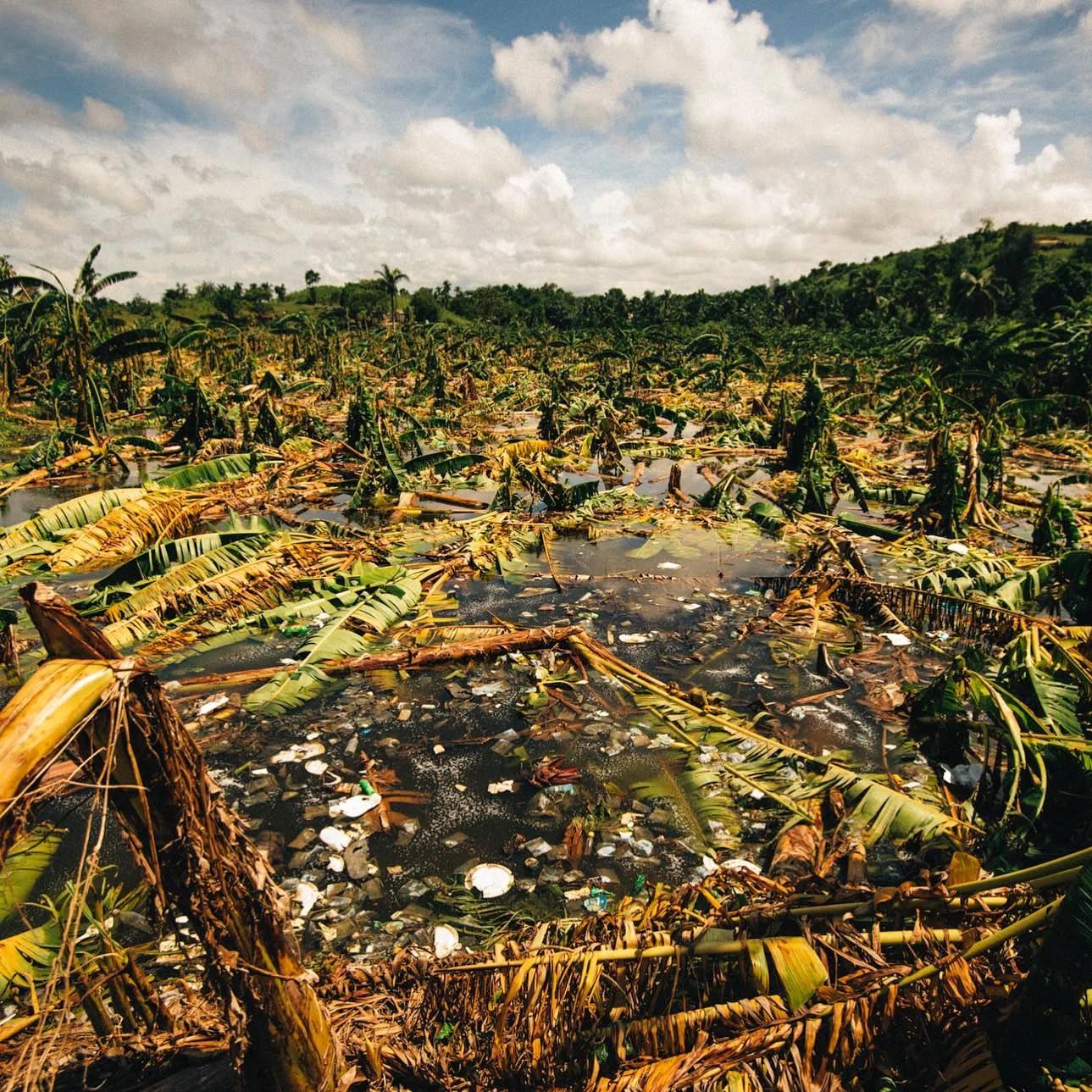
Look out for updates from W4W on their website: www.wavesforwater.org
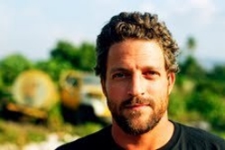
Jon Rose
Jon Rose is the founder and CEO of Waves for Water, a non-profit organization that helps bring clean water to areas that lack consistent access to it. W4W does this through its Clean Water Courier program, which is based on a Do-It-Yourself humanitarian model.