6 Must-See Islands off the Coast of Chile

Traverse the natural gems and explore the historical sites of Chile’s outre-mer.

Penguins off the coast of Chiloe Island. Mary Madigan. CC BY 2.0. 

One of the westernmost countries of South America, Chile has gained fame for its gorgeous mountains and fjords, its delicious street cuisine, the integral place futbol has in its people’s everyday life, and perhaps even its complex political history. The distinct cultural and travel experience the country offers does not apply only to its mainland, but also to the islands that surround it. In fact, Chile’s islands house some of the most individual and exclusive travel experiences and institutions: 

1. Isla Magdalena

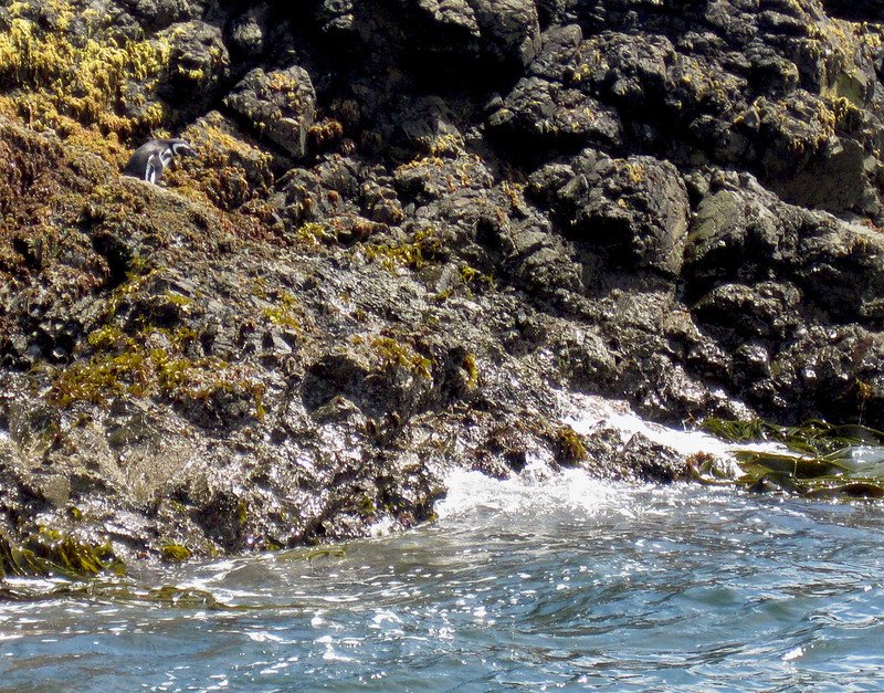
Off the coast of Isla Magdalena. Iamblukas. CC BY 2.0.

Isla Magdalena’s lush landscapes are home to everything from the circa 120,000 Magellanic penguins characteristic of southern South America, the National Monument for Penguins that explores and explains the members of this colony, and a magnificent view of the Strait of Magellan discovered by Portuguese explorer Ferdinand Magellan. The Isla Magdalena Lighthouse, another landmark, also rests on the island and contains many exhibitions that detail its history and traditions. Travel to Isla Magdalena by public ferry or private speedboat (for about 2 hours) after a fruitful day on the Chilean mainland; the island is 608 sq mi.

2. Robinson Crusoe Island 

A view of Robinson Crusoe Island’s mountains. Ashley Basil. CC BY 2.0.

Robinson Crusoe Island’s name comes from the titular Daniel Defoe protagonist and explorer who travels across the sea to a deserted island. Certainly, all visitors feel like explorers on Robinson Crusoe Island. Guests can snorkel or scuba dive along the island’s coral reefs, observe shipwrecks scattered across its coast, birdwatch, hike in the area’s luscious rainforests, visit ruins left from plundering pirates, and enjoy the local cuisine, especially the lobster.  You can even partake in day-long fishing trips to score fresh lobsters! A ~2 hour flight from Santiago or an hour-long water taxi journey drops guests off at this adventure-filled island; the island is 18.5 sq mi in area.

3. Chiloé Island

A view from Ancud on Chiloé Island. Ik T. CC BY 2.0.

Chiloé Island’s landscape defines it: the Chiloé National Park highlights much of this breath-taking landscape with green terrain, rivers, lakes, and stunning forests. For those further intrigued by the island’s natural beauty, horseback riding around the island quenches the explorer’s thirst. But this island is not only a place of natural beauty; history remains an important part of Chiloé Island culture. The churches of Chiloé, mostly built in the 17th century and showcasing Spanish colonial design, are monuments to the island’s rich history. The Ancud Regional Museum (Museo Regional de Ancud) also puts much of the island’s history, its mythology, and its indigenous residents under the spotlight. As with many other Chilean islands, water sports like kayaking and fishing also contribute to the visitor experience. A circa 30-minute ferry ride across the Canal de Chacao drops guests off on Chiloé; the island is 3,241 sq mi.

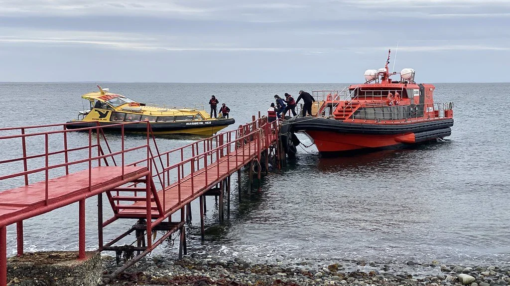
4. Isla Grande de Tierra del Fuego

Snow capped mountains of Isla Grande de Tierra del Fuego. James St. John. CC BY 2.0. 

South America’s largest island, Isla Grande de Tierra del Fuego, is part of the Tierra del Fuego archipelago off the coast of the southernmost tip of South America. A ~2 hour ferry ride across the Strait of Magellan drops visitors off at this island first dubbed “Land of Smoke” by Ferdinand Magellan. Walk the footsteps of explorers like Ferdinand Magellan and Charles Darwin on Isla Grande de Tierra del Fuego as you immerse yourself in the island’s spectacular flora, which includes many species of trees like the beech and conifer, and fauna the fauna of Parque Pinguino Rey (King Penguin Park) and the foxes, flamingos, and condors found all around the island’s mountains; the island is 18, 530 sq mi

5. Navarino 

A view of the Dientes de Navarino Mountains. Dimitry B. CC BY 2.0.

Navarino, another island that is far south of the Magellan Strait, is a worthwhile travel destination for outdoorsy adventurers. Hikers will enjoy walking among the island’s snow capped mountains and fishers can discover a multitude of rivers and even high-altitude lakes. One of the most beautiful routes for active visitors is the Dientes de Navarino (Teeth of Navarino) Trek. This somewhat frightening name refers to Navarino’s mountains through which many travelers enjoy hiking. The culturally inclined can visit Puerto Williams, the island’s only town and the past residence of indigenous Yaghan people. Puerto Williams’ museums offer insights on the isle’s Yaghan past and its weighty and resonant history. Access to Navarino is available by a 30-minute boat ride from the port of Ushuaia; the island is 35.7 sq mi.

6. Riesco Island 

A view of the Fitzroy Canal from Isla Riesco. Z_thomas. CC BY-SA 3.0.

Riesco Island’s must-see features range from Patagonian ranches to historical coal reserves. The bleating sounds ring across the island, while its cattle fields are still dominated by gauchos, or South American cowboys, and remain a sight to behold for those visitors who crave a distinctive cultural experience. The island, one of the largest islands in Chile and accessible from Patagonia through a 30-minute boat ride across the Fitzroy Canal, is also known for its coal reserves; in fact, coal mines such as the Invierno (winter) Mine, Magdalena, Elena, and Josefina are historical locations of note. Riesco sightseers should also watch out for glaciers lining Riesco’s coasts; the island is 1,970 sq mi.


Su Ertekin-Taner

Su Ertekin-Taner is a first year student at Columbia University majoring in creative writing. Her love for the power of words and her connection to her Turkish roots spills into her satire, flash fiction, and journalistic pieces among other genres. Su hopes to continue writing fearless journalism, untold stories, and prose inspired by her surroundings.

7 Real-Life Atlantises Hidden Around the World

Exploring the hidden history of sunken sites.

Diver exploring a sunken city. Linnaea Mallette. CC0 1.0

Although travel traditionally highlights cultural landmarks, distinctive experiences, and historical sites on land, much history lies where our eyes alone cannot take us – particularly under the sea. Underwater cities and towns which have been immersed in the soaking abyss of seas, lakes, and reservoirs through natural disaster or human shenanigans provide a time capsule into the defining characteristics of their era. The corpse of the city including its many artifacts can be explored through diving and even glass bottom boats. Here are seven of the most intriguing sunken cities to visit around the world.

1. Baiae, Italy

Emperor Claudius; nymphaeum submerged in Baiae, Italy. Ruthven. CC0 1.0

The ancient Roman town of Baiae overflowed with luxuries in its time: Roman elites built villas and spas fed its famous hot springs, and palace parties proliferated. That is, until an army of the Muslim Caliphate army sacked the resort city in the 8th century. By 1500, the luxuries had faded away and the town was left abandoned. The volcanic vents that had once been the joy of Roman bathers led to a steadily increasing water level and eventually, the majestic city was submerged. Now, the once-present luxuries of the city–its marble statues, mosaics, sculptures–can be viewed through glass bottomed boats and on snorkeling or scuba diving tours.

2. San Roma de Sau, Spain

The half-submerged church of San Roma de Sau. Josep Bracons. CC BY-SA 2.0

All that remains to be seen of San Roma de Sau, a thousand year old village in Catalonia, is the spire of its Medieval Romanesque church. The church, now reemerging due to drought and low water levels in Spain, reminds visitors of the artificial flood in the 1960s that sank the lightly populated town. The Catalonian government’s decision to create a reservoir forced the townspeople to leave their land, taking their valuables and their dead with them. The reservoir’s beginning led inevitably to the end of San Roma de Sau. 

3. Dwarka, India

The Dwarka lighthouse on the coast of Gujarat India overlooks the submerged city of Dwarka. VasuVR. CC BY-SA 4.0

Known as “India’s Atlantis,” Dwarka is not only an intriguing travel spot, but also a religious relic. This ancient sunken city located in modern-day Gujarat appears in the Mahabharata as Krishna’s city; the city supposedly sunk in the Arabian sea after Krishna’s death according to the text. 20th century marine archaeological explorations proved its existence outside of literary myth and have uncovered stone anchors, pillars, bastions, pottery, inscriptions, stone sculptures, as well as bronze, copper, and iron objects in Dwarka. Visitors can dive off the coast of Beyt Dwarka, a neighboring island, to view the submerged city.

4. Shi Cheng, China

A sunken artifact in Shi Cheng. Nihaopaul. CC BY-SA 3.0

Shi Cheng, much like many other of the sunken cities on this list, was flooded deliberately. The ancient city was the casualty of a 1959 hydroelectric dam and consequent artificial lake, , which now envelops and obscures this “Atlantis of the East.” Located 40m under Qiandao Lake, Shi Cheng offers a snapshot of Imperial China. The city brims with stone architecture of the Ming and Qing dynasties; stonework of lions ( fitting, as the city’s name means “lion city” in Mandarin), dragons, phoenixes, and historical inscriptions lay within the five entrance gates of the sunken city.

5. Port Royal, Jamaica

An image of Port Royal before the city was sunk. Wellcome Library, London. CC BY 4.0

The 1692 7.5 magnitude earthquake that submerged Port Royal did nothing to erase its rich history. The town, captured by the British from Spain in 1655, became the center of English life in Jamaica. The Englishmen brought the slave trade to the region, as well as an abundance of merchant and artisan activity. The town also possessed a strong scene for sex workers and pirates. Now, the submerged town still maintains its buildings and artifacts like skillets, pots, barrels, ceramics, and a pocket watch found by Edward Link in 1950–all underwater. Travelers can explore the 40 feet deep city through diving.

6. Thonis-Heracleion, Egypt

Thonis Heracleion. Courtesy of Virginia Museum of Fine Arts

Founded around the 8th century BC, Thonis-Heracleion was a distinguished city, one of great importance especially for merchants who frequently passed through the port to enter Egypt. The liquefaction of the city’s clay soil and ultimately the city itself resulted from various natural disasters including an earthquake, tsunami, rising sea levels, and subsidence. As a consequence of these catastrophes, the city eventually collapsed into the surrounding water. Much of the city’s culture and lifestyle remain preserved in watery depths, however. Temples, colossal statues - the most famous being the 5.4 meter tall God of Hapy - inscriptions, jewelry, coins, ritual objects, ceramics, goblets, and the sarcophagi of animals all endure, frozen in time. 

7. Potosi, Venezuela

Underwater church of Potosi. Juan Tello. CC BY 2.0

Much like San Roma de Sau, only a part of a gothic church spire juts out from the underwater city of Potosi. The waters of the Uribante Reservoir flooded the town in 1985; the Venezuelan government hoped that a hydroelectric dam could replace the 1200 residents of the town. Houses and churches were abandoned in 1985 for the scheduled flooding. Yet, the gothic church of Potosi has re-emerged due to severe droughts in Venezuela, most probably a result of the natural disaster, El Niño. 30 years after the flooding of the city, its church’s structure has been uncovered.


Su Ertekin-Taner

Su Ertekin-Taner is a first year student at Columbia University majoring in creative writing. Her love for the power of words and her connection to her Turkish roots spills into her satire, flash fiction, and journalistic pieces among other genres. Su hopes to continue writing fearless journalism, untold stories, and prose inspired by her surroundings.

Yakutia: One of the Coldest Places on Earth

This Russian region experiences temperatures as low as -70F and its residents live drastically differently than people who live in warmer climes. 

A village in Yakutia during the winter. @simoncroberts. Instagram.

It is seven AM. The sun hasn’t risen yet, but you’ve already gathered enough wood to heat your house for 9 months straight, in anticipation of the severe climate outside. You head to the back shed to grab the ice you harvested last November and put it in a giant tub of water to melt, ensuring that your family has something to drink when the water pipes will freeze. Now it’s time to make breakfast and wake your child up for school — because even though winter has finally arrived it’s warmer than -65 degrees Fahrenheit, which means it is safe to go outside. 

This is how residents of the northern reaches of the Sakha Republic, common name Yakutia, live during the long winter months. Yakutia is located in Russia and is home to some of the coldest continuously inhabited places in the world. In villages like Oymyakon, located in the far north, the sun doesn’t rise until approximately 9am and sets at 2:15pm, meaning students have to walk to and from school in darkness. 

Ten minutes in the cold, fresh air is enough to cause fatigue, stinging pain in any of the exposed parts of your face, and long-lasting aches in the fingers and toes. This is why many houses in the region are made of wood and built to withstand the extreme temperatures by filling every gap with oakum, a sealant made from plant fibers and tar, or even just the abundant snow, although the cold still finds its way through at times. 

The Yakut people have learned to be productive in these conditions. Most men in the Republic’s far north have traditional jobs like cattle ranching, hunting, or making crafts, living lives that hardly resemble those of urban Russians. Knife-making plays an important role in the Yakut culture, with the blades known around the world for their strength and beauty.

Summer in a Yakutian village. @Kiun B. YouTube.

When summer comes around, Yakutia becomes a completely different place. While winter temperatures can plunge down to -70 degrees Fahrenheit, in the dog days of summer the weather can get to around 86 to 95 degrees, particularly at the end of July. Summers may be short-lived — only lasting 2.5 months — but it is also the busiest time of the year for Yakut people.

It is crucial to harvest berries before the frost sets in if one wants to eat fruit during the winter., A failure to harvest the hay needed to feed the cattle in time can lead families to lose their valuable livestock.

But with hard work comes a refreshing reward. During the summer, Yakutia turns from a snowy kingdom into a lush meadow full of dense forests. Many Yakuts take advantage of the balmy heat, and head straight to the nearest lake for a swim. 

Yakutia is often called the land of rivers and lakes. There are over 700,000 rivers and 800,000 lakes that are rich with aquatic life, which is the perfect opportunity for Yakut people to stock up on food for the winter months.

Although Yakutia is by no means a popular tourist destination, the region is gaining more attention on YouTube and has fascinated viewers around the world. With increased visibility facilitated by modern communications technology , it will be no surprise if curious minds begin to pay attention to Yakutia.


Michelle Tian

Michelle is a senior at Boston University, majoring in journalism and minoring in philosophy. Her parents are first-generation immigrants from China, so her love for different cultures and traveling came naturally at a young age. After graduation, she hopes to continue sharing important messages through her work.

The Ghostly Shores of the Namib Desert’s Skeleton Coast

Bones and wreckage meet biodiversity on the Skeleton Coast of the world's oldest desert. 

A ship wreckage by the red, sandy dunes along the Skeleton Coast. op23 | Unsplash

A map highlighting the Namib Desert in red along the coast of Africa.

Home to earthy-red dunes which roll right into the Atlantic ocean, the Namib Desert is thought to be between 50-80 millions years old, making it the oldest desert in the world. It’s also one of the world's most inhospitable places—an unpredictable, arid and remote region that on the surface has no appeal whatsoever. With temperatures fluctuating from blistering hot to dangerously cold and sand for as far as the eye can see, it extends from the country of Angola, through Namibia and down to South Africa. That’s over 31 thousand square miles of desert. 

But don't be fooled, there’s more to these sandy plains than meets the eye. The Namib is home to the Skeleton Coast. And despite this desert’s penchant for death, The Skeleton Coast is teeming with rare wildlife. 

What is the Skeleton Coast

The Skeleton Coast is on the northern shores of this ancient and unexpected desert and earned its macabre name from the whale and seal bones that once littered the shore from the whaling industry. The Ovahimba who have since settled in the far north-eastern parts of Namibia once used the whale bones for building their shelters. In modern times, the Skeleton Coast hides its infamous graveyard buried beneath the sand, and with the exception of a rare adventure seeker looking for a wave to surf, the odds of seeking a human along this part of the coast are slim.

A shipwreck in the fog on the Skeleton Coast. Lee | CC BY 2.0

The Unique Climate of the Namib Desert

The bones scattered across Namibia’s Skeleton Coast aren’t from ocean mammals alone. Over the centuries, ships have ended up stranded on its shores for various reasons, but the main culprit is caused by the unique geography of the region. Hot, dry air from the interior of the continent and desert blows west combining with the cold wet air from Antarctica via a northward flowing ocean current called the Benguela Current. The hot dry winds act as a cap or roof not only prevents the cold wet air from escaping, but also from forming rain clouds. Instead, there is an eerie fog, and a lot of it. 

In fact, for 180 days of the year there is fog on the Skeleton Coast so dense, it’s caused thousands upon thousands of ships to run aground throughout history; the oldest of which is from the 1500’s. The ocean's intense surf would have prevented anyone from getting back into the water, and with a wrecked ship, this meant that sailors stranded on this isolated coast were left with only one choice: to make their way through the Namib Desert. With a dryness rivaling South America’s Atacama Desert (the driest place on Earth), and sand dunes reaching nearly 1000 ft high, this option was nearly as dangerous as swimming out to sea and surely has added human bones to its burial collection. 

A brown hyena stands over a carcass in the Namib Desert. Joe Knapman | CC BY 2.0

Wildlife on the Skeleton Coast

Incredibly diverse, the Skeleton Coast has more near-endemic species than any other desert in the world. Elephants, black rhinos, desert lions, jackals, giraffes, seals, oryx, kudus and zebras and just some of the desert adapted species inhabiting this wilderness. One such animal is the brown hyaena. They’re usually on the move after darkness has fallen, which adds to their elusiveness. The name strandwolf was coined on Namibia’s Skeleton Coast where they scavenge for dead seals along the shoreline. If you are fortunate enough to spot one, make sure you take a really good look, because sightings of these inscrutable carnivores is never guaranteed. A truly endemic avian, the Dune Lark, inhabits thinly vegetated dunes along the Skeleton Coast and larger Namibian dune system associated with Bushman grasses and Nara melons.

A blooming welwitschias. Ragnhild&Neil Crawford |CC BY 2.0    

A spiny looking nara bush in the Namib Desert. Palmora| CC BY 2.0

Nara Melons are just one of the many plants incredibly adapted to the rainless area and depend solely on the warning fog from the Atlantic Ocean. The nara bush is of great importance not only to the people of the region, but it is ecologically key to maintaining the unique desert habitat. More plants include welwitschias—which is a dwarf tree with only two leaves that can live for several thousand years—several lithops succulent plants known as living stones, lichen, pencil bush and the vividly colored succulents of rainbow colored agate mountains dotting the shore. 

The Lion’s Roar, a desert phenomenon

The phenomena of the Skeleton Coast doesn’t stop at bones, fog and compelling flora and fauna. Travelers, nomads and lost sailors once believed in the presence of desert spirits—singing songs through the mist. When the dunes form a bowl with the right acoustic properties, even a small flow of disturbed sand causes a terrific noise that resembles rolling thunder or even a low-flying airplane. The phenomenon is known locally on the Skeleton Coast as ‘the lion’s roar’.

Ugab River Gate, Agnieszka Rysio | CC BY 2.0

The Skeleton Coast National Park

Luckily, this wildly unique, albeit creepy shoreline, along with its diverse inhabitants is protected. In 1971, Namibia established a well-maintained national park to protect the curious treasures, bones and wildlife which makes the Skeleton Coast so incredible. The park is divided into a northern and southern section; the southern section is open to travelers with four wheel drive vehicles who are welcomed to go as far north as the Ugab River Gate. There, they will be greeted by a sign with a skull and crossbones warning you to go no further. The northern section is off limits, its loose, enveloping sands will literally swallow you up and can therefore only be accessed by airplane with a certified guide. It also happens to be the most attractive region of the park with lunar-esque vistas as far as the eye can see. The park attracts all types of travelers, both local and international fishers, photographers, ecologists and folks just looking for a unique adventure to one of the world's most understated treasures.


Raeann Mason

Raeann is the Content and Community Manager at CATALYST, an avid traveler, digital storyteller and guide writer. She studied Mass Communication & Media at the Walter Cronkite School of Journalism where she found her passion for a/effective journalism and cultural exchange. An advocate of international solidarity and people's liberation, Raeann works to reshape the culture of travel and hospitality to be ethically sound and sustainable.

The Largest Salt Flat in the World in Bolivia

Bolivia’s Salar de Uyuni is one of the country’s wonders. Despite the amount of tourists it still preserves its beauty.

Salar de Uyuni, Bolivia. Giacomo Buzzao. CC BY 2.0.

Located in the Andean Plateau in South America, the Salar de Uyuni is the largest salt flat in the world. It is in southwestern Bolivia, close to the border between Bolivia, Chile and north of the Argentinian border. It is over 4,050 square miles and the salt crust stretches to the horizon. It is also 10,000 feet above sea level, as it is located in the Andes. Since the salt is white, the Salar de Uyuni appears to be a large white desert, but during the rainy season, nearby lakes overflow, rivers empty into the salt flat and it becomes filled with water.

Though the seeing the dry, white salt stretch for miles is beautiful, when the salt flat is filled with water, it creates a clear mirror-like lake. Generally, there are only a few centimeters of water so it is still possible to walk on it, but as the weather is unpredictable, some areas become restricted for safety. The salt flat is mostly waterproof, but too much rain will melt some of the salt and make it dangerous to walk on. However, during this time, Salar de Uyuni turns into the world’s largest natural mirror, reflecting the light from the sky. The winter months also have clear skies that offer beautiful stargazing opportunities, the reflected stars only adding to the salt flat’s wonder.

The Salar de Uyuni is large enough to be seen from space, and it contains 10 billion tonnes of salt. 70% of the lithium in the world is also mined from this salt flat. The Salar de Uyuni was created 40,000 years ago, after Lake Michin evaporated. Over the course of its slow evaporation, the salt hardened and created a crust that formed the area into what it is today. In addition, there is still water underneath the salt that continues to evaporate as temperatures rise, which adds more salt to the surface. 

Beyond the scientific explanation for the Salar de Uyuni’s creation, the locals have passed on their own legends. In one of them, one of the nearby mountain goddesses, Yana Pollera, gave birth to a baby that two other mountain gods fought over. They both believed themselves to be the father, and Yana Pollera sent her child away to where the salt flat is located today and flooded the area with her milk that eventually evaporated into salt so it would survive. Another legend claims the flat was formed because after two mountain gods were married, the husband left and the wife cried until her tears created the Salar de Uyuni. 

Dawn at Salar de Uyuni. Trevor McKinnon CC BY-NC-SA 2.0.

Because of its location, there are many tours leaving from Bolivia and Chile, and many of them stretch over the course of multiple days in order to get the most out of the natural beauty. Planes, buses and trains are all able to get to Uyuni, the town closest to the salt flat, but there are also tours from Tupiza, a town south of Uyuni, and San Pedro de Atacama, a town in Chile.


Katherine Lim

Katherine Lim is an undergraduate student at Vassar College studying English literature and Italian. She loves both reading and writing, and she hopes to pursue both in the future. With a passion for travel and nature, she wants to experience more of the world and everything it has to offer.

Discover Cambodia’s Beauty Despite Dark Political Past

Though still recovering from Pol Pot’s regime, Cambodia contains numerous sites and monuments worth traveling for.

Angkor Wat Reflection. Radek Kucharski.  CC BY2.0.

Cambodia is known for its massive and brilliantly crafted religious temples, vast untouched forests and vibrant city life. What some may not know is Cambodians have and are still recovering socially, economically and politically from one of recent history's most horrific events: the reign of the Khmer Rouge. 

Under the rule of dictator  Pol Pot, the Khmer Rouge was a Marxist regime created in 1975. Whether from execution, starvation, exhaustion and disease, more than 2 million civilians died during the genocide. Despite the defeat of the Khmer Rouge on January 7, 1979 by the Vietnamese military, Cambodians struggled to regain their political and economic prosperity. General poverty rates have lingered around 35% which is a great improvement from the 50% at the initial end of the events. Those who experienced the genocide are now be in their 50s, and thus Cambodians are still living with the traumatic experiences they went through.

With that said, the Southeast Asian country has shown great perseverance and progress towards a bright future. Now, Cambodian citizens celebrate their traditional cultures and welcome outsiders to experience the atmosphere and history of their country. Here are a few of the most popular spots.

1. Angkor Wat

Said to be the largest religious monument in the world, Angkor Wat is a vast Buddhist temple that touches over 400 acres of land and comprises over 1,000 buildings. Cambodia is home to this cultural wonder of the world and is a destination that provides both visual beauty and an introduction to Cambodia’s rich history and culture. 

Angkor Wat has five lotus-like towers rising 65 meters up, being the first part of the temple visitors tend to notice. The awe-inspiring scenery continues with carvings throughout the inside of the temple. Celestial dancers, known as apsaras in Khmer (Cambodia’s national language), helped reintroduce Apsara dance in Cambodia. Carvings of war, spiritual journeys and everyday life explain Cambodia’s hardships and relationship with culture and religion. Ta Prohm, also known as the Tomb Raider Temple due to its appearance in the 2001 film, and Angkor Thom are other beautifully architected sights nearAngkor Wat.  

2. Banteay Srei 

Banteay in Angkor. Juan Antonio Segal. CC BY 2.0.

Known as the Temple of the Women, Banteay Srei is sacred in Angkor. Though it is much smaller in size than Angkor Wat, it contains some of Cambodia's most delicate carvings. Images of women holding lotus flowers and memorable stories of the Hindu religion are depicted here. Banteay Srei is still a place for women to visit and observe to feel inspired and appreciated, as well as a place where anyone can experience its beauty and history.

3.  Bayon

Bayon Temple Ruins in Cambodia. Uwe Schwarzbach.  CC BY-NC-SA 2.0.

This Buddhist Temple is home to 216 smiling, peaceful faces carved into towers. Numerous other carvings can be seen representing the experiences of the Khmer people. Bayon temple allows visitors to understand the goals and journey of the Khmer Empire and is a great temple to visit if you are interested in Buddhism and appreciating Cambodia’s past.  

4. Phnom Penh

Bustling Phnom Penh. Baron Reznik. CC BY-NC-SA 2.0.

Phnom Penh is the capital of Cambodia andhome to vibrantly colored buildings, tight streets with motorbikes, friendly locals and more architectural beauty. A main mark of the Cambodian experience, Phnom Penh is affordable and easy-going—a great way to submerge yourself in the country's culture. here are some upscale restaurants and locations, but overall, Phnom Penh remains its gritty, lively and romantically chaotic self. 

5. Krong Siem Reap

Angkor Wat in Krong Siem Reap. Kim Seng. CC BY-NC-ND 2.0.

Krong Siem Reap is another other major city destination in Cambodia. Krong Siem Reap is a staple of Cambodia’s religious history, being home to Angkor Wat, the ruins of Banteay Srei and Ta Prohm. Locals treat travelers as if they have been life-long friends, and travelers will get the chance to explore much of Cambodia’s Buddhist history as long as remaining respectful. 

Krong Siem Reap is also known for its exquisite food scene. Cafes offer coffee, teas and delicious local food dishes with some even offering vegetarian and vegan-friendly options. Restaurants to grab an authentic and budgeted meal are around every corner. 

6. Kirirom National Park

Kirirom National Park Rest Area. Arie. CC BY2.0. 

Located mostly in Phnom Sruoch District, Kirirom National Park is covered with deep forestry and high elevation. Kirirom, meaning “Mountain of Joy,” is loved for its high elevation pine forests and many glistening waterfalls. Along with vast, isolated hiking trails, the endangered sun bears, pileated gibbons and tigers can be found living in the forests. 

7. Koh Tonsay

Koh Tonsay. James Antrobus. CC BY2.0. 

Located on the country's south coast in the Gulf of Thailand, Koh Tonsay can be translated as “Rabbit Island”  and received its name because it houses the furry little creatures. It is a relatively quiet coast with a more rustic beach style. While tourists tend to visit other parts of the Cambodian coast more influenced by Chinese businesses, Koh Tonsay remains a sliver of true Cambodian land. It is not as flashy as some other beaches on the coast of Cambodia, but Koh Tonsay offers a unique and isolated beach experience. 

8. Bousra Waterfall 

Bousra Waterfall. Lucien Tan. CC BY-ND 2.0.

Located just outside of Sen Monorom, the Bousra (also spelled Bou Sra and Busra) waterfall is a three-level natural wonder offering viewing platforms at different heights and access to its base, where visitors can get misted and explore the powerful waters.


Haleigh Kierman

Haleigh is a student at The University of Massachusetts, Amherst. A double Journalism and Communications major with a minor in Anthropology, she is initially from Guam, but lived in a small, rural town outside of Boston most of her life. Travel and social action journalism are her two passions and she is appreciative to live in a time where writers voices are more important than ever.

5 Cultures That Acknowledge More Than Two Genders

A close look at these 5 cultures shows the existence of more than two genders has been part of the human experience for thousands of years.

Two-Spirit person at a march. Mia Culpa. CC BY-NC-SA 2.0.

Several societies have understood and sometimes honored genders outside of the binary for hundreds or thousands of years. The way gender is expressed differs between cultures and has been greatly influenced by globalism and colonialism. An exploration into the following five genders demonstrates the complexity of nonbinary genders and their role in society.

Two-Spirit

 Two-Spirit banner at a Bay Area Pride Parade. Quinn Dombrowski. CC BY-SA 2.0.

To be Two Spirit is to contain the spirits of both the male and the female in Indigenous North American society. For one person to have both of these perspectives is regarded as a great honor and historically indicated a different role in society in terms of responsibilities and jobs. For example, Two-Spirit people were often entrusted with creating art in the Navajo Nation. While this identity has existed for hundreds of years across several Indigenous North American tribes, the title “Two-Spirit” itself was created in 1990 as an all-inclusive term for intersex, transgender and nonbinary people across Indigenous tribes.

Hijra

Hijras at a festival. Sabatica Sabata. CC BY-NC-SA 2.0. 

‘Hijra’ is a third gender acknowledged in Hinduism. Hijras are often people born biologically male who dress traditionally feminine or intersex people. Regardless of their biological sex, hijra is regarded as an independent third gender. Like Two-Spirit people, hijras have a special and honored place in traditional Hindu society. They were believed to have the power to instill fertility upon couples and often live in groups to be mentored by an elder in the community. However, being hijra was criminalized by the British upon their colonization of India. Much of the way hijras are treated today as well as the opportunities available to them continue to suffer as a result of British oppression. For example, hijras are often still denied work today.

Māhū

Scholar Hinaleimoana Wong-Kalu. University of Hawai‘i–West O‘ahu. CC BY-ND 2.0 

The Hawaiian māhū are people who are understood to have aspects of both genders within them. When Europeans arrived in Hawaii, they took the term and gave it a derogatory and homophobic and transphobic meaning. The term still carries a negative association for some because of the impact of colonialism. However, prior to European arrival, and still among many in the community today, māhū means “in the middle” (of male and female) and is regarded in traditional Hawaiian culture as a meaningful identity indicating a wealth of wisdom and knowledge. 

Muxes

Muxe. Arnaud B. CC BY-SA 2.0.

Muxe is a gender that exists in Oaxaca, Mexico, in the Zapotec community. Muxes have a strong tie to Zapotec tradition, as they continue to practice certain Zapotec customs that most no longer take part in, such as dressing traditionally. Muxes are generally people assigned male at birth who present traditionally feminine, but muxe is considered a third gender as opposed to a transgender woman. Like Two-Spirit and hijra people, muxes play a distinct role in Zapotec society, different from those who identify with their assigned sex at birth.

Six Genders of Classical Judaism

Talmud. Chajm Guski. CC BY-SA 2.0.

The ‘Talmud’ is a book of the ancient teachings of various rabbis and Jewish religious scholars. While it isn’t a holy book itself, it contains valuable interpretations of the Torah still referenced today. The Talmud acknowledges six genders as opposed to two. The Talmud is thousands of years old, demonstrating that the idea of gender fluidity has existed for much longer than most people would think. “Zachar” and “Nekevah” translate roughly to “male” and “female” respectively, and they refer to people who grow up resembling the sex they were identified as at birth. “Androgynos” was a term used for someone with both male and female characteristics, while “Tumtum” was a term used for someone who seems to present neither male nor female characteristics. “Ay’lonit” and “Saris” are used to describe people who were assigned female or male at birth (respectively) but grow up to resemble the opposite gender. All of these terms are parallel to identities common today, suggesting that people who do not fit into the gender binary have existed throughout human history. 


Calliana Leff

Calliana is currently an undergraduate student at Boston University majoring in English and minoring in psychology. She is passionate about sustainability and traveling in an ethical and respectful way. She hopes to continue her writing career and see more of the world after she graduates.