Australia’s Underground Town

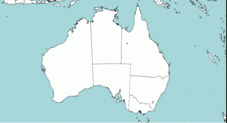
In the 100-year-old mining town of Coober Pedy, Australia, more than half of the population lives underground, escaping the heat. 

An underground bookstore in Coober Pedy, Australia. Smart Encyclopedia. CC BY-NC 2.0 

Over half of the few thousand residents of Coober Pedy, Australia, live underground. The town was founded over 100 years ago, in 1915, when a teenage boy out prospecting for gold discovered opals. A settlement was quickly established and miners began to flock to the area. Coober Pedy became one of the largest opal mining operations in the world, producing around 70% of the world’s opal and earning the title “Opal Capital of the World.” 

But the settlers of Coober Pedy had a problem: Coober Pedy is hot, with temperatures in the summer rising to over 113 degrees Fahrenheit in the shade. The opposite extreme is true during winter nights when the desert becomes very cold—considering this, life aboveground is greatly impacted by the weather. Rather than moving to a more temperate climate where opportunities for mining work would be more difficult to find, the settlers took inspiration from the mining industry itself, carving underground and hillside dugouts. In these cooler dugouts, the temperature stays at 75 degrees Fahrenheit year-round. 

The inhabitants’ subterranean lifestyle earned Coober Pedy its name, a corruption of the Aboriginal phrase “kupa piti,” which is often translated as “white man in a hole.” The name Coober Pedy was made official in 1920, but the settlement was not declared a town until the 1960s, after which it underwent another population boom and further development. 

Today, the underground residences have all the amenities that a regular home would on the surface, such as internet, water and electricity, as well as multiple bedrooms, bathrooms and living areas. Some homes, like the one carved by Faye Nayler and two of her friends, even have a swimming pool and bar. A large portion of the population live most of their life underground, and it is a comfortable and relatively normal lifestyle—aside from the lack of sunlight. There are stores, churches and museums underground alongside the residences; the town truly is an underground community. Coober Pedy’s inhabitants do have to venture aboveground for food, however, because both of the town’s grocery stores are located on the surface. 

An underground church in Coober Pedy. Werner Bayer. CC BY 2.0 

Coober Pedy is still a worldwide hub for precious opal, but mining is no longer its only major industry. The town has become a popular attraction for visitors hoping to experience subterranean life. Visitors can stay in hotels with underground accommodations, like the Desert Cave Hotel. Another lodging option is a homestay in family-operated underground apartment-style accommodations like Di’s Dugouts or the Underground B&B. There are also underground campgrounds available to book. 

A hotel in Coober Pedy. Smart Encyclopedia. CC BY-NC 2.0 

While the underground lifestyle is Coober Pedy’s main draw, visitors can also explore other attractions such as the Centenary Mosaic Garden; Kanku Breakaways Conservation Park, which is an Aboriginal heritage site; and can even try their hand at mining for opal using a digging technique called noodling. Faye Nayler’s house is now open to visitors as Faye’s Underground Home, where visitors can pay a small entrance fee to receive a guided tour of the house. There are a number of other tours available around Coober Pedy for visitors to learn more about the town’s unique history.  


Rachel Lynch

Rachel is a student at Sarah Lawrence College in Bronxville, NY currently taking a semester off. She plans to study Writing and Child Development. Rachel loves to travel and is inspired by the places she’s been and everywhere she wants to go. She hopes to educate people on social justice issues and the history and culture of travel destinations through her writing.

Exploring the Wonders of Australia’s Wild and Remote Kimberley

The Kimberley region of Western Australia boasts a spectacularly diverse landscape offering both biodiversity and impressive geological formations.

Aerial view of the Kimberley. Drumsara. CC-BY-SA 2.0. 

Although Australia provides plenty of examples of nature’s extraordinary beauty, few compare to the Kimberley region. Situated in Western Australia’s northernmost corner, the Kimberley is a grandiose territory teeming with rich ecosystems. A plethora of microcommunities sprinkle across its sundry landscapes while towering hills spill into vast canyons neighboring pristine swimming holes. 

The region covers over 150,000 square miles, with only about 40,000 residents inhabiting the area. Perhaps the most famous part of the Kimberley is Broome’s Cable Beach, ranked as one of the world’s most gorgeous stretches of sand and sea. The beach displays nearly 14 miles of fine sand meeting glassy waters. The beach itself has an interesting history; the name “Cable Beach” comes from the telegraph cable placed there in 1889. For adventurers more daring, Tunnel Creek National Park houses the oldest cave system in Australia. Again, the history of the stop is fascinating; Aboriginal leader Jandamarra hid in the cave system but was later caught and killed at its opening. 

The swirling sky at Cable Beach in Broome. hmorandell. CC BY-NC-SA 2.0. 

However, the history of the land tells a story drastically different than the extravagant serenity the region now boasts. 

Exploration of the Kimberley by Europeans was initiated in 1879 by government surveyor Alexander Forrest, who explored much of Western Australia. Upon arrival, Forrest made note of the region’s vast landscape which made it ideal for cattle grazing. From this point on, the resources of the land quickly became tied to conflict; diggers struck gold which led to a quickly fleeting gold rush, and conflicts over cattle grazing raged between the Indigenous population and newly arrived Europeans. In the mid-20th century irrigation projects led to the rise of extensive farming, primarily that of sugar cane and rice. Oil drilling and diamond mining are now conducted in the region. 

Today, the Kimberley contains residents as diverse as its wildlife; there are over 100 Aboriginal communities that share the region’s unmatched tranquility as well as its bustling economic opportunities. Due to the region’s iconic landscape, nearly 300,000 travelers visit every year, producing over $300 million annually. 

Tunnel Creek National Park. Nievedee. CC BY-SA 4.0. 

As with most dazzling spectacles of nature, the region boasts pristine weather that complements the untouched wilderness. The wet season extends from November to April and is characterized by heavy rain and humid, sticky air. From May to October is the dry season, which is characterized by sun-drenched days and cloudless, baby blue skies. 

Raft Point. Johnny. CC BY-NC 2.0. 

An exciting history and a dazzling landscape make Australia’s Kimberley region a powerfully adventurous destination. Surely any visitor will find their imagination stretched by the area’s countless wonders.


Ella Nguyen

Ella is an undergraduate student at Vassar College pursuing a degree in Hispanic Studies. She wants to assist in the field of immigration law and hopes to utilize Spanish in her future projects. In her free time she enjoys cooking, writing poetry, and learning about cosmetics.

Slope Point and Champagne Pool: Exploring New Zealand’s Wild Wonders

Sometimes nature is simple: vibrant sunsets, rays of warming moonlight or bouncing ocean waves. Other times, however, nature shocks and stuns. New Zealand houses two such examples: the odd site of Slope Point and the equally eerie Champagne Pool.

Slope Point with sheep. Seabird NZ. CC BY-ND 2.0. 

Slope Point

Perhaps most descriptions of the wonders of wind speak of a gentle breeze or freshly blowing air. On the southernmost tip of New Zealand’s South Island, the winds are instead far from calm; the violently whipping winds gave one area the name “Slope Point.” Situated along a steep cliff at the island’s southern edge, Slope Point is an ideal spot for those mystified by science. The ocean winds are violent and unrelenting to the area’s trees. The wind provides a scary picture of nature’s true power, blowing away anything that may come in its path. The location of Slope Point forces the trees to become the first victims of the winds. As a result, the tall trees are bent at an odd angle, making them seem as if they were purposely posed. Although few people live in the area, local farmers planted the trees to provide shelter from the wind for their herds of sheep. 

Photographs of the area offer profound inspiration for artists: the odd trees bend against a gray background striped with warm rays of sun. Although the area hosts an eerie feel, it is surely one underlined with the beauty of Mother Nature’s masterful hand. 

Champagne Pool

Boiling Champagne Pool. t3rmin4t0r. CC BY 2.0. 

Far north of Slope Point lies the mystical Champagne Pool on New Zealand’s North Island. Although an uncanny site, Champagne Pool is only one of many geothermal spots peppering the area around the city of Rotorua. The surrounding area, called Wai-O-Tapu, is known for its geothermal sites carved throughout the landscape. The strips of active volcanic sites and geothermal pools have created an admittedly scary yet magnificent look into what lies just beneath our feet. 

Champagne Pool is a captivating hot spring that stretches over 200 feet and is about equally as deep. A hydrothermal eruption caused this crater, which boils at over 160 degrees Fahrenheit, to form about 900 years ago. The hot spring earned its name from the presence of carbon dioxide that causes it to bubble like Champagne. Although seemingly uninhabitable, the hot spring teems with a rich microbial ecosystem. Additionally, striking photos of the site capture the vibrancy of the pool’s outer rim. Its neon orange strip is caused by antimony deposits that harden on the cooled rim of the pool. The surrounding grounds are equally rich in minerals; gold, mercury and silver are found in nearby rock beds. 

Whether one is an artist, a scientist or an adventurous visitor, both Slope Point and Champagne Pool stand as equally inspiring trips. 


Ella Nguyen

Ella is an undergraduate student at Vassar College pursuing a degree in Hispanic Studies. She wants to assist in the field of immigration law and hopes to utilize Spanish in her future projects. In her free time she enjoys cooking, writing poetry, and learning about cosmetics.

Aotearoa: Reclaiming Maori Language and Identity in New Zealand 

Compared to Indigenous groups around the world, the Maori in New Zealand enjoy more agency because of the Treaty of Waitangi, a founding document that recognizes Maori ownership of land and their subsequent autonomy in the country’s government. However, some feel that more can be done to create a bicultural and celebratory society—one that puts the Maori language at the forefront. 

A performance of the haka, a traditional Maori dance. Matthieu Aubry. CC BY-NC-SA 2.0.

New Zealand is an island country known for its scenic views, its native kiwi bird and its iconic role as the fictional Middle Earth. The country, named Aotearoa (meaning “long white cloud”) in the Maori language, is also steeped in rich history and culture.

Before European settlement, New Zealand was home to the Maori, one of the region’s many Polynesian ethnic groups. According to their oral histories, the Maori first voyaged from present-day Tahiti. They arrived and began inhabiting Aotearoa as early as 1300 A.D. Once settled, the Maori formed tribal societies. Their culture revolves around respect for the natural environment. The Maori also possess elements of a warrior culture—they craft unique performative arts such as the haka, a war dance turned into a ceremonial celebration.

Although the first Europeans—Dutch navigators—made contact with the Maori in 1642, the Maori way of life was not significantly impacted until the late 1700s. With the arrival of British Capt. James Cook, the scramble for New Zealand ensued. As nearby French voyagers and ungoverned sealers and whalers reaped profits from the islands’ natural resources, the British moved to make New Zealand a colony in 1840.

Reconstruction of the signing of the Treaty of Waitangi. Archives New Zealand. CC BY 2.0

In that same year, the Treaty of Waitangi was created. This artifact is not only recognized as a founding document but also as one that acknowledges Maori rights to the land. Despite its contentious nature, the Treaty of Waitangi is still considered a key success for the treatment of Indigenous people in New Zealand. In countries like Canada and Australia, Indigenous groups suffer a lower quality of life and enjoy less autonomy than their counterparts in New Zealand. These disparities can be traced back to the absence of a document acknowledging Indigenous people’s land rights. 

Although the status of the Maori in New Zealand may be considered a model for Indigenous treatment across the globe, there are still discrepancies that prevent them from fully embracing their dual identities. Though Maori is considered one of the national languages and has been celebrated every September since 1975, a national study found that only 148,000 people in New Zealand can hold a conversation in it.

In a piece for The Guardian, Leigh-Marama McLachlan explains her rejection of Maori culture to sustain success in New Zealand. She writes, “Back then, almost no one in my family spoke [Maori]. My grandmother was like so many Maori of that generation who were led to believe that our language would be of no use to their children.” Although McLachlan possesses some rudimentary Maori, she laments the overwhelmingly monolingual sentiment of the country.

The personal rejection of Maori culture can be traced back to the early stages of New Zealand’s modernization. In a 2015 study, Maori education professors Lesley Rameka and Kura Paul-Burke found that education for children dismissed the value of Maori. Textbooks failed to frame Maori history in a positive light, rendering the culture and language as “unintellectual, trivial and strange.”

A Maori carving. Bernard Spragg.

Since the last Maori Language Week in September, some feel that it is time to restore places to their rightful Maori names. Since the protests against racial injustice in the United States, policymakers and stakeholders were forced to reexamine New Zealand’s racist past of colonialism and disenfranchisement. With an overall renewed interest in Maori rights and treatment, several telecommunications firms in the country have already changed their names to include “Aotearoa.”


Rhiannon Koh

Rhiannon earned her B.A. in Urban Studies & Planning from UC San Diego. Her honors thesis was a speculative fiction piece exploring the aspects of surveillance technology, climate change, and the future of urbanized humanity. She is committed to expanding the stories we tell.

Locked Up: Unmasking Australia’s Aboriginal Youth Prison Crisis

The Aboriginal people have been severely marginalized by Australia’s government, but among the most impacted are the group’s children.

A young Aboriginal girl. mingzhuxia. CC BY-NC-SA 2.0

Indigenous people make up approximately 3% of Australia’s overall population and are considered the country’s most disadvantaged group. It is believed that the Aboriginal people lived in Australia for over 47,000 years prior to European colonization. Even today, the Aboriginal people continue to suffer some of the consequences of violent colonization such as low literacy rates, low life expectancy and a high unemployment rate.

Aboriginal children in particular are 30 times more likely to be stopped and prosecuted than other Australian youths. This reveals a pattern of racial profiling and stereotyping that has been called out by protests affiliating with the U.S.’s Black Lives Matter movement. 

Progress was made in 2018, when police in Western Australia apologized for practicing “forceful removal,” the separation of Indigenous children from their families. Forceful removal was popular throughout the late 19th century and was legal until 1969. Many refer to those impacted by forceful removal as the “Stolen Generation.” 

Since May 26, 1998, Australians have observed “National Sorry Day” as a way to apologize to the Aboriginal people for the harmful practice. It is a nationwide campaign committed to paying homage to affected groups while teaching youth of Australia’s harmful past actions. In 2008, former Prime Minister Kevin Rudd made a proposal in front of Parliament to help bridge the gap between Indigenous and non-Indigenous people

Australia’s National Sorry Day in 2015. butupa. CC BY-NC-ND 2.0

Yet, the gap between the Aboriginal community and other Australians remains as wide as ever. In February, the police of New South Wales revealed details about the Suspect Targeting Management Plan, which is intended to prevent future crimes by targeting likely or repeat offenders. Reports from 2016 to 2018 show that up to 72% of targeted children were likely from Indigenous descent. The youngest child identified was 9 years old. 

The minimum age of criminal responsibility in Australia is one of the lowest in the world, allowing children as young as 10 to be sentenced to jail. Additionally, Aboriginal children are 17 times  more likely to be jailed than non-Indigenous youth. Statistics from Western Australia say that 60 to 70% of children currently being held in the state’s detention centers are of an Aboriginal background. 

As of now, very little research proves that locking up children reduces criminal activity in the future. In fact, youth already in the criminal justice system are far more likely to be repeat offenders, challenging the original intent of New South Wales’ Suspect Target Management Plan. 

There is a push by lawyers and advocacy groups to raise the age of criminal responsibility in Australia to at least 14. Others believe that an alternative is to provide better health care and other social services in an attempt to elevate Aboriginal children’s socioeconomic standing. The end goal would be to improve their overall quality of life, allowing for better employment opportunities and an end to the societal obstacles currently facing the group.


Eva Ashbaugh

Eva is a Political Science and Gender, Sexuality, and Women's Studies double major at the University of Pittsburgh. As a political science major concentrating on International Relations, she is passionate about human rights, foreign policy, and fighting for equality. She hopes to one day travel and help educate people to make the world a better place.

New Zealand’s “Headscarf for Harmony” Effort

Women wear headscarves to stand in solidarity with New Zealand Muslim community.

This week, women in New Zealand are wearing hijabs to stand in solidarity with the Muslim community following the shooting of 50 people at two mosques in Christchurch.

The effort, called “Headscarf for Harmony”, was created by Auckland doctor Thaya Ashman. After hearing a Muslim woman say that she was afraid to leave her house wearing a hijab, Ashman wanted a way to show her support and solidarity. “I wanted to say: We are with you, we want you to feel at home on your own streets, we love, support and respect you,” she told Reuters.


Ashman spoke with the Islamic Women’s Council of New Zealand and the Muslim Association of New Zealand before putting the effort into action. She told the New Zealand Herald that she used the word headscarf instead of hijab to recognize the cultural difference present for non-Muslims.

The Headscarf for Harmony hashtag continues to spread across social media. where New Zealanders are posting pictures of themselves in headscarves accompanied by captions offering their support for the Muslim community.

"These people are New Zealanders, just like I am,” twenty four-year-old Cherie Hailwood told CNN. “I understand that one day is very different to wearing it all the time, but I am honored to be given the permission of the Muslim community to walk in their shoes. Even just for a day.”

Prime Minister Jacinda Ardern wore a black headscarf when meeting with members of the Muslim community. Even news anchors and reporters joined the effort, wearing headscarves on live television. At an open prayer at the Al Noor mosque where the attack had taken place, New Zealand women wore head scarves as a gesture of respect and solidarity.

“Being a Muslim, I’m overwhelmed,” one man tweeted, “I have never seen this kind of solidarity in my entire life—the vigils, the Haka performances, the scarves. It’s just amazing and heartwarming.”

Not all supported the effort. On Stuff.co.nz a Muslim woman published an unsigned article saying that while the movement may mean well, it is no more than “cheap tokenism”.

She wrote that the effort, “stinks of white savior mentality, where Muslim women need to be rescued by (largely) white folk. This type of ideology plays a part in the pyramid of white supremacy and must be acknowledged so people can stop virtue signaling and understand the impact of their actions.”

She went on to say that the attack, “was not just about Muslims, it was against any person of colour in a 'white' country so this focus on hijabs is derailing the examination of white supremacy, systematic racism, orientalism and bigotry. We don't want to be turned into a caricature.”


EMMA BRUCE is an undergraduate student studying English and marketing at Emerson College in Boston. While not writing she explores the nearest museums, reads poetry, and takes classes at her local dance studio. She is passionate about sustainable travel and can't wait to see where life will take her.

Abstract Australia from Above

“The real voyage does not consist in seeking new landscapes, but in having new eyes.” — MARCEL PROUST

Islands on natural salt lake, Lake Johnston, north of Esperance, in Western Australia. (Taken 2014)

I have been attracted to the Australian landscape because of its size and subtle differences — a sense of wonderment, how it all came about, the evolution of the landscape. Like the rest of the world it has gone through many stages to be what it is today — uniquely Australian. But it also is a very old landscape. It is the flattest and driest continent, which compared with other countries, does not manifest itself in grandeur as we know it; large rivers, large mountains and the dramatic changes of the seasons.

The Pinnacles. Limestone formations, Nambung National Park. (Taken 2009)

However, I found that by looking at the landscape from the air, many natural characteristics revealed themselves much better, showing the evolution and the geographical variations. Nature is a great teacher. Observing and experiencing it can stimulate our creative senses which in turn is beneficial to ourselves and our environment.

Pink Lake, north-west of Esperance, Western Australia. This is the natural colouration of the salt lake. (Taken 1988)

It was in 1955 that I bought my first camera, and this was the beginning of a long association with photography. Intrigued by the unusualness of the Australian landscape, I became a landscape photographer with a strong bias for aerial photography, which I felt captured the vastness of the outback best — each flight became a flight of discovery.

Late light on a drifting sand dune, Windorah, south east Queensland. (Taken 1994)

There are so many Australian landscapes worthy of consideration whether they be rivers, coastal plains or deserts — all of which vary seasonally and at different times of the day. As much as possible I like to be inspired by what I see and this is where I experience a sense of wonderment of a world so complex, varied and beautiful.

Coastline between Esperance and Cape Arid, in Western Australia. This shows the reflection of the clouds in the lake, with the beach and ocean in the foreground. (Taken 2006)

Of course there are many ways to appreciate the landscape. My own involvement is to photograph the highlights and to interpret them with the camera in a painterly way. I emphasise these highlights by pointing the camera down and focussing on the subject, excluding the horizon so one looses a point of reference and the reality often takes on an abstract view. I hope that the character of the subject is enhanced and that it reveals more through isolation by the camera angle.

A turkey nest dam near Newdegate, Western Australia, contrasts against the ploughed fields. (Taken 1994)

The aerial point of view also allows us to examine the impact of humanity on Earth. There is a beauty in the man made landscape which takes on a relationship beyond the form as we know it. Certain subjects such as mining dumps, industry and farming look mundane at ground level, but from above my eye begins to recognise a gratifying order in the chaos — crops, paddocks and ploughed fields become masterpieces in abstraction often unknown to their creators. Simultaneously, the aerial perspective can also indicate the abuse and destruction that has taken place.

Salt lakes surrounded by wheat fields, 50 kilometers north east of Esperance, Western Australia. (Taken 1994)

At all times, I take a very personal approach to my work, but I also take great care to retain the optical reality. There are a million pictures out there. I am the only limitation. I can tune in and absorb the reality of the variations, combined with my way of seeing and my attitude. The older I get the harder it becomes, and the more I am drawn to nature. It is the creation of all life and matter that appeals to me now. Maybe I can make a small contribution to its well being which is in jeopardy. If beliefs in eternity are formed, nature is a great catalyst. I often feel intimidated by a great outback landscape, but also inspired by it.

Forrest River, Kimberley, Western Australia. A tidal river system, north-west of Wyndham. (Taken 2003)

We now have more technical gadgetry at our disposal and there is no doubt it can help us to get a better photograph. But that in itself means little unless it enhances our understanding of the world around us. It is more important to use our creative spirit and gain wisdom than purely use it as a tool. Today in our digital age we have Photoshop with its possibility to enhance or to completely distort or create our own image using photographic components. We have become so image conscious that we often forget the beauty of reality.

Ocean between Ningaloo Reef and Coral Bay, Western Australia. The blue variation is due to the ocean’s floor level. (Taken 2006)

The subject of photography can either be concrete or intangible. In the first case the picture is basically realistic, where as in the latter case it is essentially abstract. But what makes photography so interesting is that by combining both we can introduce creativity in the subject and have the best of both worlds.

Ant clearings approx. 4–5 metres across, Great Sandy Desert, Pilbara, Western Australia. (Taken 2003)

Although many photographers can take photographs and do it well, it is work done in the full utilization of that creative spirit that stands out. It should be influenced by the subject itself and come from within oneself.

Tidal variations result in a coastal river pattern, Northern Territory. (Taken 2004)

“I still can’t find any better definition for the word Art, than this. Nature, Reality, Truth, but with a significance, a conception, and a character which the artist brings out in it and to which he gives expression, which he disentangles and makes free.” — VINCENT VAN GOUGH

Lake Dumbleyung, Wagin, Western Australia. Affected by farming this natural lake has become saline. After the first rains, it turns pink. (Taken 2005)

We do not always appreciate the aerial point of view. People regard the landscape as something you fly over. But in reality it is an opportunity to see the landscape from a different perspective. I never cease to marvel at the natural variations in the Australian landscape and although I value what is there photographically, in the end it is the observation and appreciation of the diversity that is the reward.

Top of Curtis Island, Cape Capricorn, north-east of Gladstone, Queensland. An estuary with sand banks. (Taken 1997)

Postscript — All of my photographs are as seen from the air and are not manipulated. I feel that the beauty, colours, and uniqueness of the Australian landscape is complete and needs no enhancing.

RICHARD WOLDENDORP is a Dutch-born Australian landscape photographer, with a focus on the aerial perspective. Appointed the Order of Australia in June 2012, “For service to the arts as an Australian landscape photographer.”

THIS ARTICLE WAS ORIGINALLY PUBLISHED ON MAPTIA


Into the Outback

An epic and ancient landscape, deeply entwined with the artistic, musical, and spiritual traditions of Indigenous Australians, the Outback is one of the largest remaining, intact natural areas on Earth. A cultural, ecological, and geological wonder, I explore and capture these vibrant regions on foot and from the air.
 

Known for its Aboriginal peoples and its vast, ancient landscapes, the Outback is an incredibly special place for me. I think that once you get that distinctive red dust in your blood it never comes out.

My roots are deeply connected to the rural areas of western Queensland and from a very young age, the never-ending expanse of inland Australia has been something that has captivated me. Ever since I can remember, we would take long road trips out to a family-run cattle station, and there was always this great sense of wonder and adventure. In the Outback, you can travel for days in any direction and stumble across places that are unique, untouched, and rarely visited. It was on these early trips that I fell in love with the bush, the people, and its landscape. I’ve never stopped venturing back.

Pannawonica Hill, near the small town of Pannawonica, a tiny iron-ore mining settlement in the Pilbara region of Western Australia. // © Dan Proud

Drawn to remote, wide open spaces, to the dusty and the desolate, I have found that there are countless unique rocky outcrops and ridges to explore. From the arid and ancient regions of Kimberly and Pilbara in Western Australia, to the rugged, weathered peaks and dramatic rocky gorges found in the Flinders Ranges of South Australia, to the red centre and Australia’s most famous monolith, Uluru — it is not only the sheer size of the Outback that is astounding (it could encompass almost all of Europe), it is also home to some of the world’s most spectacular and untouched landscapes. Over the past few years, I’ve been lucky enough to photograph, film, and fly over these regions — both in light aircraft, and more recently, with drones.
 

The West MacDonnell Ranges, known as the West Macs, seen from the air. Found in Australia’s Red Centre, west of Alice Springs. // © Dan Proud

Deeply entwined with the landscape itself are the artistic, musical, and spiritual traditions of the Indigenous Australians, among the longest surviving cultural traditions in human history. Some 30,000 to 70,000 years ago — many millennia before the European colonisation that would come to threaten and profoundly disrupt many Aboriginal communities — the first inhabitants of Australia arrived from the north, making them amongst the world’s earlier mariners. They spread throughout the landmass, surviving even the harsh climatic conditions of the Last Glacial Maximum.

Evidence of ancient Aboriginal art is found all over the Outback, most notably at Uluru and Kakadu National Park in the Northern Territory. An impressive sandstone rock formation, Uluṟu — as it called by the Pitjantjatjara Anangu, the Aboriginal people of the area — or Ayers Rock, still holds great sacred and cultural significance for the local indigenous population. Appearing to change color at different times of year, this natural monolith is quite magnificent as it glows a deep red or purple at sunrise and sunset.
 

Uluru, or Ayers Rock, the huge sandstone monolith in Australia’s Red Centre, glows deep red at sunset. // © Dan Proud

It was only in 1606, little over four centuries ago, that the first known European landing was made by Dutch navigator Willem Janszoon on the western shore of Cape York, in Queensland. This discovery was closely followed by that of Dirk Hartog, another Dutch explorer, who sailed off course during a voyage in 1616 and landed on what is now known as Cape Inscription, thus discovering the coast of Western Australia.

For many decades to come, the true extent of the continent would not be known, and with the exception of further Dutch visits to the west, Australia remained largely unvisited. Although a number of shipwrecks are evidence that other Dutch and British navigators did encounter the coast during the 17th century, usually unintentionally, it would be over 150 years before the crew of HMS Endeavour, under the command of British explorer Lieutenant James Cook, sighted the east coast of Australia in 1770 and Europeans widely came to believe that the great, fabled southern continent existed.
 

Trees in stark contrast with the vibrant orange of Uluru, or Ayers Rock. // © Dan Proud

Running in parallel ridges to the east and west of Alice Springs, through Australia’s Red Centre, lie the East and West MacDonnell Ranges, also known as the Macs. Most people imagine the Outback to be completely flat, but these mountains run for more than 600 kilometres and in places reach heights of over 1,500 metres. Formed 300 to 350 million years ago, folding, faulting, and erosion have since shaped the Macs to form numerous narrow gaps and gorges, and they contain many areas of cultural significance. Seen from the air, their undulating and intricate rock formations are spectacular.
 

The West MacDonnell Ranges seen from the air, in Australia’s Red Centre, west of Alice Springs. // © Dan Proud

Weather patterns in the Outback are also something that surprises many people. While often envisaged as a uniformly arid area, the Outback regions stretch from the northern to southern Australian coastlines, and encompass a number of climatic zones — including tropical and monsoonal climates in northern areas and temperate climates in the southerly regions. At times, dramatic dust and thunder storms roll in, soaking the dry ground and often causing flash flooding. Witnessing these storms is an incredible experience.
 

Dust and thunder storm meet near the tiny settlement of Innamincka, Southern Australia. Situated on the banks of Cooper Creek, it is surrounded by the Strzelecki, Tirari and Sturt Stony Deserts. // © Dan Proud

Reflecting its wide climatic and geological variation, the Outback contains a number of distinctive and ecologically-rich ecosystems, along with many well-adapted animals, such as the red kangaroo, the emu, and the dingo, which are often to be found hidden in the bushes to keep cool during the heat of the day. Recognised as one of the largest remaining, intact natural areas on Earth, the Outback is home to many important endemic species.

One such species is Adansonia gregorii, known locally as the boab tree, which is found nowhere else in the world but the Kimberley region of Western Australia, and east into the Northern Territory. With their striking swollen trunks, boab trees can reach up to five metres in diameter at their base, and amazingly, some individual trees are more than 1,500 years old, making them the oldest living beings in Australia, and among the oldest in the world.

For thousands of years, Indigenous Australians have used these giants for shelter, food and medicine; often collecting water from hollows within the tree, and using the white powder that fills the seed pods as food. Decorative paintings or carvings were also made on the outer surface of the fruit.
 

A boab tree growing in the Kimberly region of Western Australia. // © Dan Proud

Also found in the Kimberly region is the Cockburn Range, a magnificent sandstone escarpment that rises for 600 metres above the surrounding plains. Shaped like a vast fortress with towering orange cliffs, many rivers have cut through the formation to form steep-sided gorges. Flying above the Range at sunset, when the western face is lit up with a brilliant red glow, reveals another of the Outback’s epic and ancient landscapes.
 

Sunset flight over the Cockburn Ranges in Kimberley, Western Australia. // © Dan Proud

The geology of South Australia’s Outback is no less dramatic, and among the rugged, weathered peaks and rocky gorges of the Flinders Ranges, some of the oldest fossil evidence of animal life was discovered in 1946, in the Ediacara Hills. Similar fossils have been found in the Ranges since, but their locations are kept a closely guarded secret to protect these unique sites.
 

Cast in golden light, Bunyeroo Valley in Southern Australia. // © Dan Proud

The first humans to inhabit the Flinders Ranges were the Adnyamathanha people — meaning “hill people” or “rock people” — whose descendants still reside in the area, and also the Ndajurri people, who no longer exist. Cave paintings and rock engravings tell us that the Adnyamathanha have lived in this region for tens of thousands of years. Though my perspective is usually broad and from the air, in the nooks and crannies of these arid landscapes live the yellow-footed rock-wallaby, which neared extinction after the arrival of Europeans due to hunting and predation by foxes, and also two of the world’s smallest marsupials — the endangered dunnart, and the nocturnal, secretive planigale, smallest of all, often weighing less then five grams.
 

The dramatic Flinders Ranges of Southern Australia seen from above, photographed by drone. // © Dan Proud

Last but certainly not least, we come to the spectacular Pilbara region of Western Australia. Stretching over a vast area of more than 500,000 square kilometres in the north of Western Australia, it is home to some of Earth’s oldest rock formations, dating back an impressive two billion years.

Seen from the air, parts of the Pilbara can sometimes resemble another planet. Yet the greens and yellows of the acacia trees, the hardy shrubs, and the drought-resistant Triodia spinifex grasses — contrasting so spectacularly with the brilliant orange and ochre of the land itself — remind us that life can flourish and adapt even in the most challenging of conditions.
 

The vibrant colors and unusual contours of the mineral-rich Pilbara landscape in Western Australia. // © Dan Proud

Known also for its vast mineral deposits, for many years the Pilbara has been a mining powerhouse for crude oil, natural gas, salt, and iron ore. Today, although the fragile ecosystems of this area have been damaged by these extractive industries, a number of Aboriginal and environmentally sensitive areas now have protected status in the Pilbara — including the stark and beautiful Karijini National Park with its deep gorges and striking canyons.
 

Stunning displays of rock layers at Hancock Gorge in the Pilbara. // © Dan Proud

Culturally, Australia’s Outback regions will always be deeply ingrained in our country’s heritage, history, and folklore. For Indigenous Australians, creation of the land itself is believed to be the work of heroic ancestral figures who traveled across a formless expanse, creating sacred sites on their travels. Ecologically, it is one of the most untouched and intact natural areas we have left on the planet, and home to a plethora of important endemic species. Geologically, it represents a vast and ancient landscape — one of the most unique on Earth and one that I could never tire of exploring. Every time I head up into the air or set out to photograph the Outback, I’m blown away.
 

Dotted with acacia trees, the striking landscape of Pilbara’s Outback region at dusk. // © Dan Proud


THIS ARTICLE WAS ORIGINALLY PUBLISHED ON MAPTIA.


DAN PROUD

Dan Proud is a Queensland-based photographer and film maker with a passion for aerial cinematography and capturing the magical wide open spaces of Australia.