
Ashley McDermott
Experiencing the Canadian side of Lake Huron gives travellers the opportunity to delve into local culture, see unusual landscapes and adventure outdoors along the lake’s diverse shoreline.

Lake Huron Circle Tour sign. Tony Webster. CC BY-SA 2.0
Driving in the U.S. Midwest, Ontario or Montreal, you may have noticed the small rectangular green square signs depicting a Great Lake and the words "Circle Tour" underneath highway markers. The signs are the legacy of the Great Lakes Commission's Circle Tours, founded in 1988, a network of scenic highways encircling each of the Great Lakes that runs through eight U.S. States and two Canadian Provinces. While the unveiling of the route caused thousands of guidebook requests to pour into the Great Lakes Commission's offices, the Circle Tours are now much less known, with signage deteriorating and missing or incorrect information listed for the routes online.
One casualty of time is the Canadian side of the Huron Circle Tour, as maintenance on the route markers ceased years ago. Though 3 million people live on Lake Huron's shores, and it is only five hours from the Toronto metropolitan area and one hour from Detroit, most travelers only see popular and crowded summer vacation sites, such as Bruce Peninsula National Park. The Lake Huron Circle Tour encompasses the longest shoreline of any lake in the world, a route running through historical sites and the most diverse geology in North America, including formations dating back 2 billion years. It gives travelers the chance to see some of the lake's 3,000 freshwater islands, including Manitoulin Island, the largest freshwater island in the world.
1. Goderich
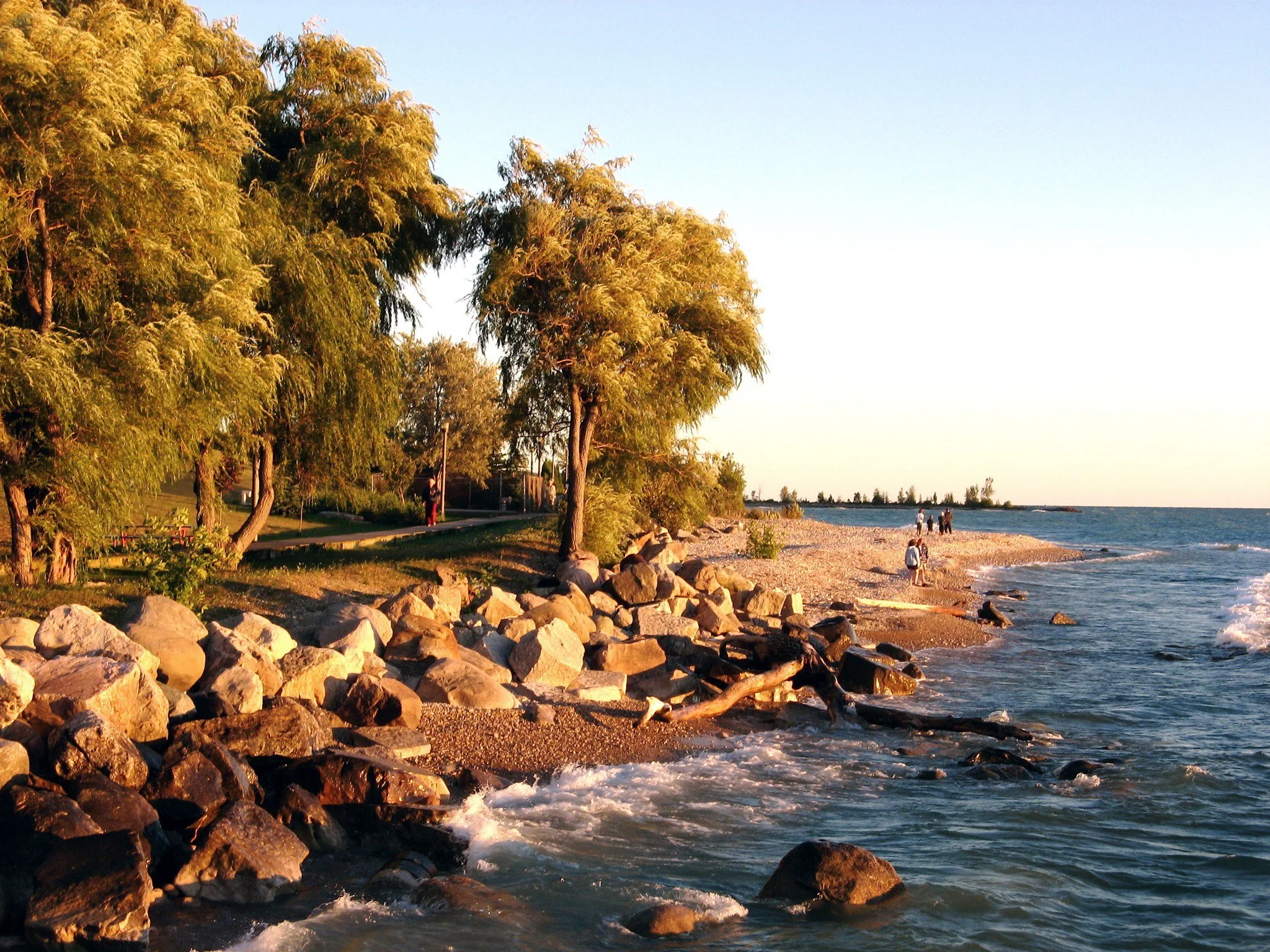
Golden hour along Goderich's boardwalk. Shane Zurbrigg. CC BY-NC-ND 2.0.
78 miles northwest of the Blue Water Bridge connecting the U.S. to Canada, Goderich's main square is not a square, per se, but an octagon. Inspired by Da Vinci's Vitruvian Man and British nationalism, Goderich's co-founder, John Galt, designed "The Square" to be an octagon, with streets radiating from the center to form the lines of the Union Jack.
In the waters just off the coast of Goderich is the largest underground salt mine in the world, and lakers frequently enter the harbour to procure loads of salt. Despite the large-scale industry operating just off the coast, the city has three white sand beaches, with paved walking trails and boardwalks. Lighthouse Park on the bluffs offers what locals describe as one of the best sunsets over Lake Huron; by climbing the stairs from the beach to the Lighthouse Park, it is even possible to see the sunset twice.

The Maitland River from the Menesetung Bridge. Ashley McDermott.
The railways that once linked Goderich to the rest of Canada and secured its place as a regional hub now form the G2G trail. The trail runs 132 km (82 miles) to Guelph, offering excellent views of the Maitland River Delta as it crosses the Menesetung Bridge, which in 1909 was once the longest bridge in Canada. As the trail continues through farmland in Huron and Perth Counties, communities have embraced the trail by putting up benches on their properties and offering coolers with drinks in the summer. The area is home to a large Mennonite community, and the route offers opportunities to engage with Mennonite culture, such as visiting local farm shops and bakeries.
2. Penetanguishene
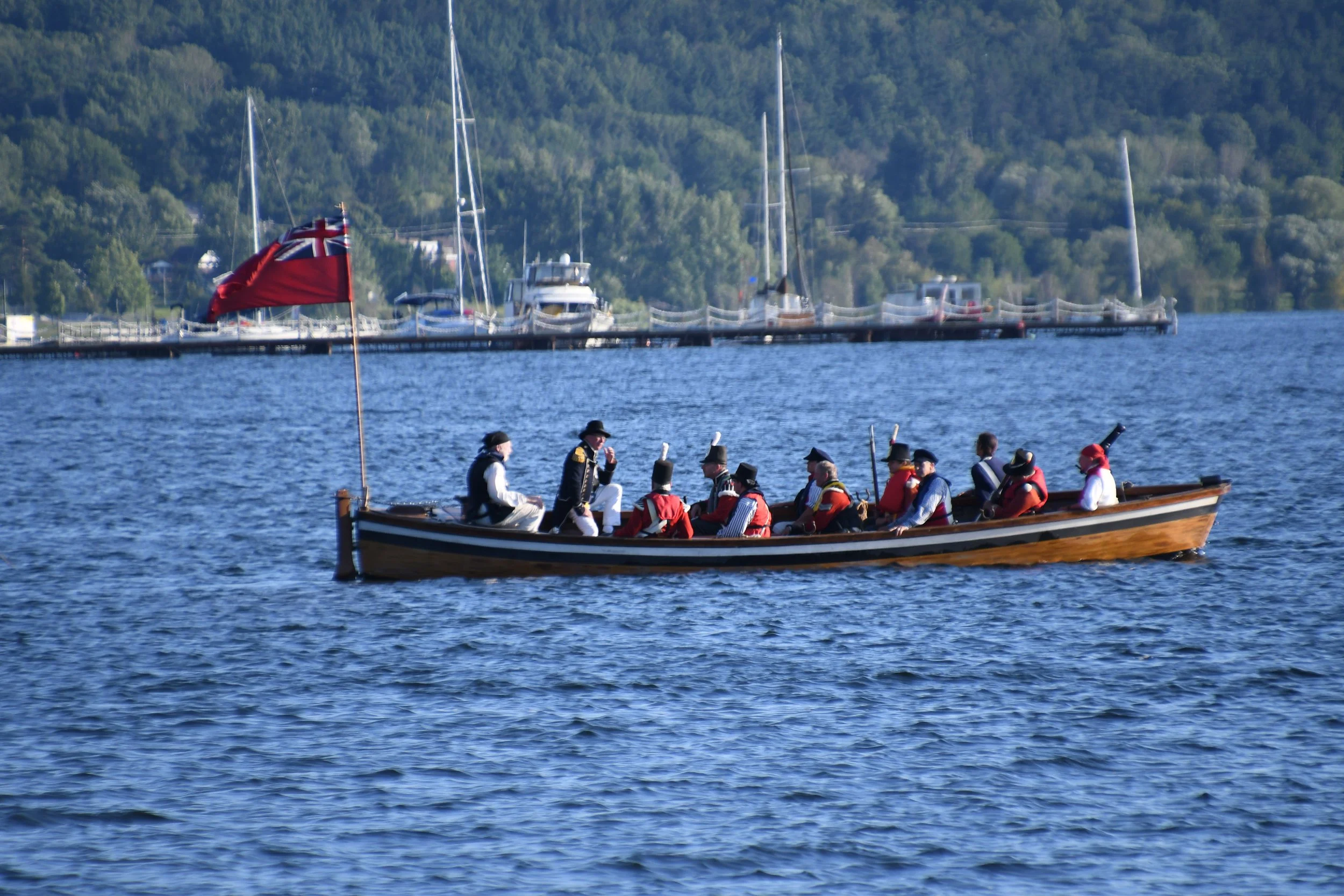
War of 1812 reenactors preparing for battle. Joe Ross. CC BY-SA 2.0
Following the coast on the eastern side of the Bruce Peninsula will bring you to Penetanguishene. The name Penetanguishene is from the Algonquin language, meaning "place of the white rolling sands." As the name suggests, the town encompasses a shallow bay, white sand beaches and rolling hills. The town sits just south of 2,915 hectares of sugar maple and red oak forest in Awenda Provincial Park.

Kettle Lake in Awenda Provincial Park. Mhsheikholeslami. CC BY-SA 4.0.
The site of Penetanguishene has long been inhabited, and it is one of the oldest towns in Canada west of Quebec City. Beginning as early as A.D. 800, the area was home to semi-permanent Wyandot villages. The arrival of Metis families in 1828, who migrated from Drummond Island after the War of 1812, marked the start of what is now recognized as the Georgian Bay Historic Metis Community, the largest historic Metis population in Ontario and a central feature of Penetanguishene’s cultural landscape.
The history of Wyandot, Metis, French and English peoples in the region is the focus of Discovery Harbour, a historical reproduction of the naval base constructed during and after the War of 1812, which includes reproductions of the H.M.S Tecumseth and H.M.S Bee.
3. Georgian Bay Islands National Park

Tonch South campsite, Georgian Bay Islands National Park. Jason Fowler. CC BY-NC-SA 2.0
Across the Georgian Bay from Penetanguishene is Honey Harbour, which serves as the launch for the DayTripper ferry, the only public means of accessing Georgian Bay Islands National Park. While the DayTripper only stops at two locations on Beausoleil Island, the park encompasses 63 of the Georgian Bay's 30,000 islands and lies within the UNESCO Georgian Bay Biosphere Reserve.
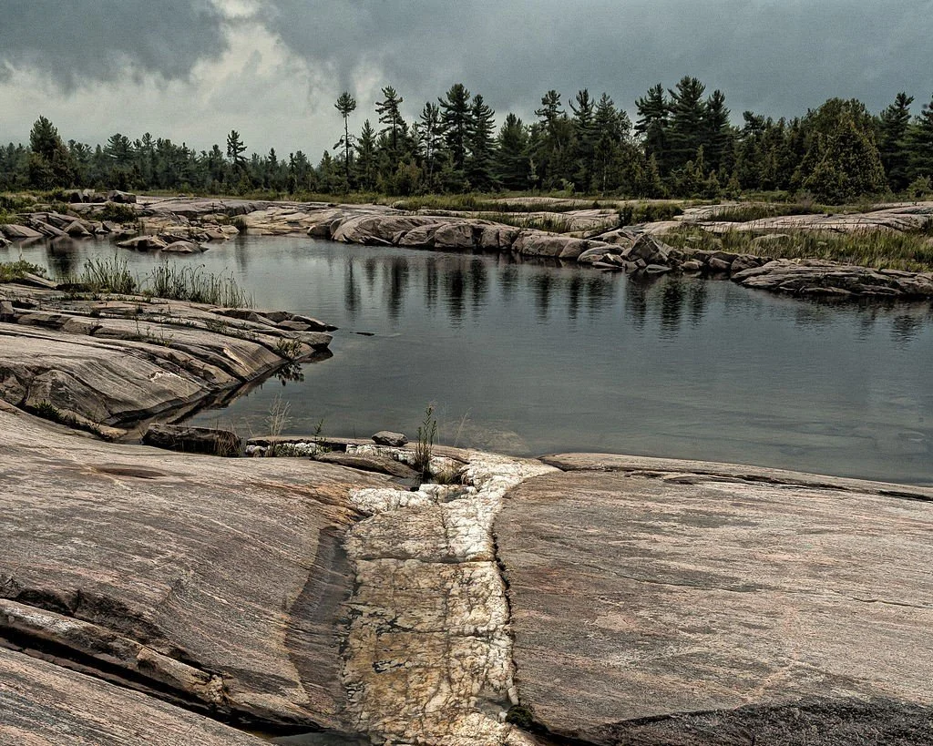
Quartz rock formation in the Georgian Bay. Jonathan Wilkins. CC BY-SA 3.0
Located on the Canadian Shield, the park contains the most diverse geology in North America, spanning 2 billion years of the Earth's history, and it is known for its Precambrian-era gneiss and migmatite rock formations. White pines grow in the rocky terroir of the many small islands dotting the bay, which was a favorite subject of the Group of Seven, a renowned early 20th-century collective of Canadian landscape painters. Travelers to Beausoleil can enjoy kayaking and hiking among these unusual rock formations. Overnight stays on Beausoleil Island also allow for excellent stargazing, given the remote location away from population centers.
4. Parry Sound
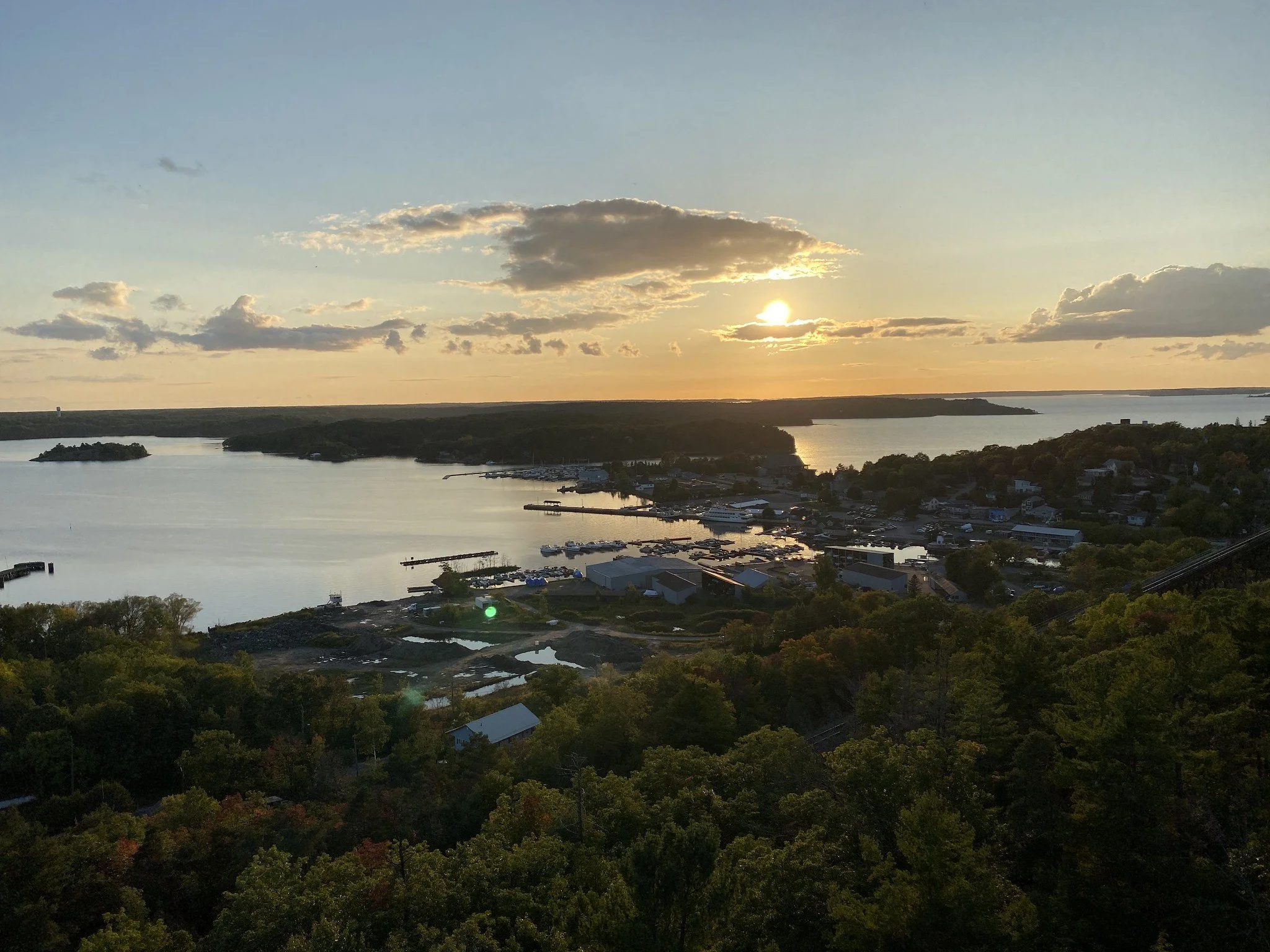
Parry Sound at sunset. WabbitWanderer. CC BY-SA 2.0
Almost an hour north of Honey Harbour is Parry Sound, considered to be the gateway to the Georgian Bay and the deepest natural freshwater port in the world. Often described as a sailor's paradise, the town is a base for exploring the surrounding waters, whether through kayaking, cruises, water taxis or fishing charters.
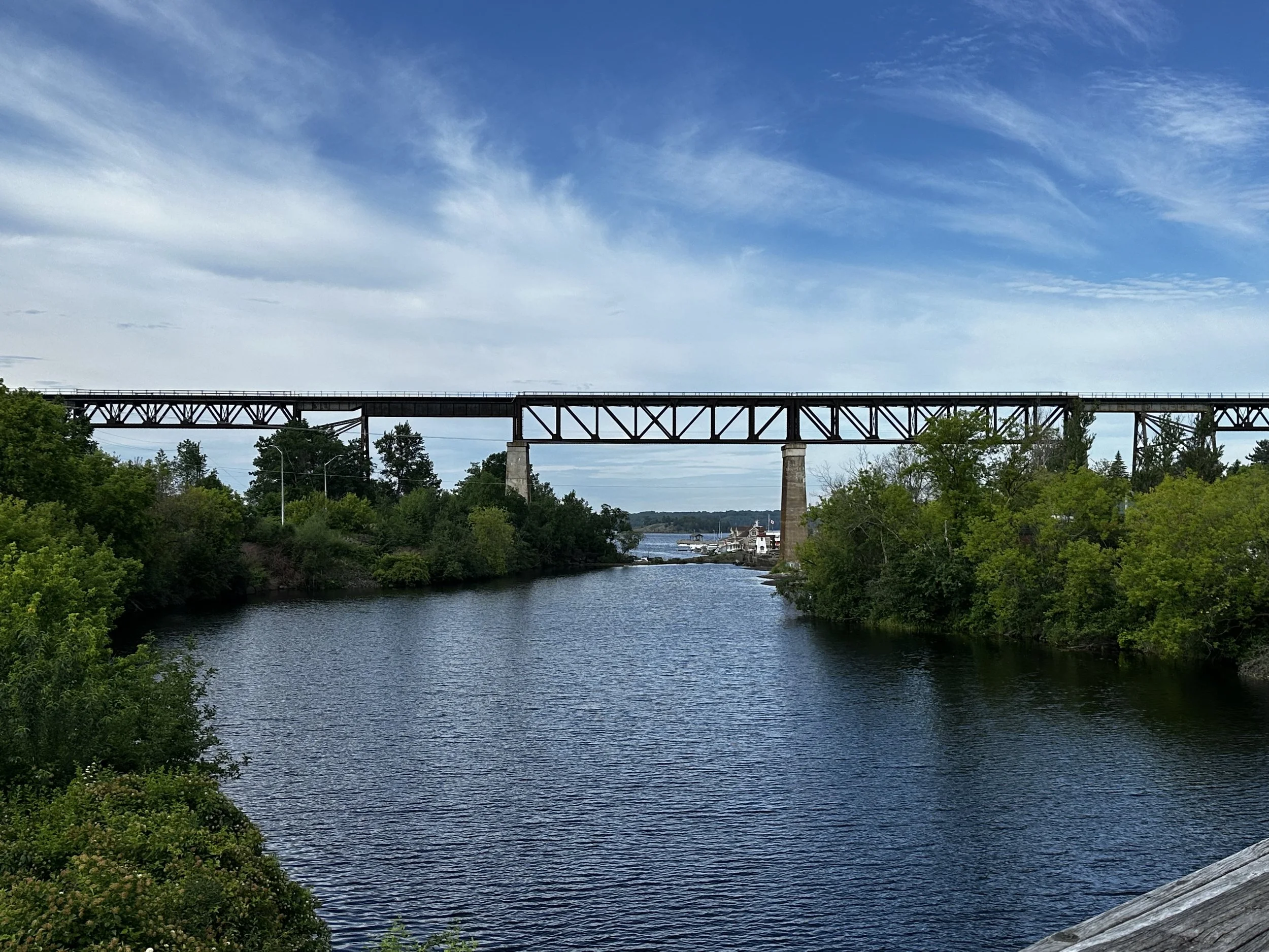
Parry Sound underneath the trestle. Ashley McDermott.
The lively town is the result of a history as the regional hub for mining and logging. The most visible reminder of this history is Parry Sound's iconic 104-foot-tall railway trestle that runs through the center of town over the Seguin River. Underneath the trestle, visitors can stroll along the rapids of the Seguin River on a greenway that links the brewery and restaurant scene on Great North Road and quirky mom-and-pop shops on Seguin Street to the quintessential harbor town establishments along the waterfront.
5. Manitoulin Island
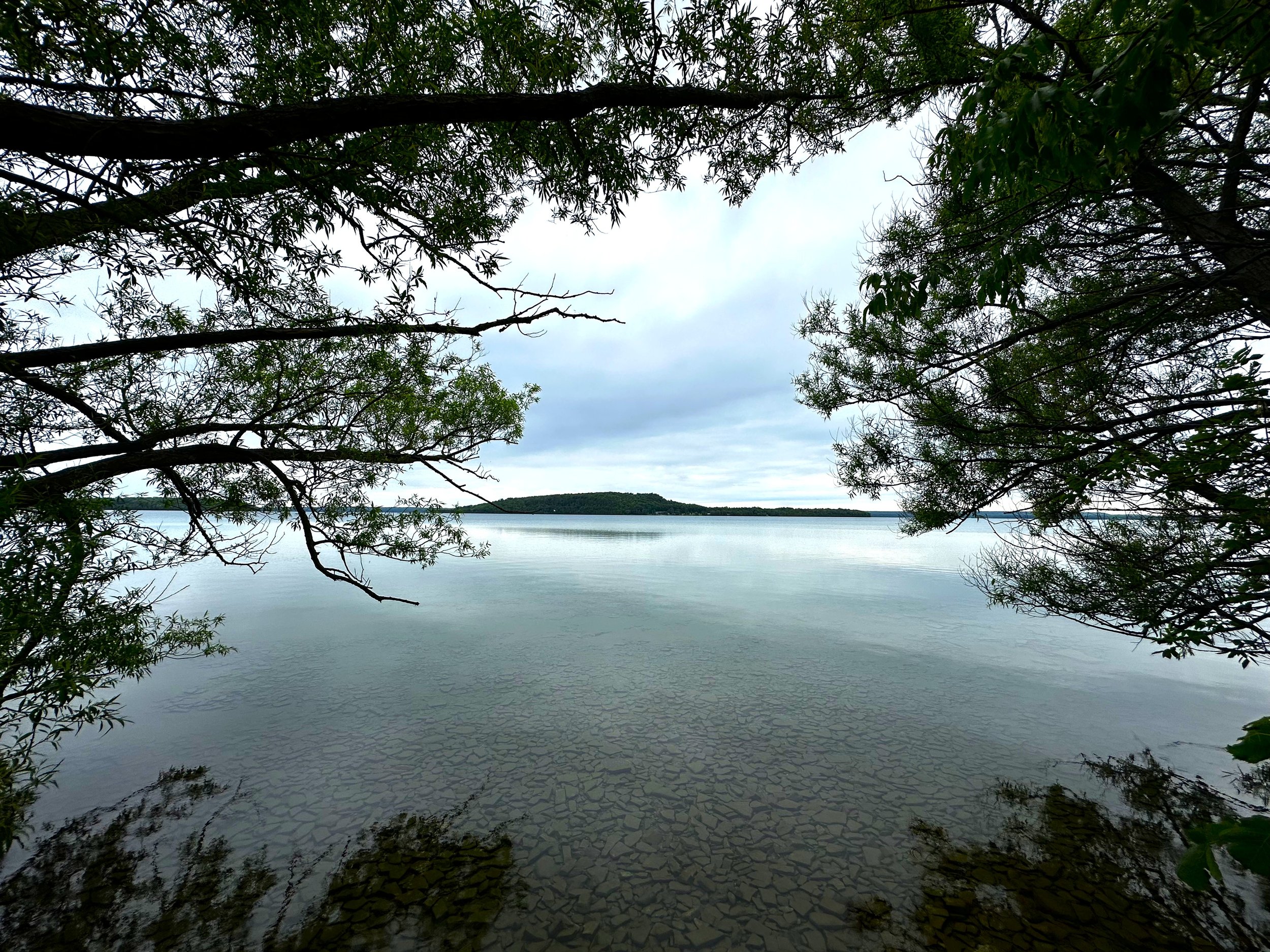
Manitoulin's recursive island. Ashley McDermott.
Located within Lake Huron, there are only two ways to get to Manitoulin Island, the world's largest freshwater island. First is to take the MS Chi-Cheemaun ferry connecting Highway 6 in Tobermory to South Baymouth. The second, longer adventure takes Highway 6 from Goat Island over the one-lane Little Current Swing Bridge, a former railroad bridge built in 1912. For the first 15 minutes of every daylight hour, the bridge rotates into the "open" position, allowing maritime traffic through the channel between the islands.
The influence of Manitoulin's six Anishinaabe First Nations communities is felt throughout the island. Visitors can get a sense of local cultures and view heritage art, like porcupine quill boxes at the Ojibwe Cultural Center, as well as delve into the island’s complex relationship with the past through tours of Wiikwemkoong, Canada's only officially recognized Unceded Territory. During the summer, the island hosts multiple powwows.

Cup and Saucer Trail. Jock Rutherford. CC BY-SA 2.0
Manitoulin lies along the Niagara escarpment, and hiking the dolomite cliffs gives panoramic views of the island's lakes and Lake Huron. The trails on the coast, especially Misery Bay, are a stark contrast, crossing glacial beaches made of flat limestone covered with thin layers of soil, mosses and lichen. The island is also home to 108 lakes, including a recursive island called Mindemoya, which is an island in a lake within an island in a lake!
6. Chutes Provincial Park
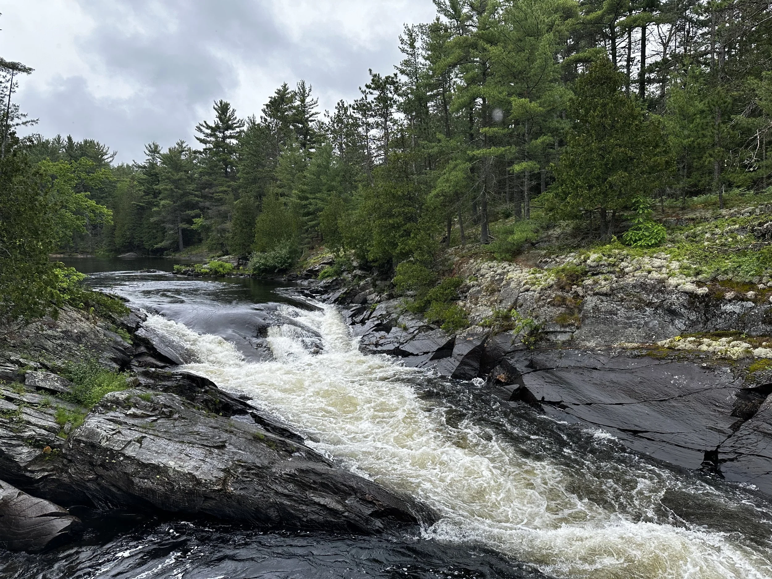
Chutes Provincial Park. Ashley McDermott.
Along the Trans-Canada between Sudbury and Sault Ste. Marie is Chutes Provincial Park. Just on the outskirts of the small town of Massey, Ontario, the park is unexpected; turn on Massey's main street, past a sports field and find yourself amidst a secluded forest alongside the thundering Aux Sables River.
The Aux Sables River has been a major thoroughfare for centuries, serving as a water highway for both Indigenous peoples and settlers. Chutes is named for the series of waterfalls that frustrated loggers in the 19th century as they moved white pine downriver to the local mill. At the park, the Twin Bridges Trail takes visitors from the riverside campgrounds alongside the Aux Sables, giving great views of the cataracts, including the Big Chute and Seven Sisters Rapids.
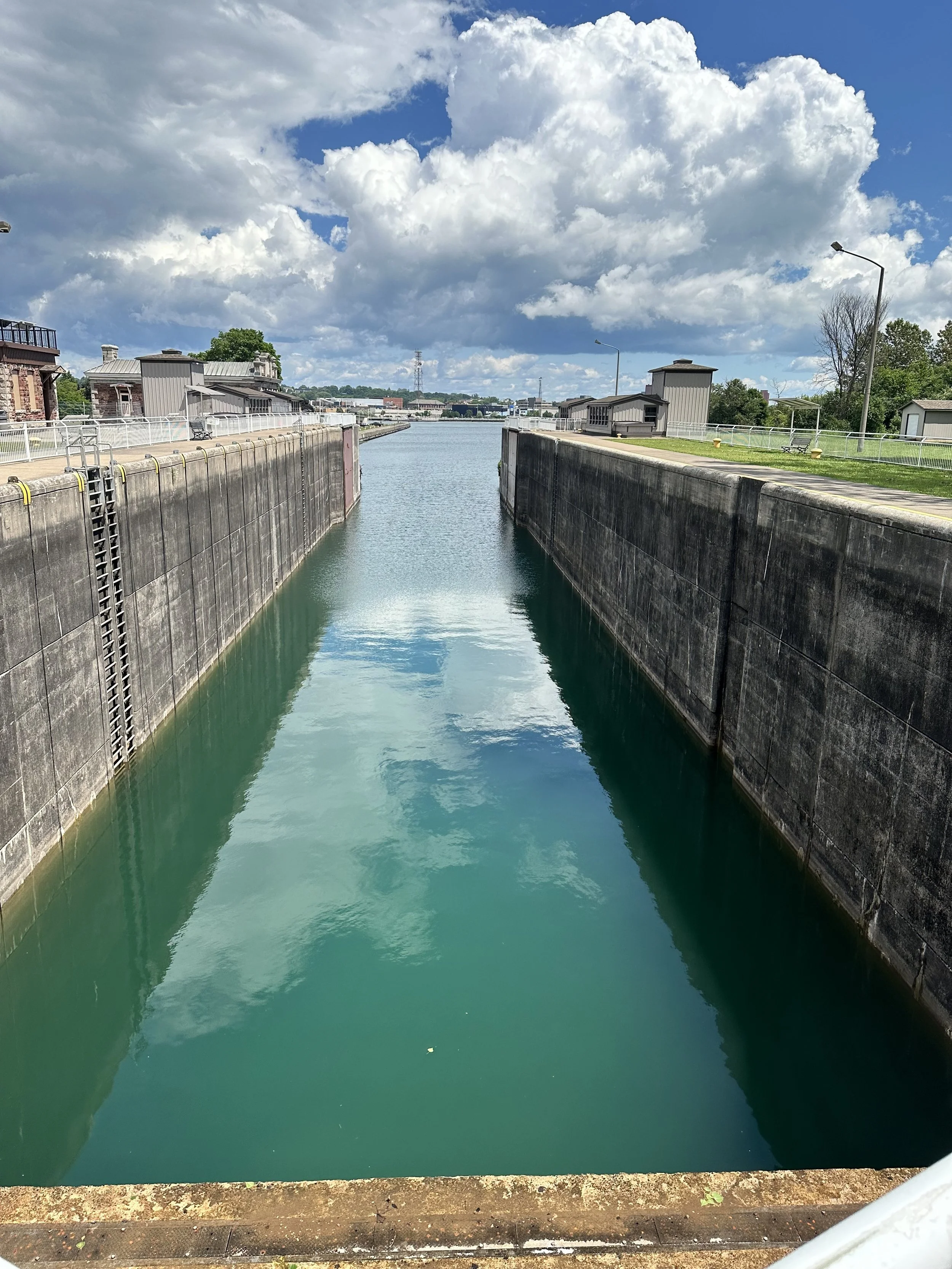
7. Sault Ste. Marie, Canada

Sault Ste. Marie International Bridge from Whitefish Island. Ashley McDermott
Sault Ste. Marie used to be one settlement, but it now refers to two cities: one on the Canadian side of the St. Marys River connecting Lake Huron to Lake Superior and one on the U.S. side. Between the cities famously runs the Soo Locks, two of the largest locks in the world. Despite being designed for lakers, bulk carriers that can hold up to 80,000 tons of cargo, it is possible to paddle a canoe, kayak or even a paddleboard through the locks.
The city is home to a plethora of Italian restaurants, reflecting the city's history of immigration in the late 19th century, and many museums, including the Bush Plane Heritage Centre, which celebrates the history of aerial fighting and bush plane use in the remotest regions of Canada.
The historic canal in Sault Ste. Marie. Ashley McDermott
Between the historic canal and the contemporary locks along the international border lies Whitefish Island, home to abundant wildlife such as herons, beavers and turtles. The island was returned to the Batchewana First Nation in 1997. On the island, Attikamek Trail is open to the public and accessible through the Sault Ste. Marie Canal National Historic Site.
Ashley McDermott
Ashley is a PhD candidate in Linguistic Anthropology at the University of Michigan. She is committed to making her research useful for the communities she works with. Her work explores how families navigate language use and language shift in Bishkek, Kyrgyzstan. When she’s not working on her research, you’ll find her adventuring with her toddler daughter, whose commentary keeps every day interesting.